
Trekking Nepal’s 3 Passes — An Itinerary & Photo Journal
Daily journal entries detail Nepal’s Three Passes Loop—the Khumbu (Everest) Region's longest trek—taken counter-clockwise.

18 Days
1: Kathmandu to Phakding
2: Phakding to Namche Bazaar
3: Everest View Hotel & Khumjung Acclimatization Hike
4: Rest Day
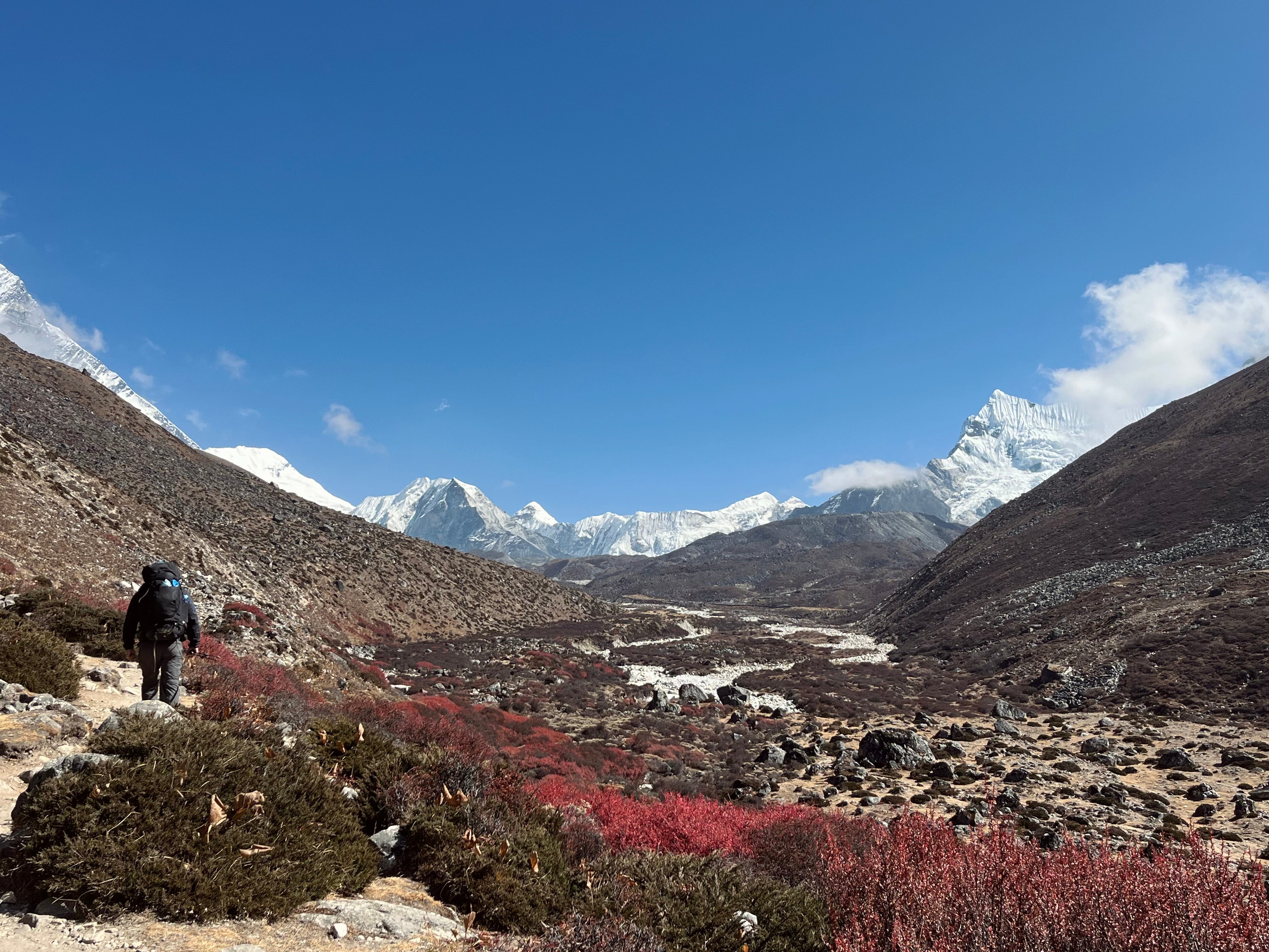
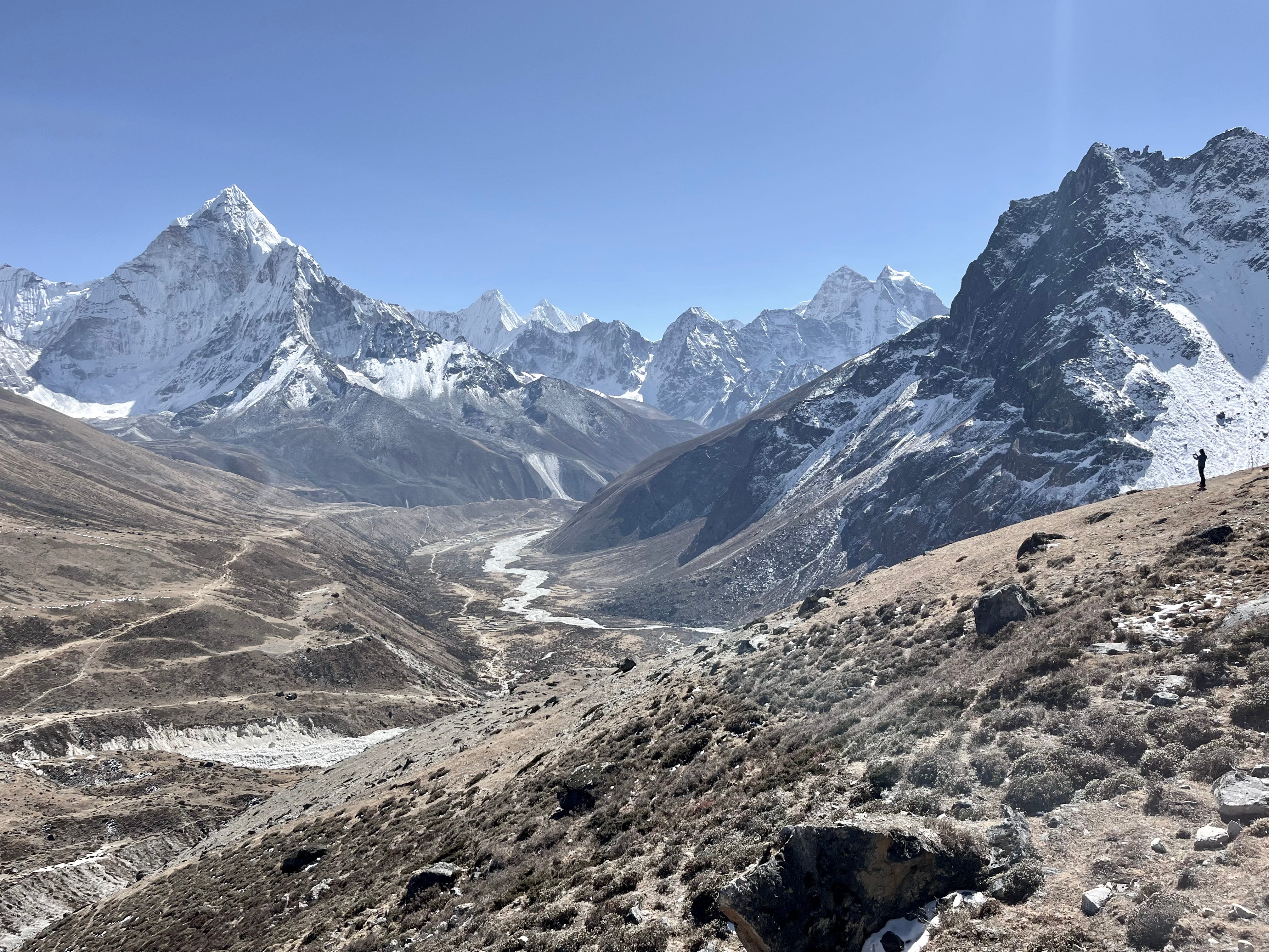
5: Namche Bazaar to Phortse
6: Phortse to Pangboche
7: Ama Damblam Base Camp & Pangboche to Dingboche
8: Dingboche to Chukhung
9: Chhukung Ri Acclimatization Hike
10: Chhukung to Lobuche via Kongma La Pass
11: Lobuche to Gorakshep, EBC, & Kala Patthar
12: Gorakshep to Dzongla
13: Dzongla to Gokyo via Cho La Pass
14: Gokyo Ri & 4th Lake Hikes
15: Gokyo to Thame via Renjo La Pass
16: Thame to Namche Bazaar
17: Rest Day
18: Namche Bazaar to Lukla
Oh, to backpack bare-bones in Nepal.
I spent a month there and trekked for 18 days. But it was all too brief.
Still, this tale somehow stretched absurdly long (read it all, and I’ll gift you a freshly baked loaf of bread).
The Three Passes Trek, though, deserves every word—especially when taken counter-clockwise, the direction with an easier elevation gain.
We traveled without a guide or porters—fully self-supported, except for the tea house stays and ordering food from menus. Every day, we hauled our gear up mountains, but by evening, a bed and a hot meal awaited us.
Such is life on Nepal’s trails.
When I arrived to Nepal, I spent a week in Kathmandu, the “Wooden City,” named after a temple said to have been built in 1596 from the wood of a single tree—a structure the myth claims still stands in the central square.
My trekking partner, Matt—a U.S. Aerospace Engineer on a year-long sabbatical to travel the world—arrived a week later. We had met the year before while trekking Navarino Island in the Chilean Patagonia. When I asked where he'd be in October, when I could get some time off, he replied, "Nepal," and I suggested we team up for another adventure.
Day 1: Kathmandu to Phakding
Trekking Distance: 6.2km / 3.8mi (Lukla to Phakding)
Elevation Gain: -230m / -755ft (Lukla to Phakding)
Max. Elevation: 2,860m / 9,383ft
Tea House: Green Village Guest House
On October 27, 2024, we set off for Manthali. We took a night shuttle with plans to fly out of Ramechhap Airport to Lukla.
Although our destination was just 171 kilometers away, the journey stretched into a grueling eight hours due to road damage caused by recent landslides.
Record-breaking precipitation and unusually high temperatures in September—Nepal’s highest in four decades, according to The Rising Nepal—triggered devastating floods and landslides between September 27 and 29, sparking nationwide efforts in reconstruction and relocation.
The bumpy ride through the aftermath of this destruction lasted all night. Packed with fellow passengers, the cramped seating rendered sleep a distant hope. Meanwhile, Matt began to develop a cough.
Tip: It's possible to catch a direct flight from Kathmandu to Lukla for about $30 more, which is worth it to skip the van ride to Manthali. If you see this option on the airline’s website (we used Tara), don’t hesitate—book it immediately. Availability is limited, and if you leave the page and come back later, it’s often already sold out.
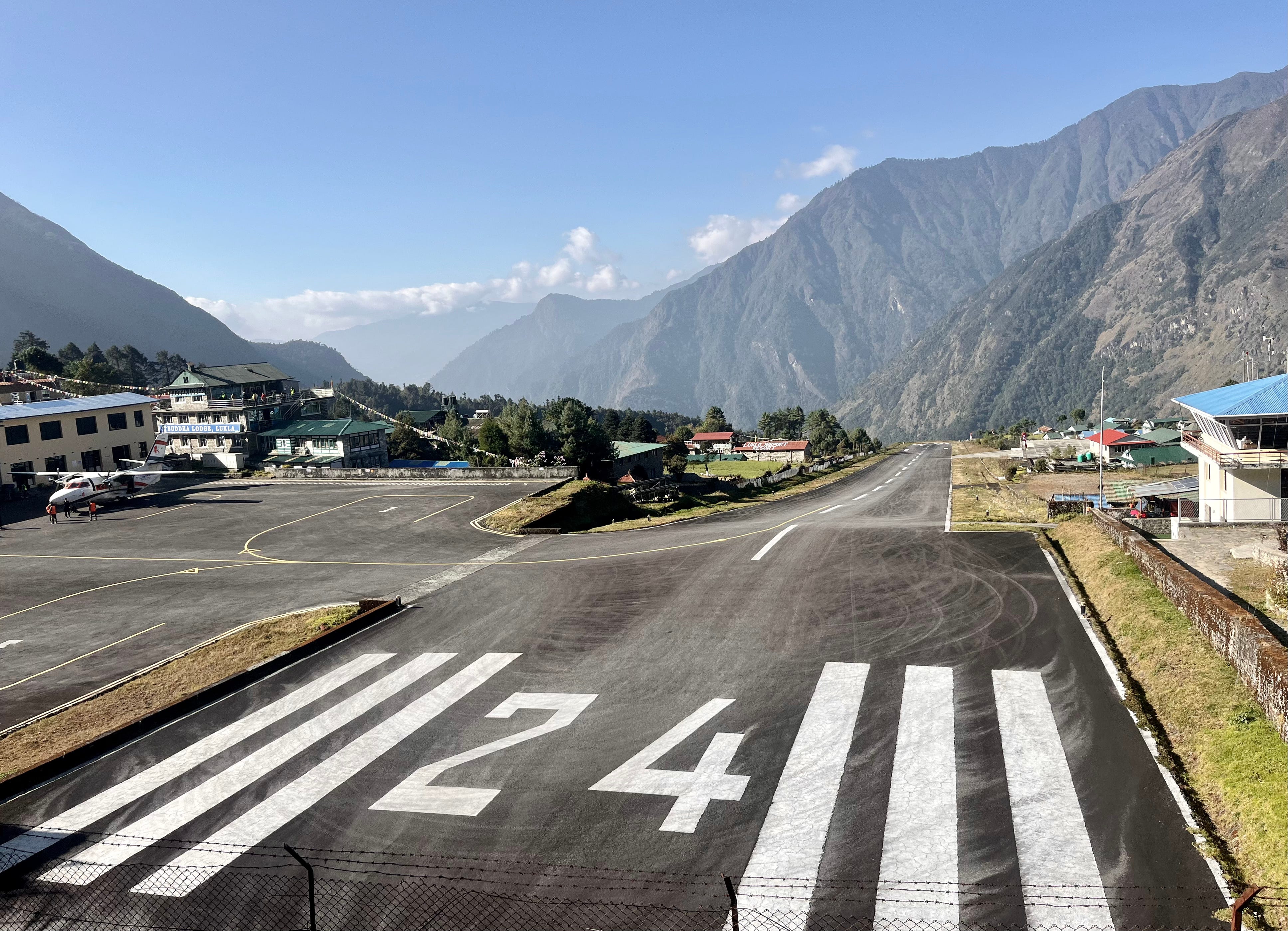
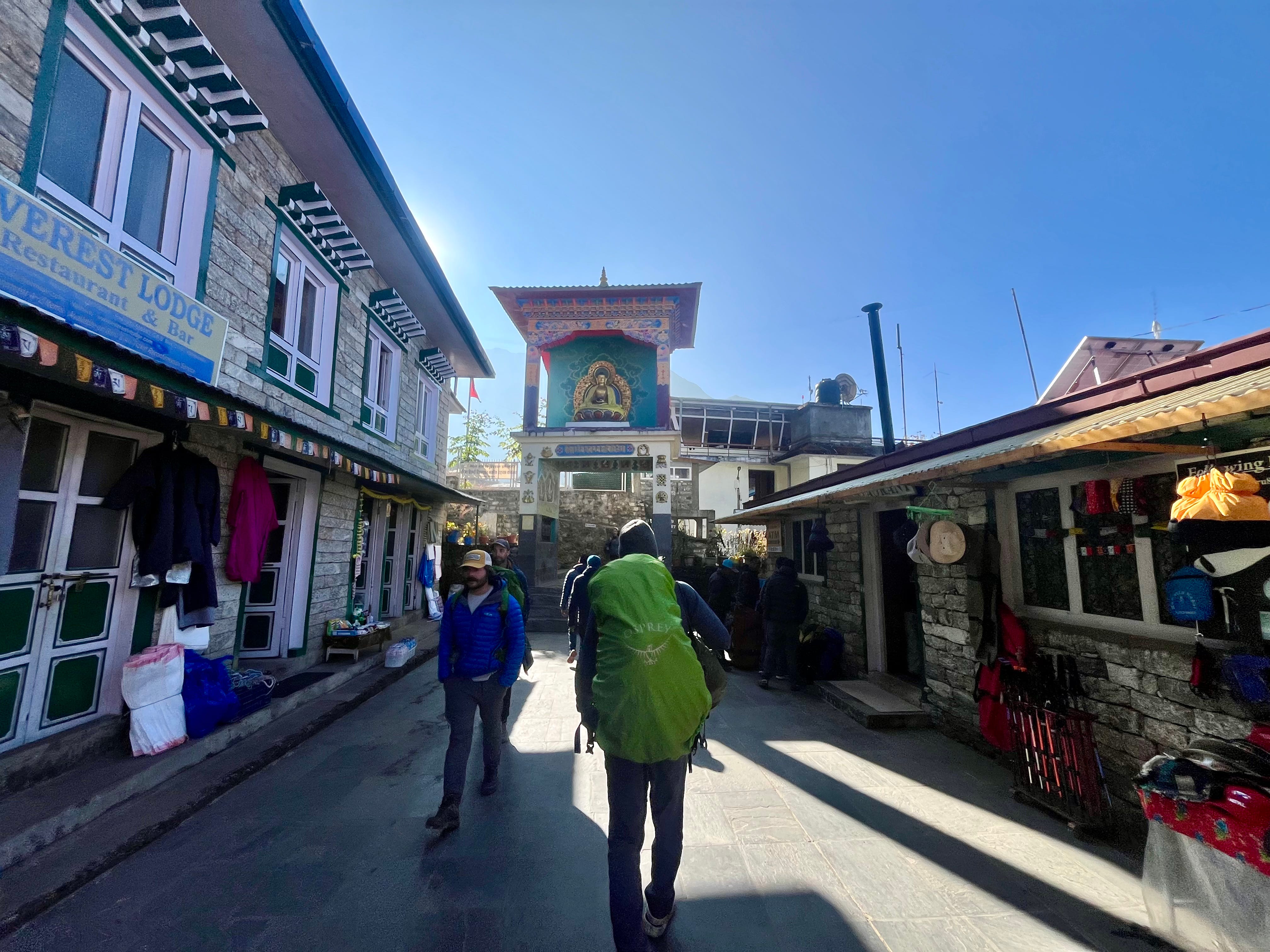
We arrived at what some consider to be the most dangerous airport in the world: Lukla’s Tenzing-Hillary Airport. The runway is 1,729 feet (runways are commonly 7,000-10,000-feet), and it’s situated on the edge of a cliff with a 2,000-foot drop on one side and a stone wall on the other. And with notoriously bad weather, there’s a high margin of error.
This flight from Manthali to Lukla, though eventful, lasts just 15 minutes. And the airport experience is chaotic, with delays often ranging from two to six hours or even a couple days. Our flight, originally scheduled for 8:00 a.m., didn’t depart until 8:35 a.m. after several time changes. We considered ourselves lucky to board relatively close to our scheduled time, as some travelers with earlier flights were delayed until 11:00 a.m.
The small plane flew deep into the Himalayas, surrounded by misty peaks, including Everest. As we approached the world’s most dangerous airstrip, everyone held their breath as the small aircraft landed. It wobbled before coming to a stop.
Once on the ground, security personnel instructed us not to take photos of the runway for “security reasons.”
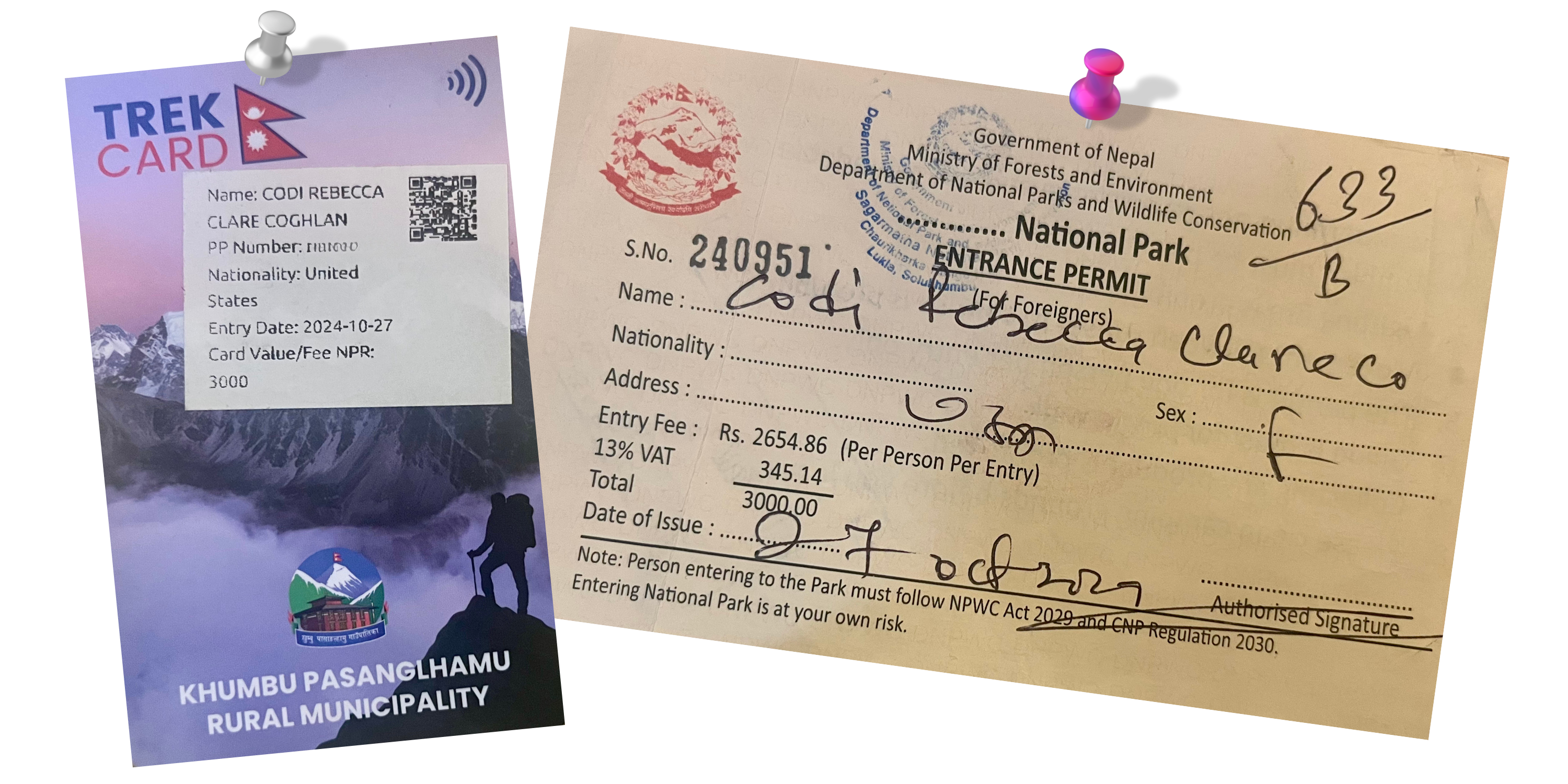
In the Khumbu Region, trekkers must obtain both a traveler’s card and a park permit before setting off. At the airport, we noticed a QR code for registration prominently displayed on the wall. After scanning it, we completed the registration online, only to later be informed by a park official that the QR Code was outdated.
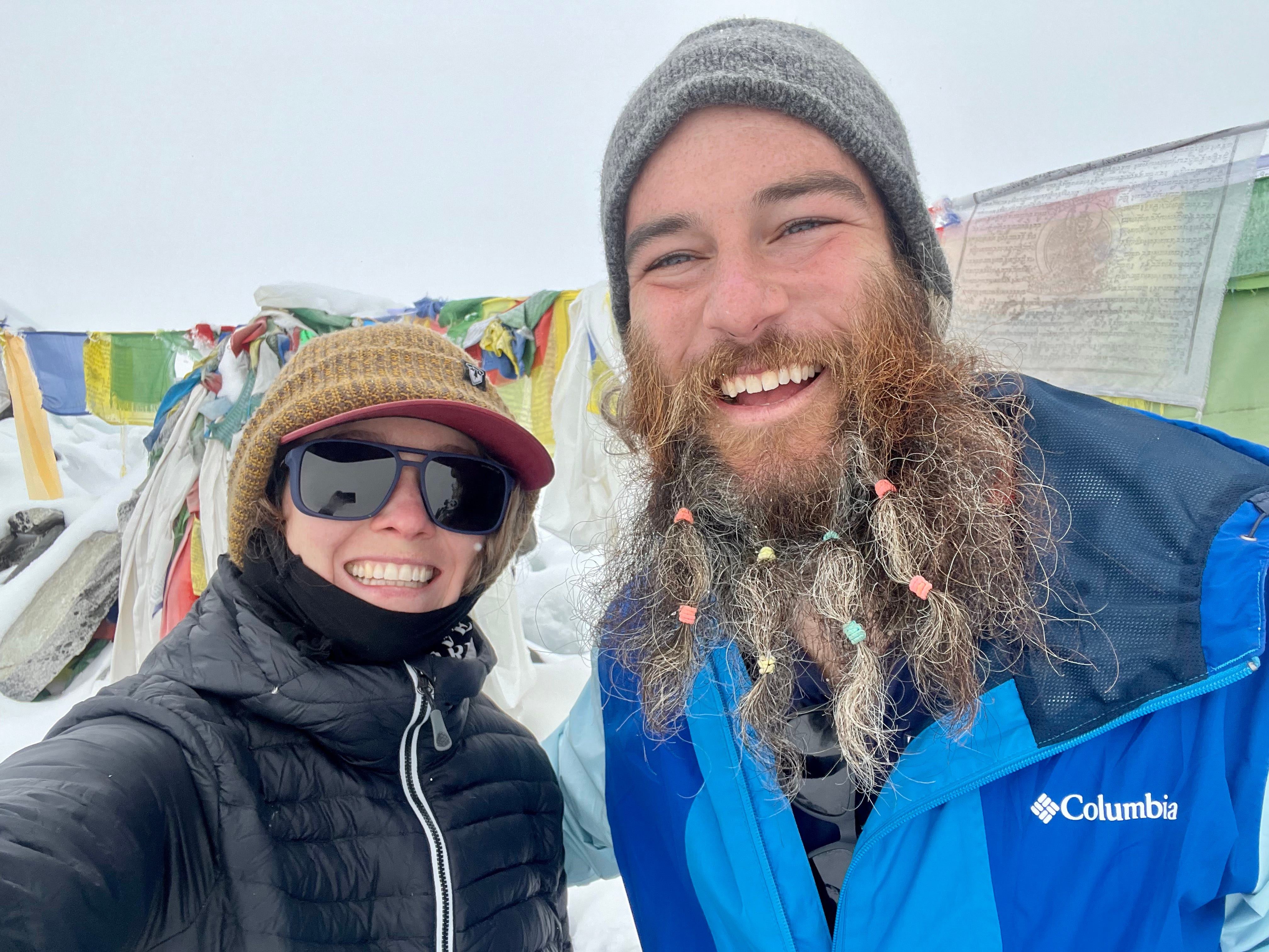
We wandered into town, where Matt popped into a beauty shop and had colorful ties put into his beard. With his new look, we headed to the checkpoint near the trail entrance and joined the queue alongside the other travelers.
The permitting and registration process involved waiting in one line to receive a park pass, followed by a separate line for the traveler’s registration and card. After some initial confusion about which line was which, we finally sorted it out and each paid two 3,000-rupee fees.
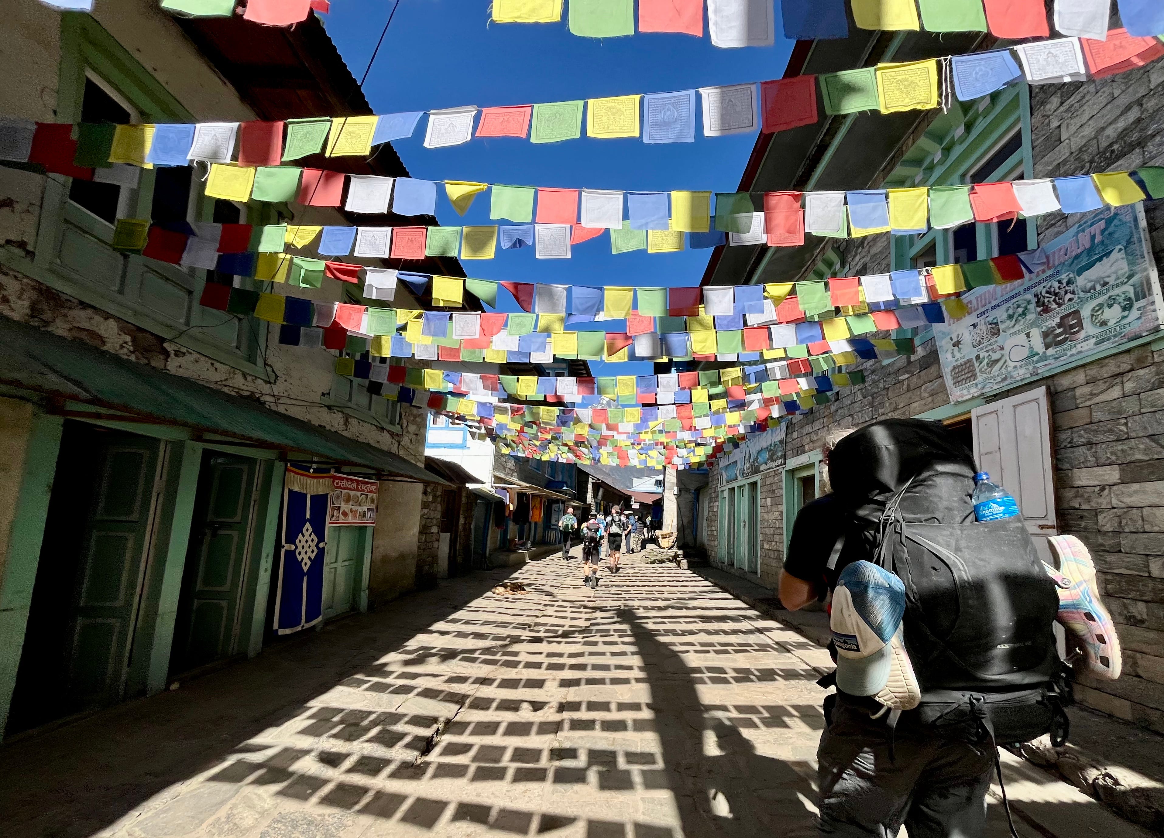
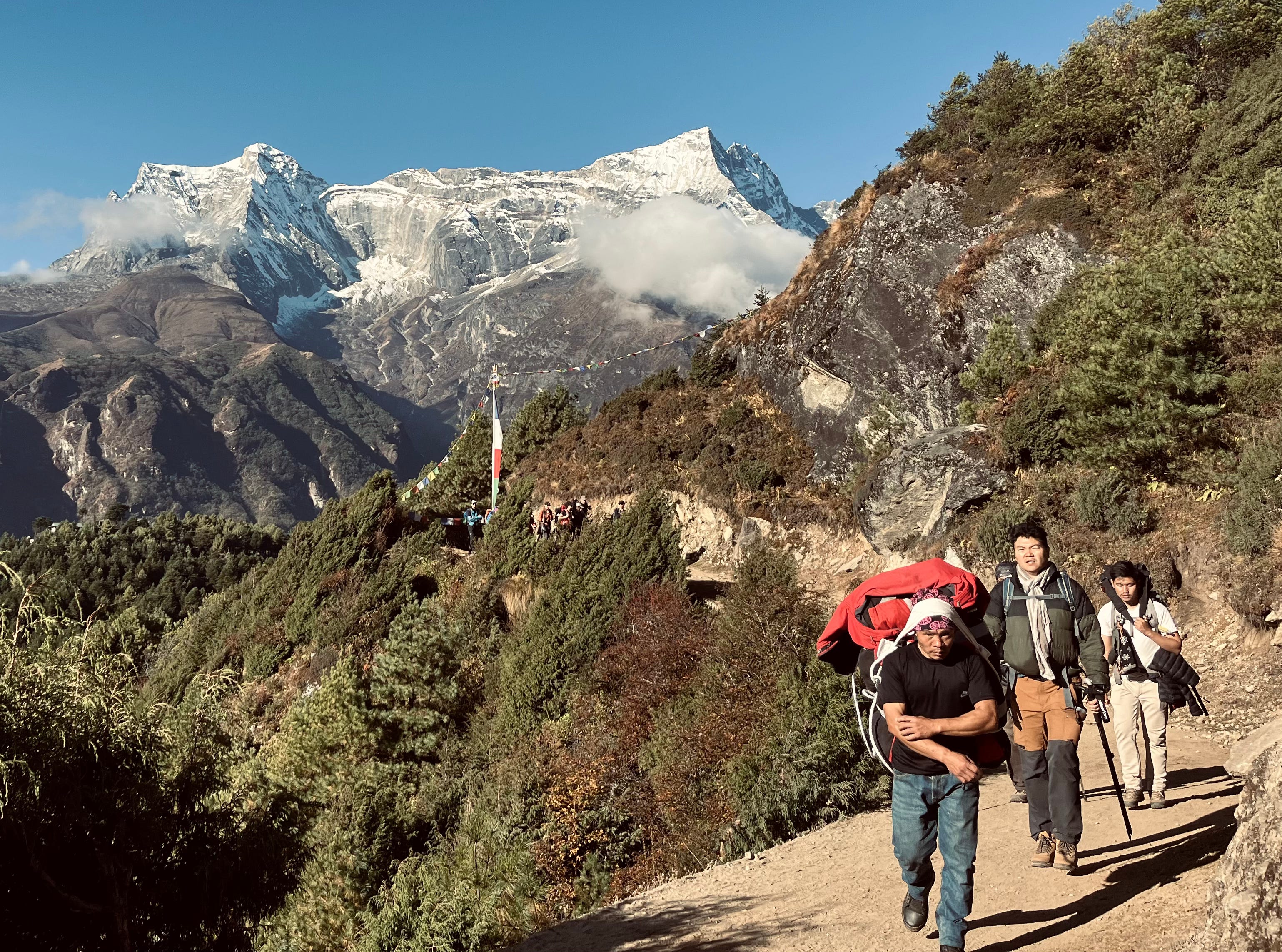
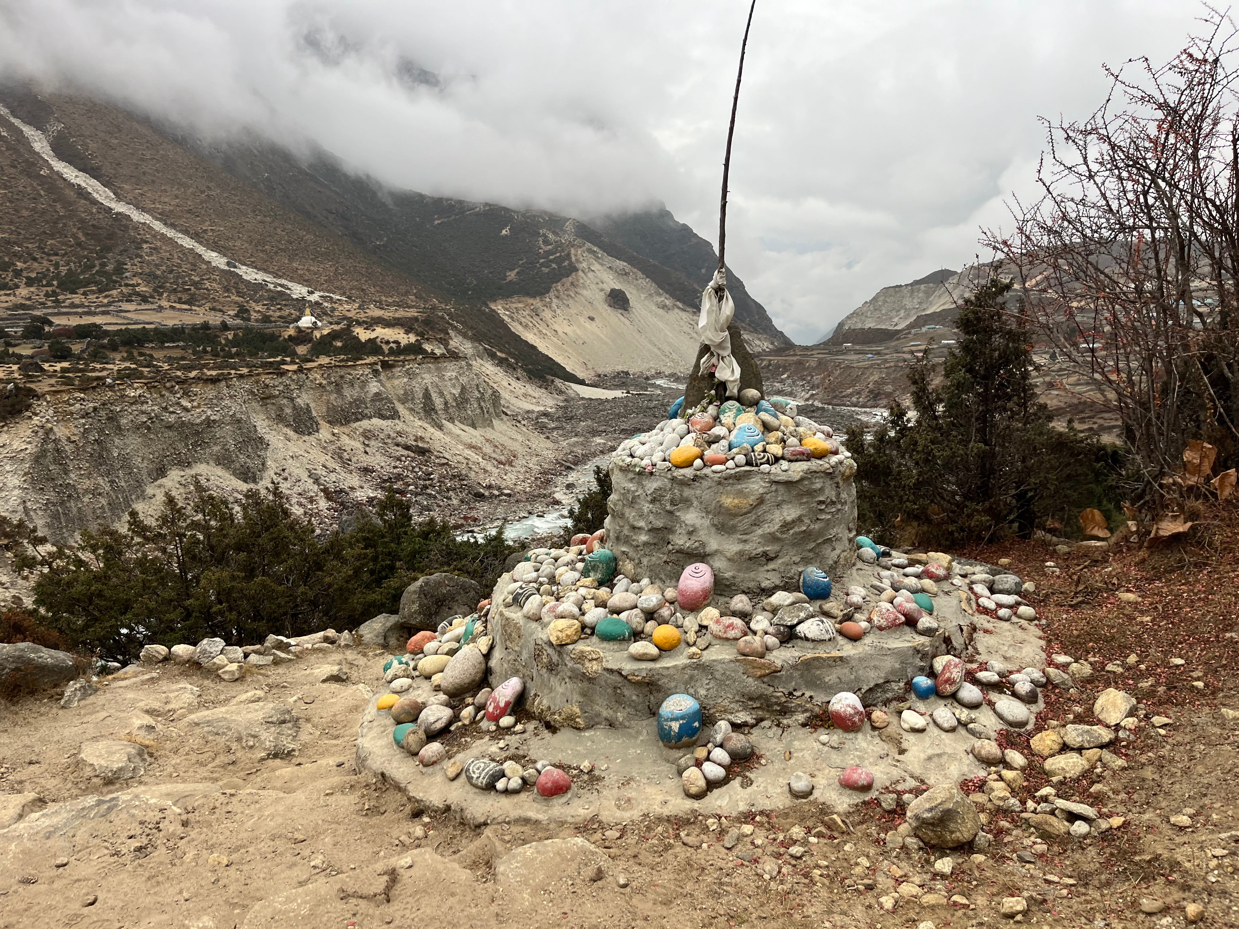
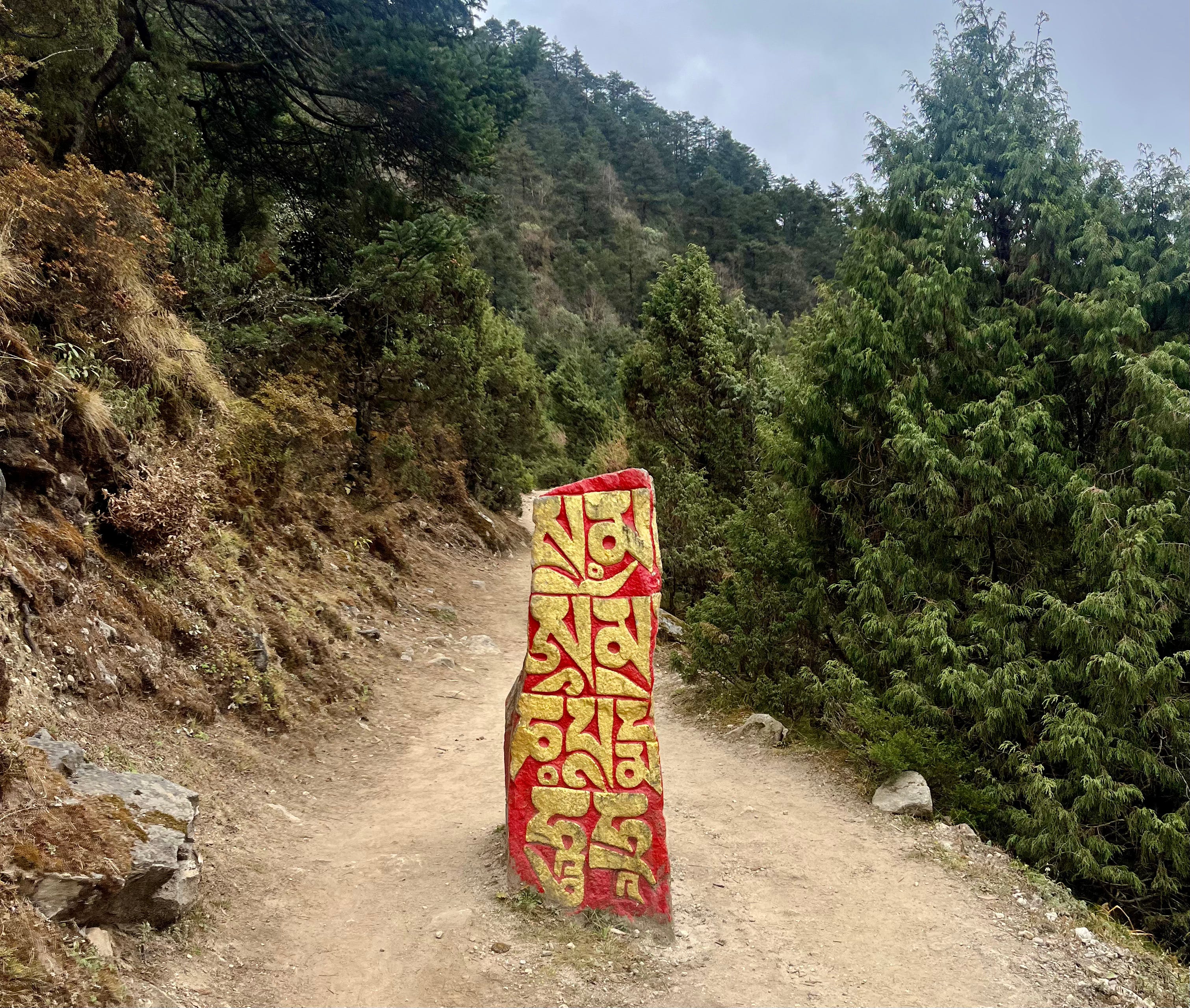
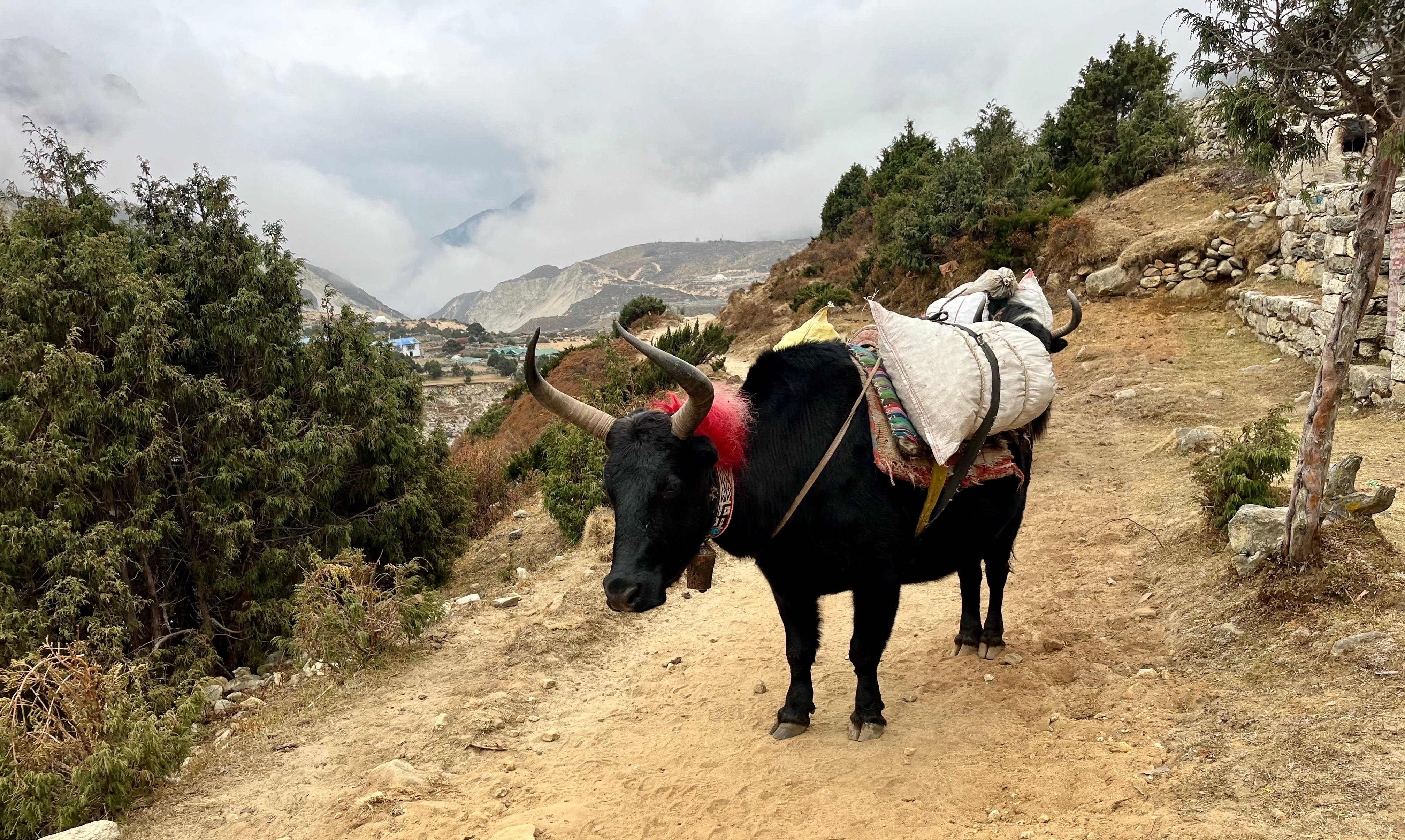
We followed other trekkers into the wilderness. For the next five miles, we trekked on beautiful stone trails, passing shrines with prayer wheels and stones engraved with Nepali script, painted in black and white. Yak herds wore bells, a Nepalese custom, which produced continuous, soft, hollow jingles intended to evoke a sense of calm.
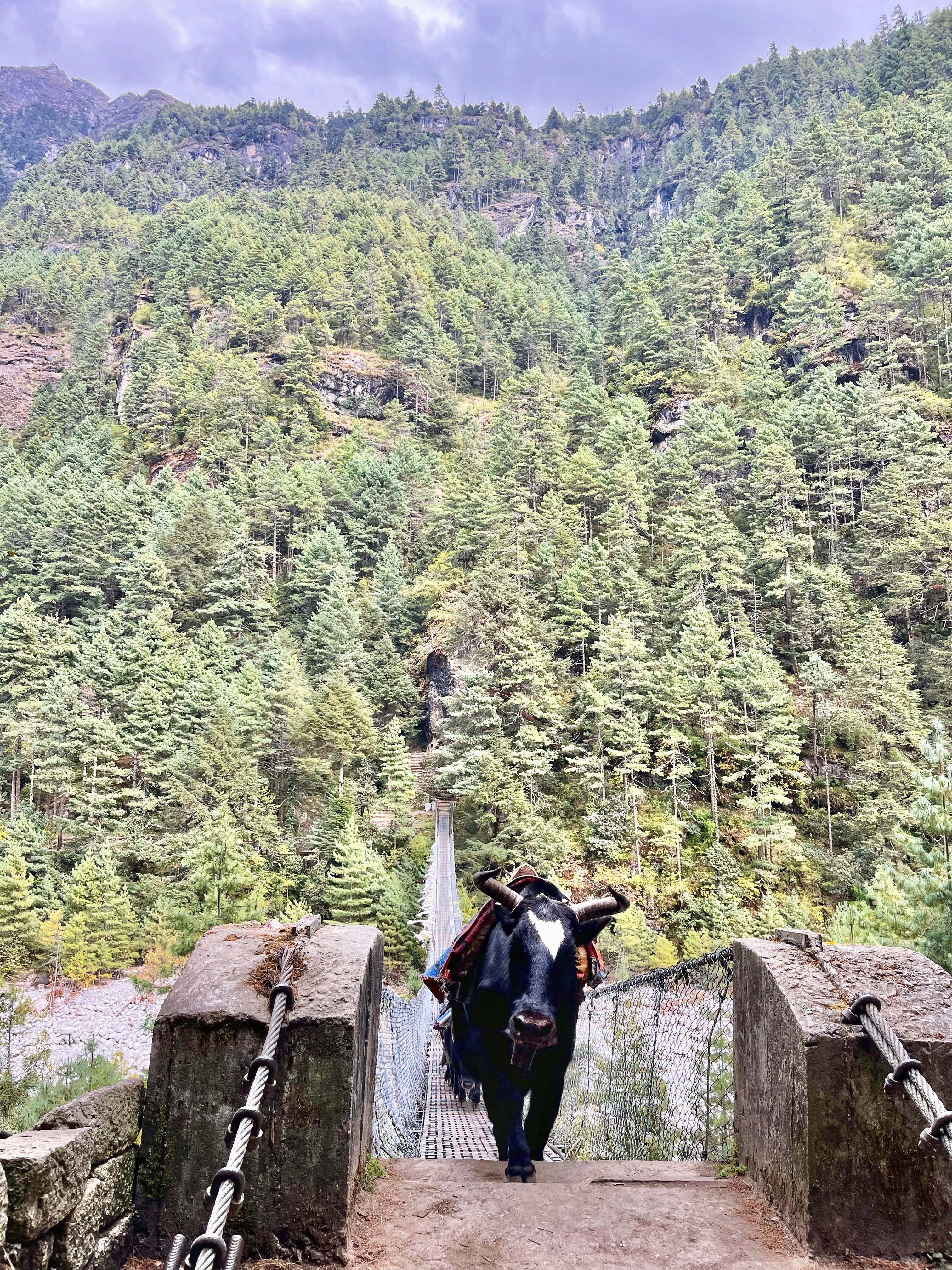
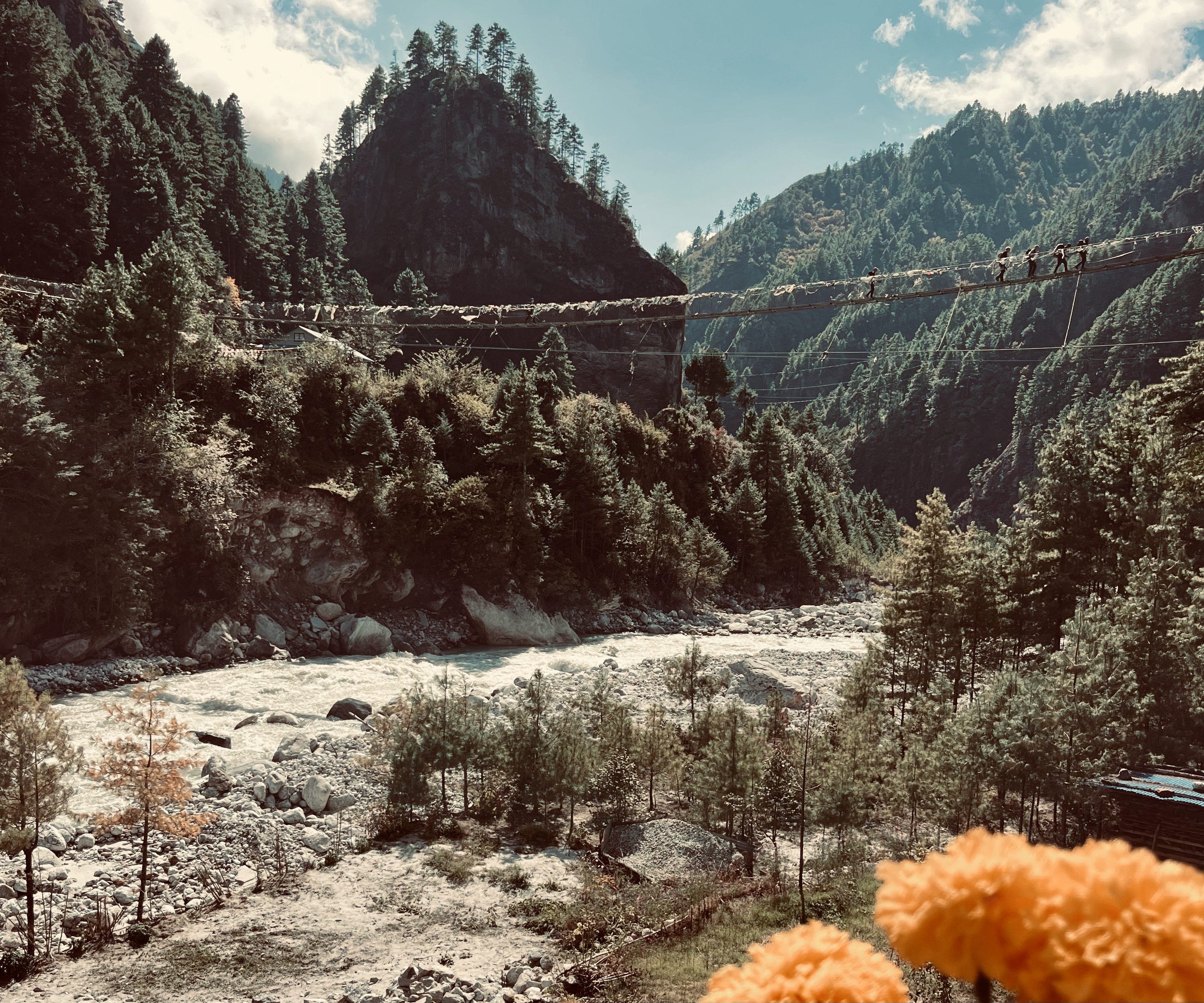
We crossed a couple suspension bridges, which swayed beneath our feet. Matt bravely confronted his fear of heights.
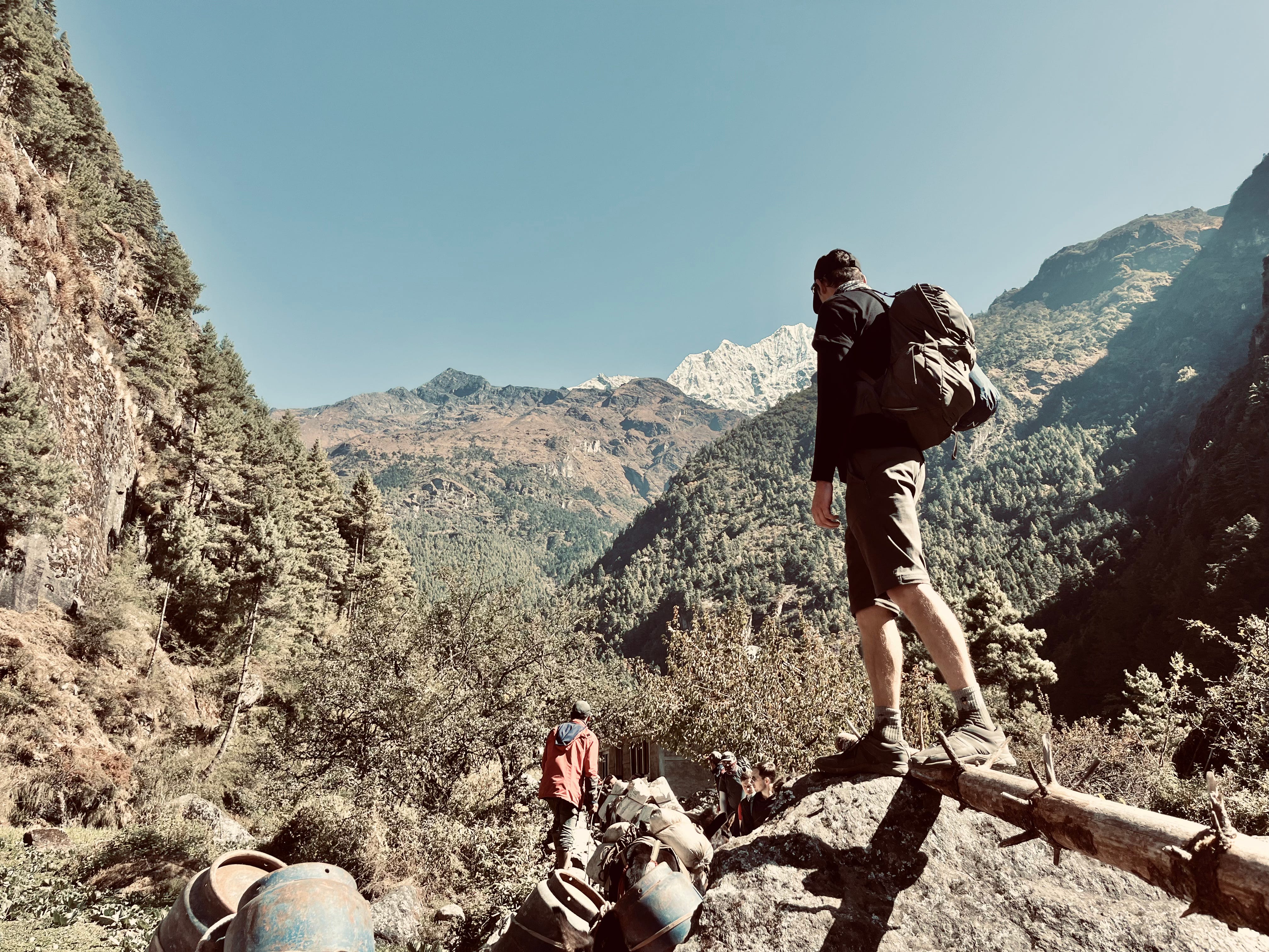
Trekkers dodged yaks and donkeys carrying supplies, as well as porters who moved with remarkable strength and speed, some hauling loads up to 50 kilos secured by head straps.
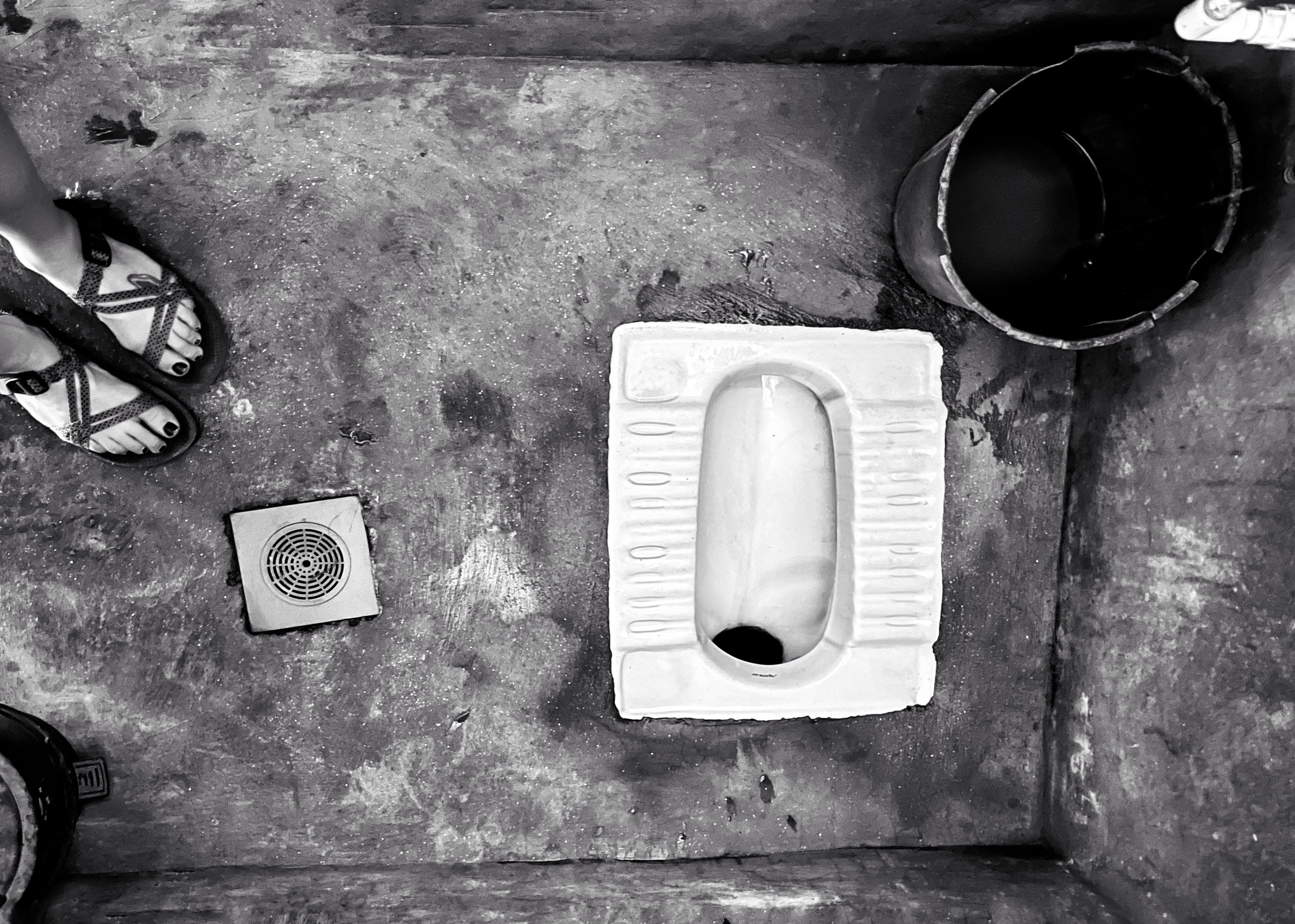
Around halfway through the day’s hike, we stopped for lunch at one of the many restaurants along the trail, ate fried noodles, and used their facilities—one of Nepal’s ubiquitous squat toilets: a hole in the floor requiring manual flushing by scooping water from a bucket and pouring it in.
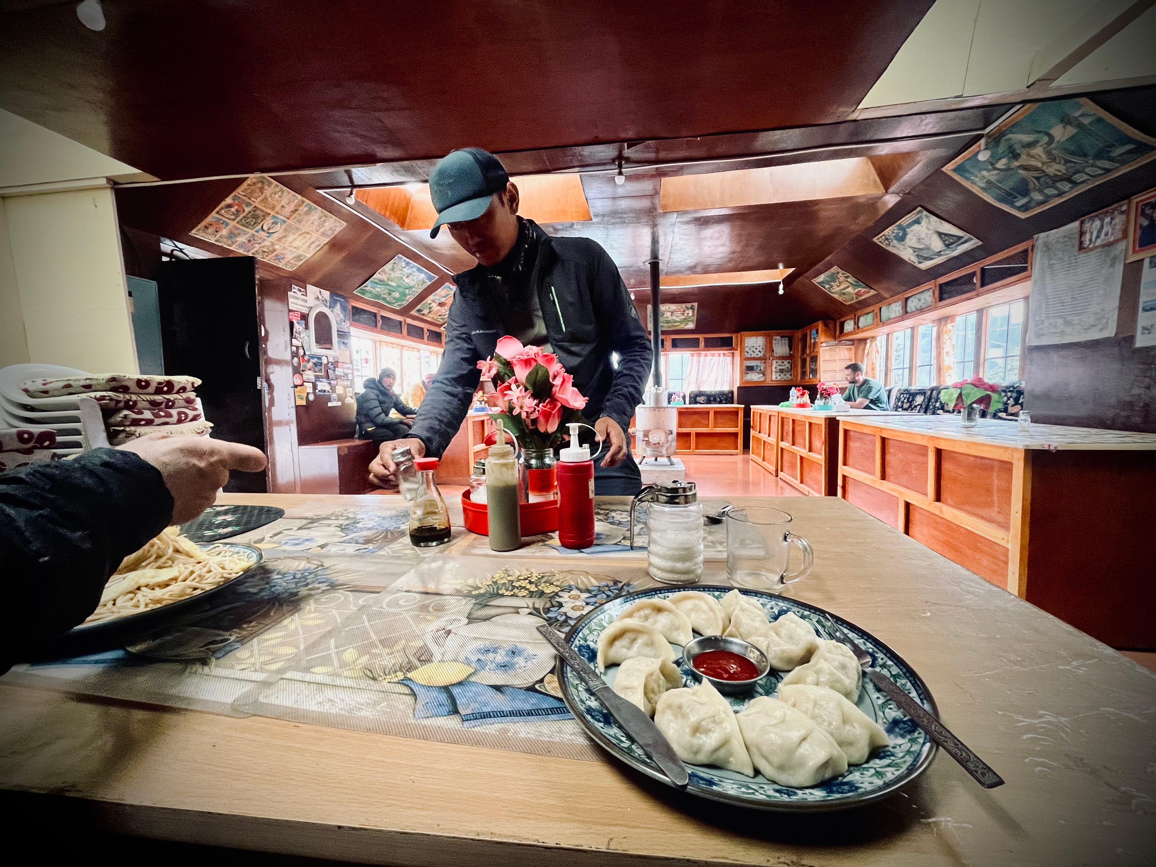
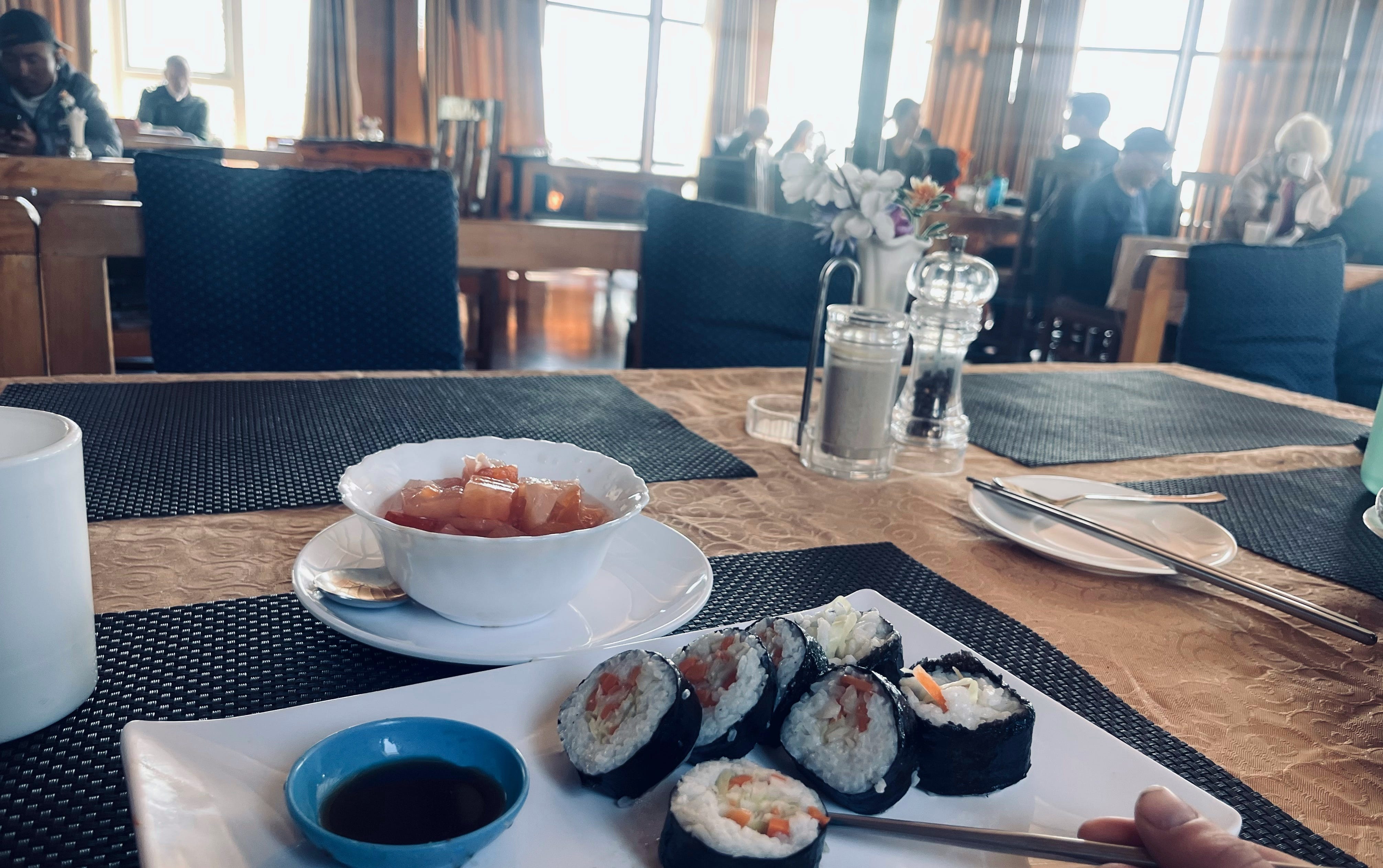
We passed crowds of trekkers throughout the day, until reaching and settling in at Green Village Guest House in Phakding. Tired, nursing colds, sore knees, and some stomach troubles, we warmed up by a wood-burning stove with tea, momo (Nepalese dumplings typically served with a flavorful tomato-based dipping sauce), and garlic soup (supposedly a remedy for symptoms caused by high altitude). We especially enjoyed Green Village’s delicious lemon ginger honey tea and warm showers.
Day 2: Phakding to Namche Bazaar
Trekking Distance: 7.7km / 4.8mi
Elevation Gain: 830m / 2,723ft
Max. Elevation: 3,440m / 11,285ft
Tea House: Shambala Inn (no online presence but right across from Hotel 8848)
We began our day with breakfast as we would begin every day. I had porridge and black tea. Matt, not feeling well, at all, had eggs. After packing up and checking out at 9:00 a.m., later than most of the other travelers, we set off.
Today, we’d hike five miles, mostly on a stone laden trail. Matt was coughing and congested, moving slower than usual, so I waited for him often. The first stretch of the trail, before entering Sagarmatha National Park, was quite developed with houses, restaurants, and shops along the way.
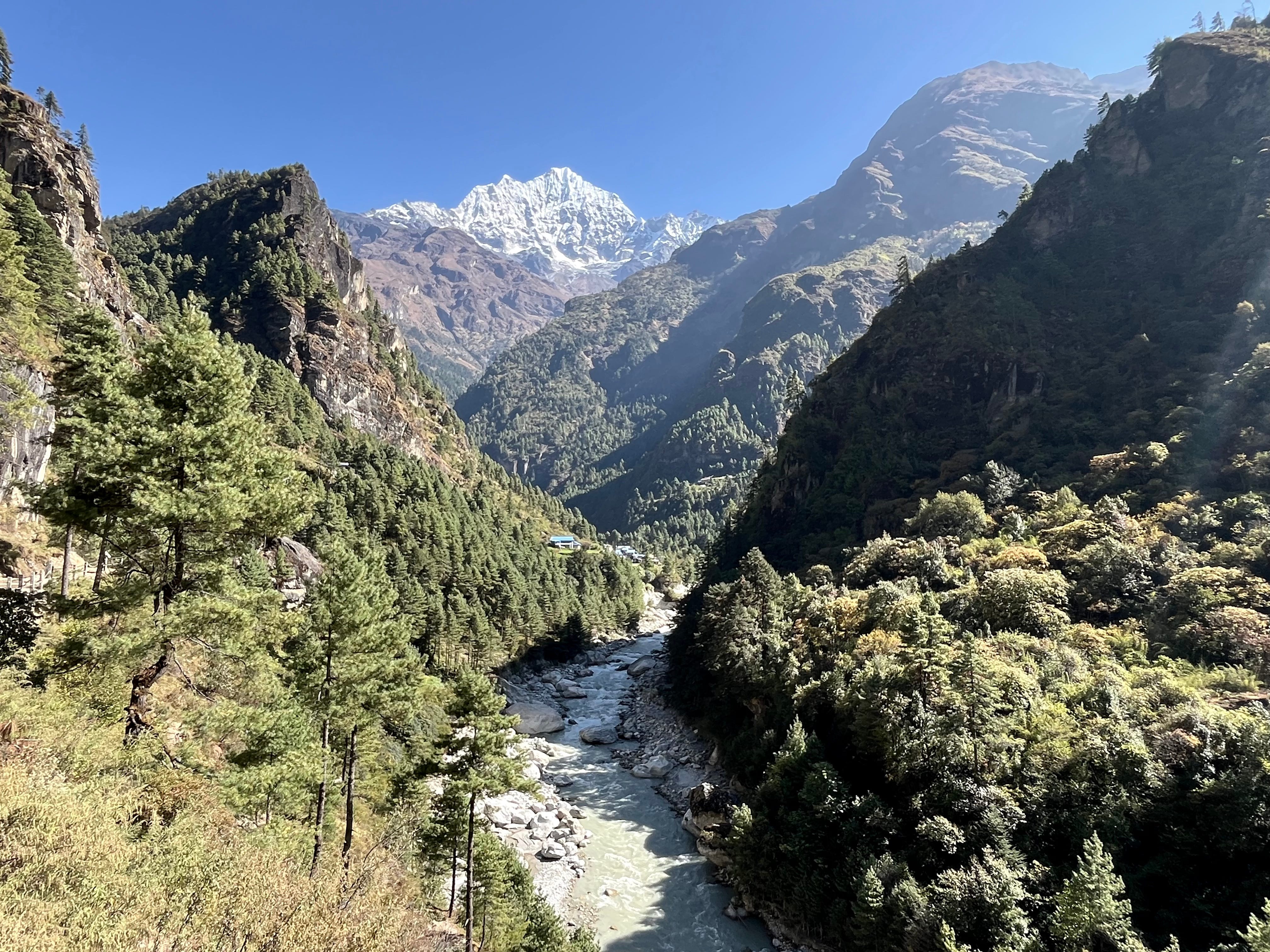
The Dhudh River paralleled our route, winding alongside us in stunning shades of light turquoise-gray. We stopped at a riverside restaurant for momo and ran into a group of Israeli trekkers we’d met during our van ride in. With the sun out, we were in good spirits.
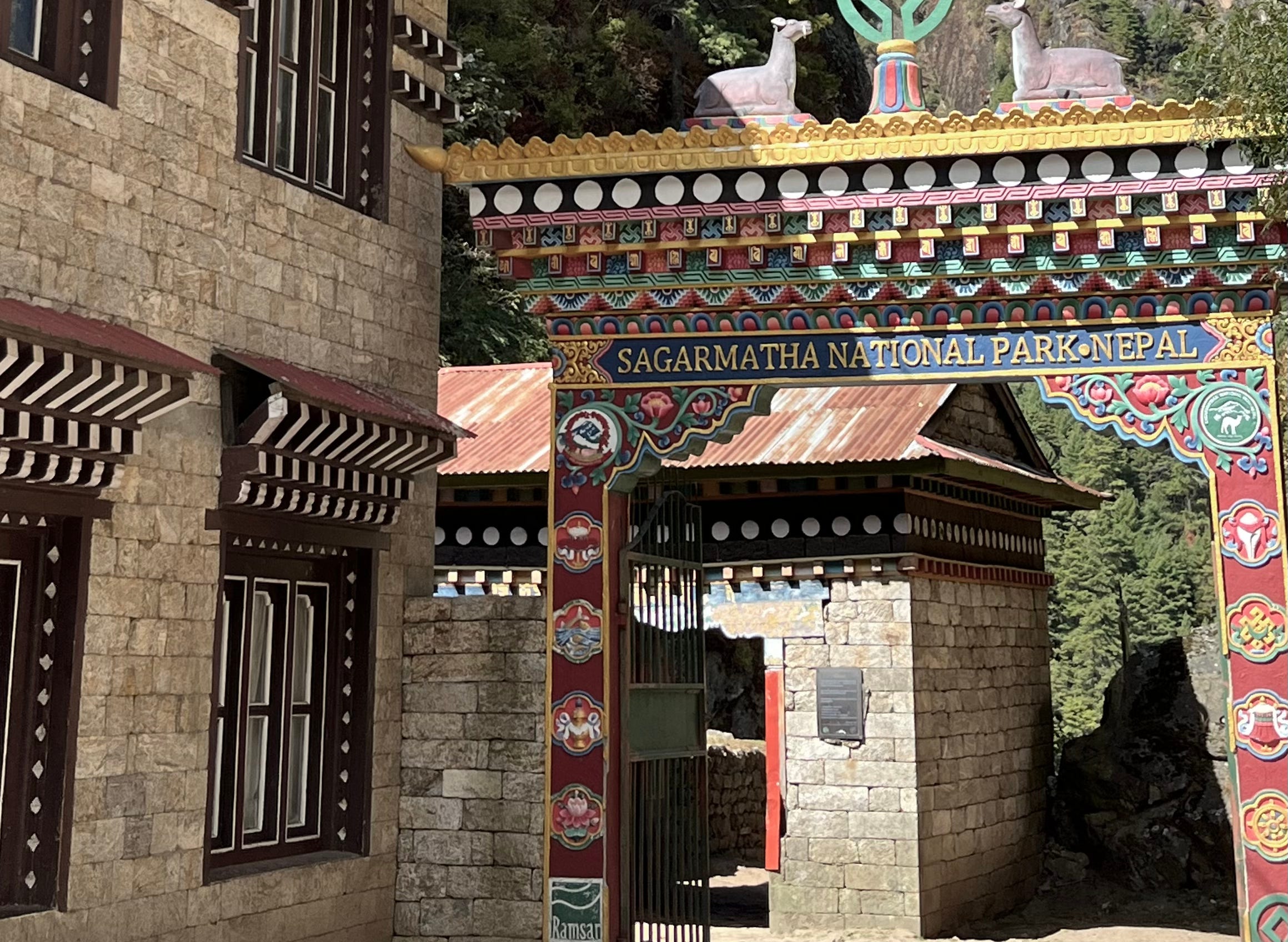
Eventually, we reached the national park’s checkpoint, marked by a beautifully carved and painted wooden gate. From there, the trail turned to dirt and sand, becoming steeper and more technical. I preferred this over the stone path—it was smoother and easier on my feet. Groups of yaks and donkeys led by herders passed often, taking up the trail and leaving their evidence. The Sherpa people, however, cleverly dry and repurpose yak dung as fuel for their fires.
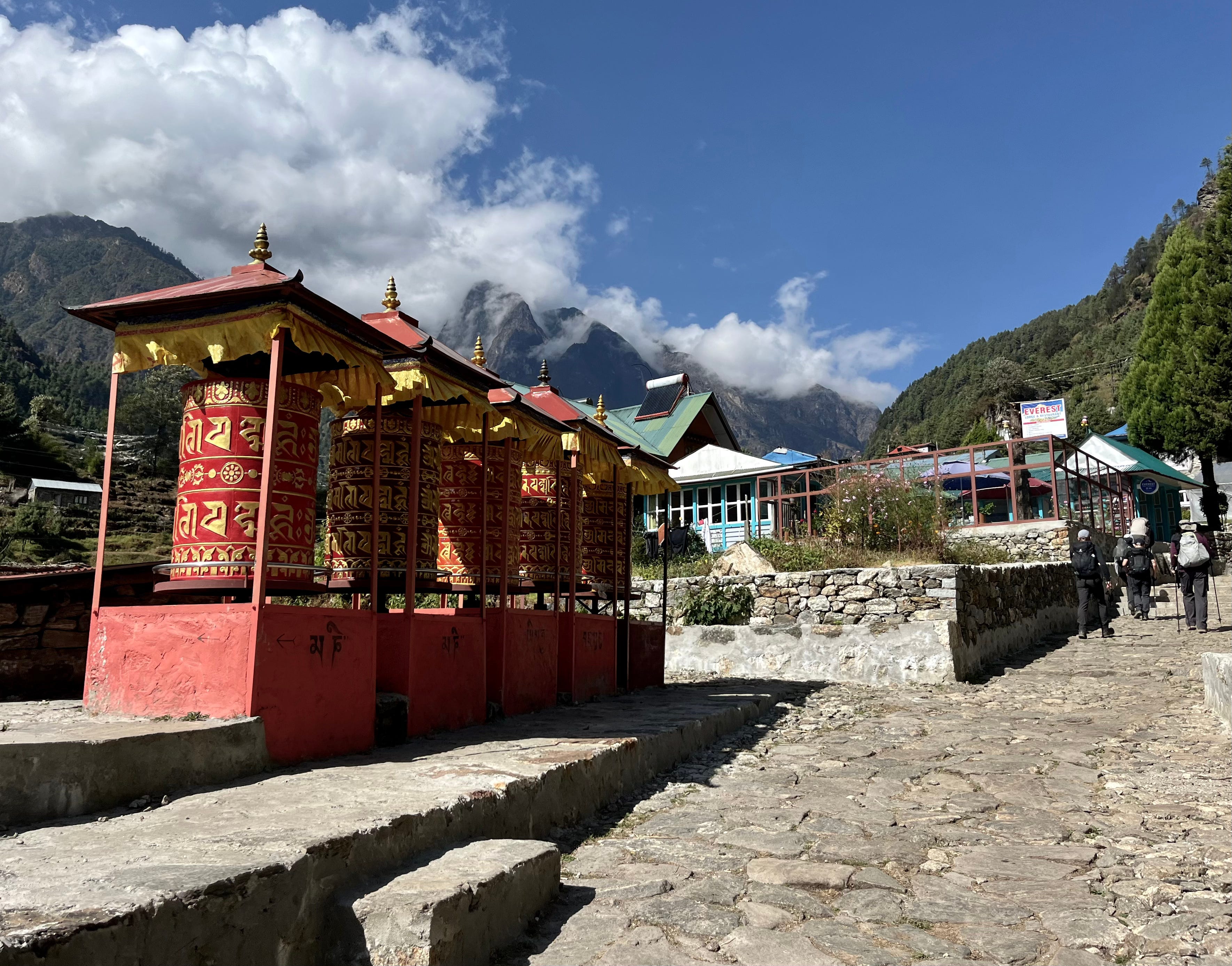
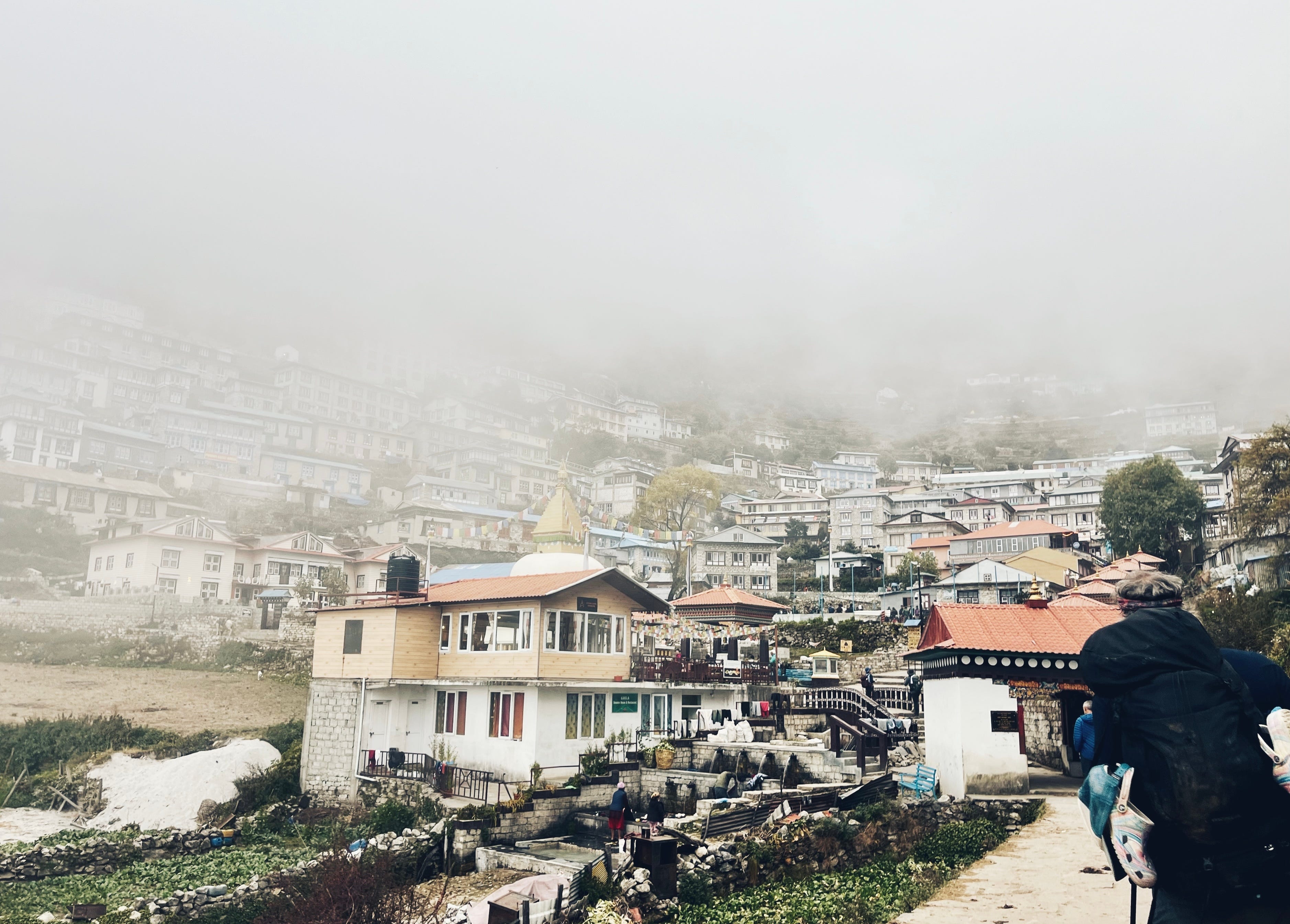
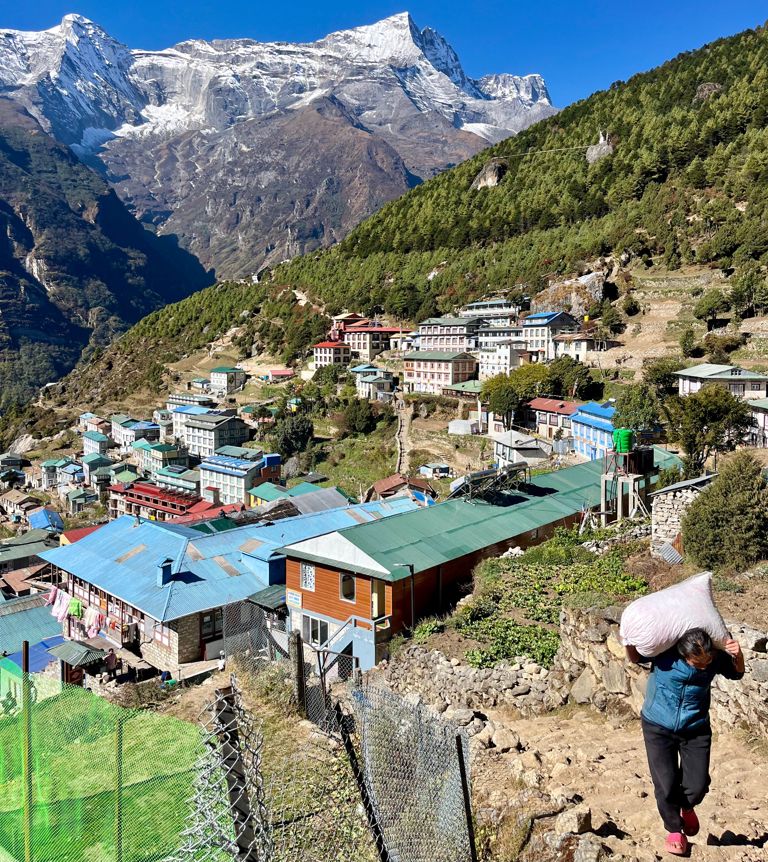
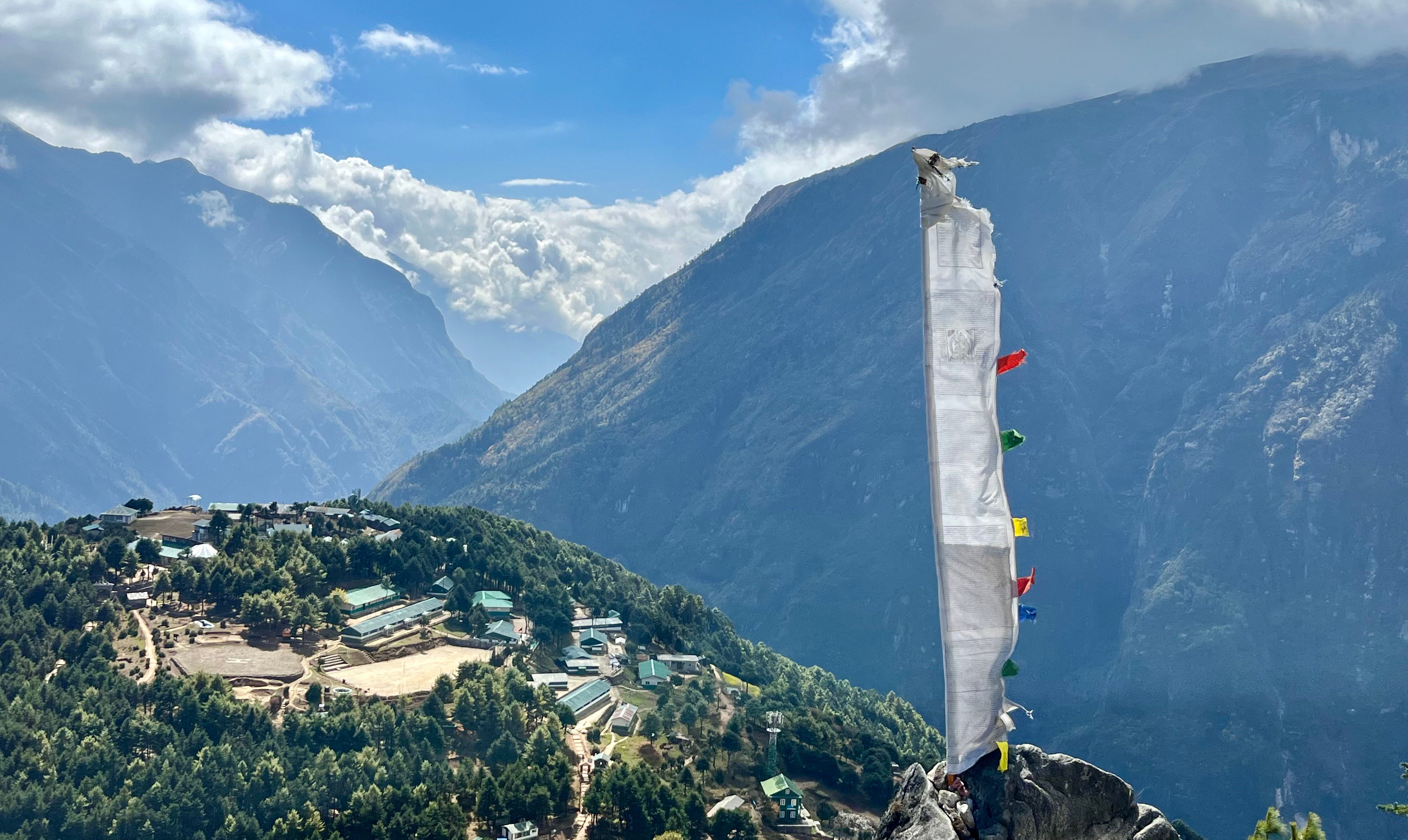
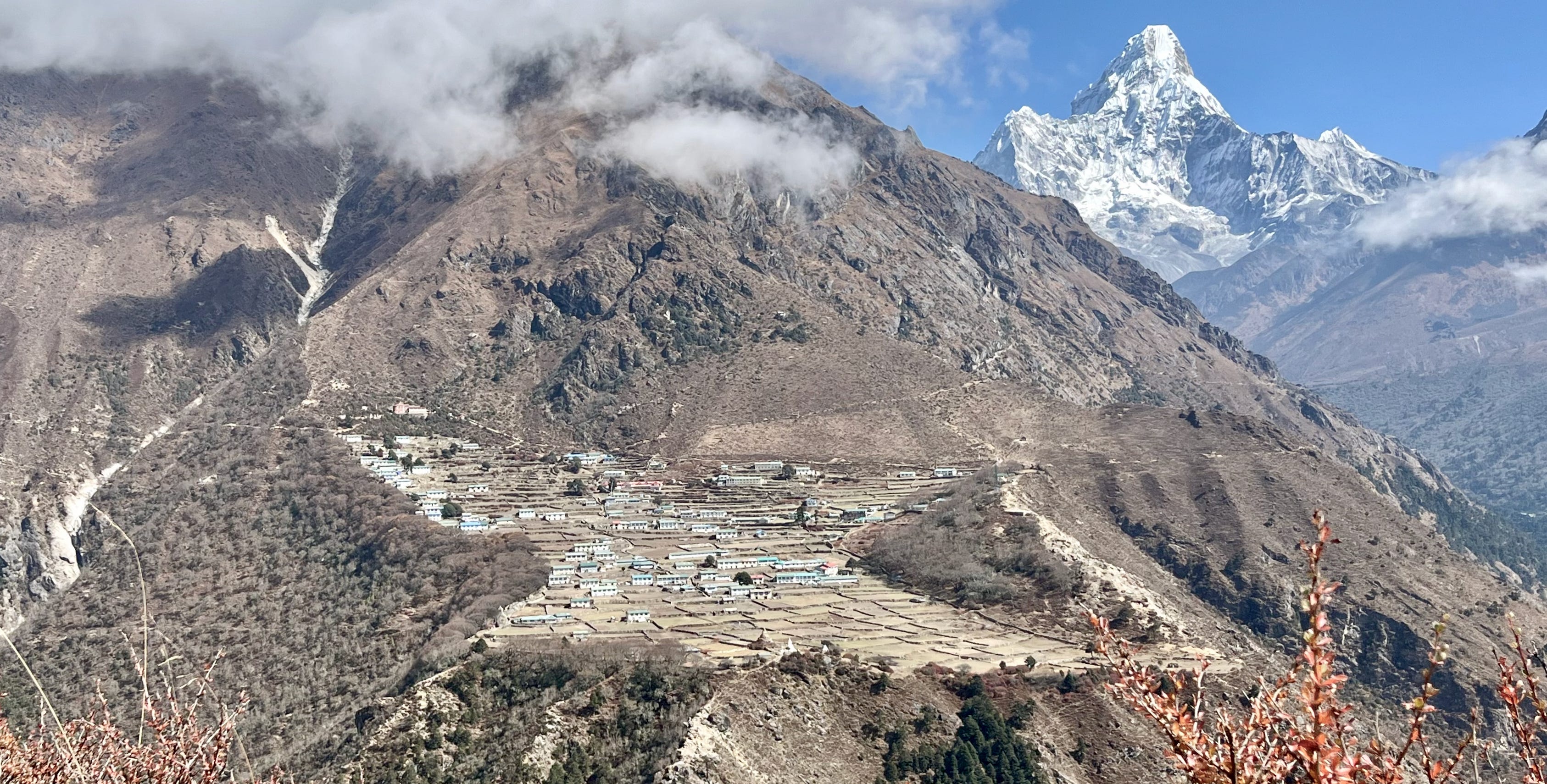
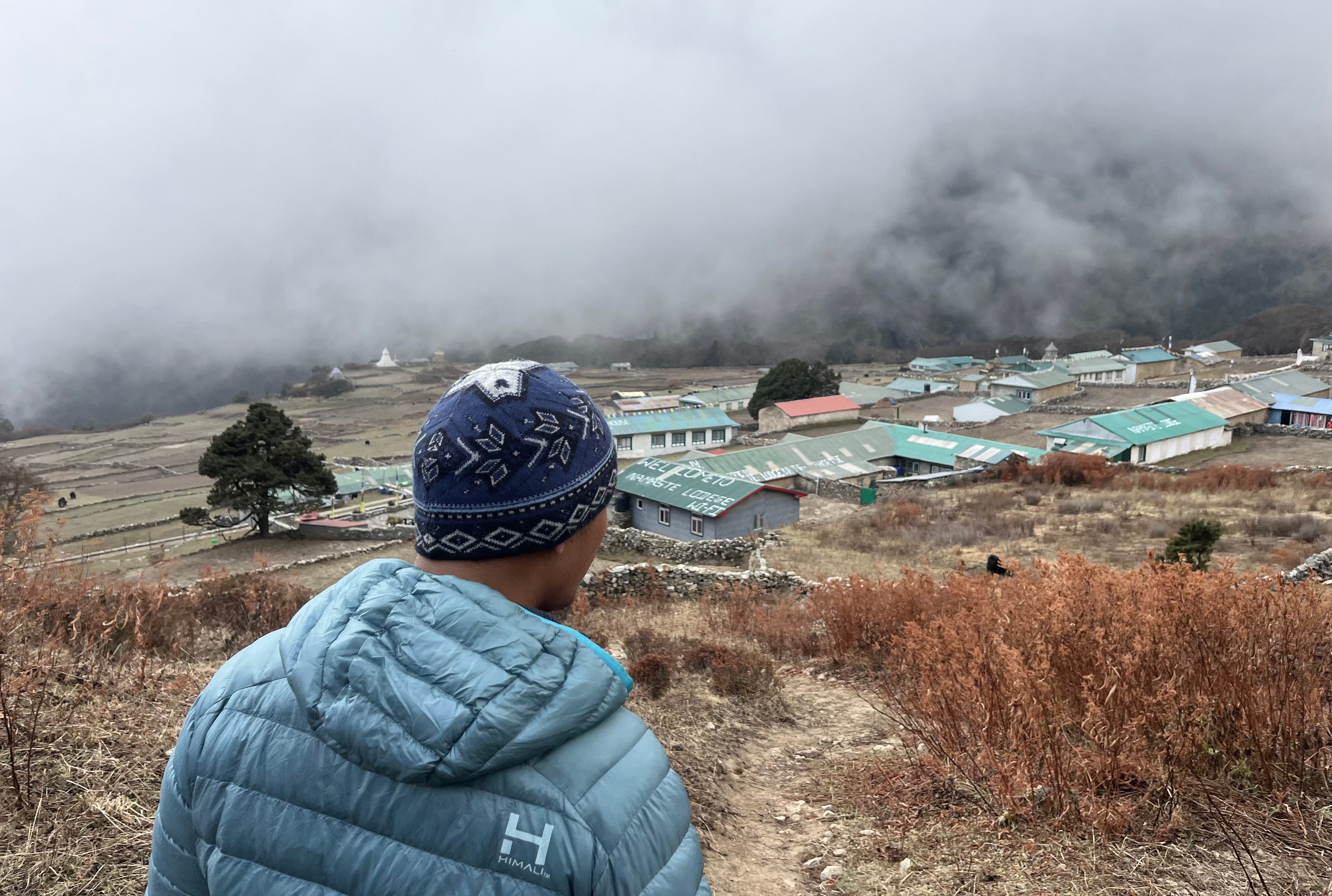
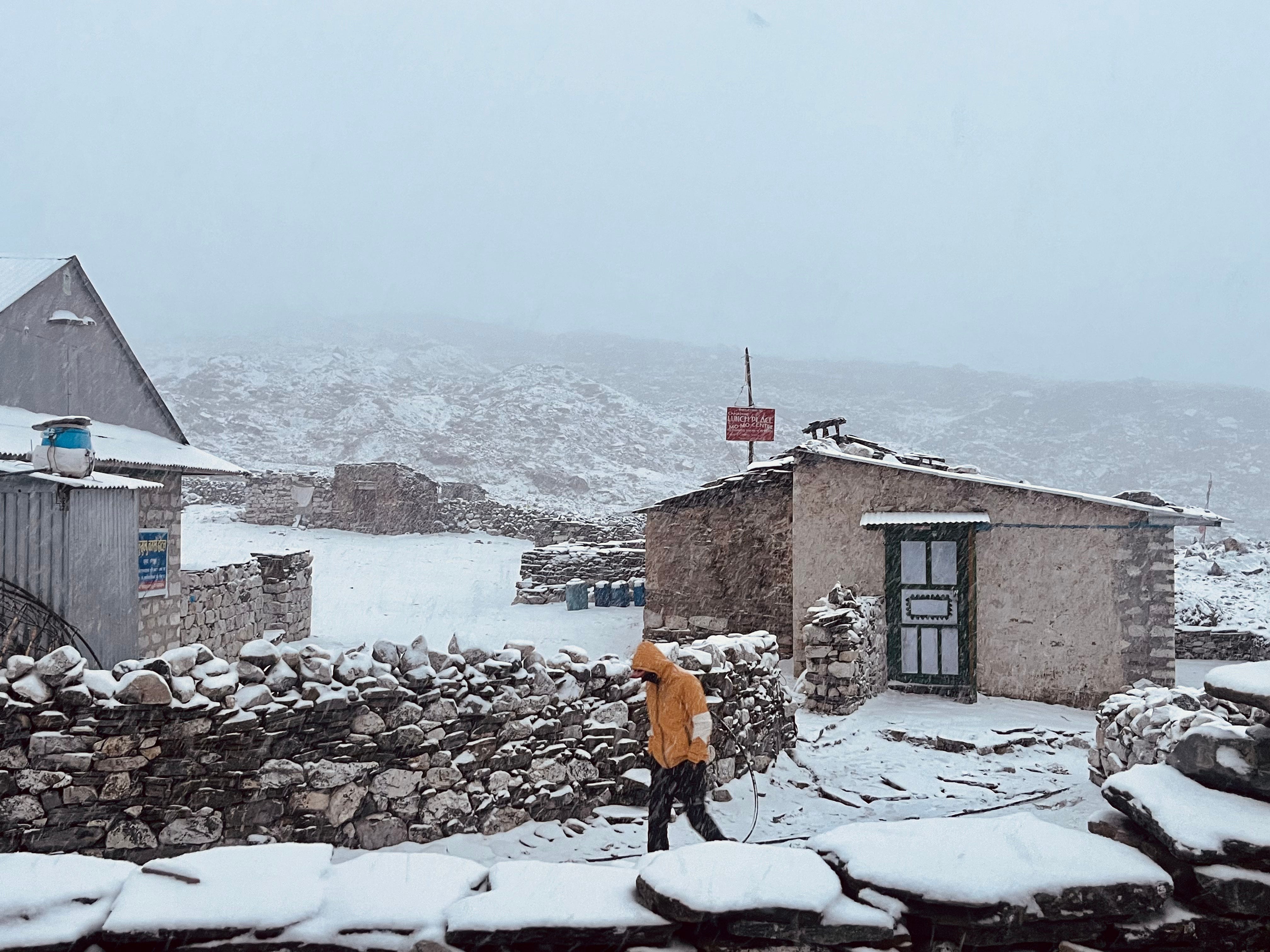
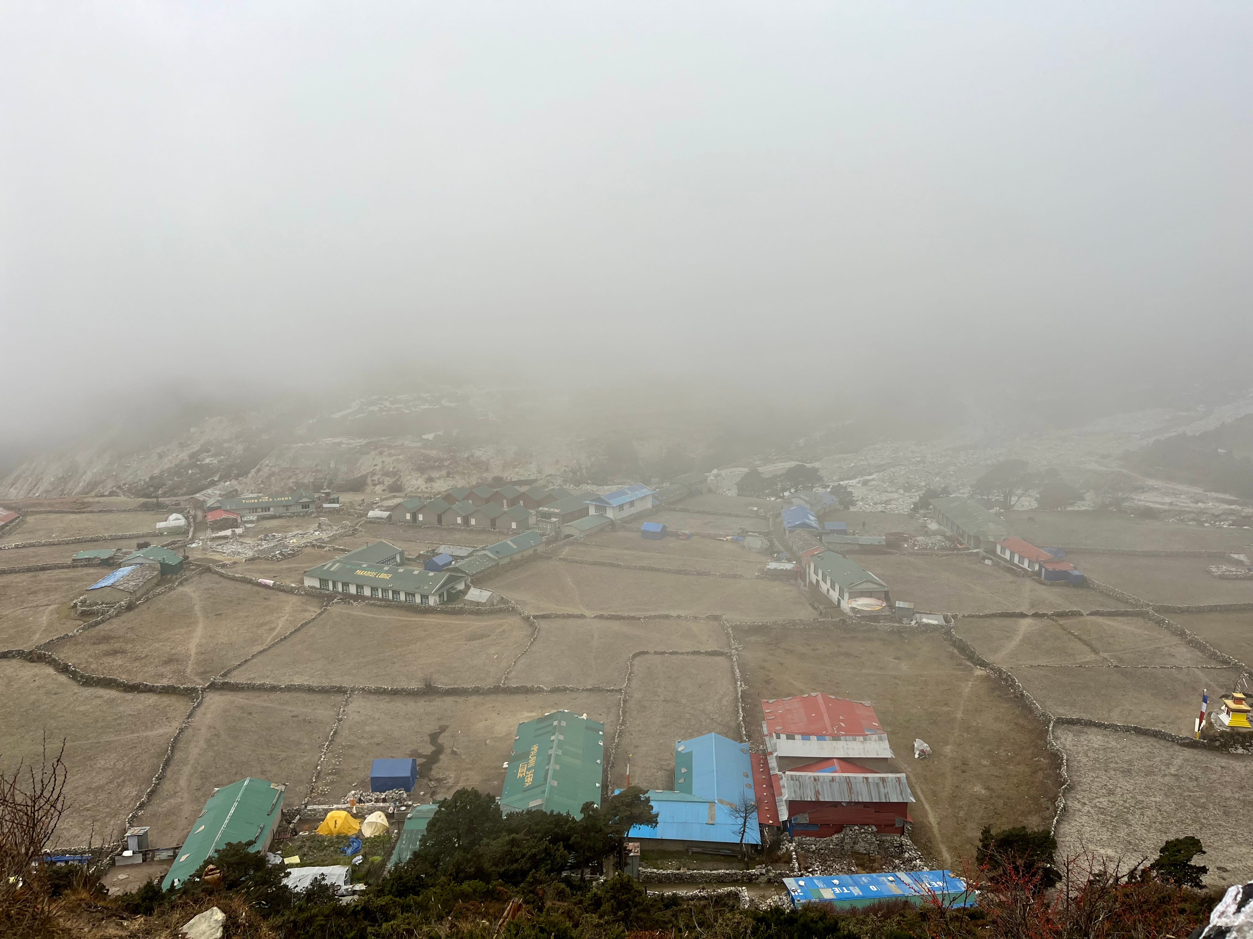
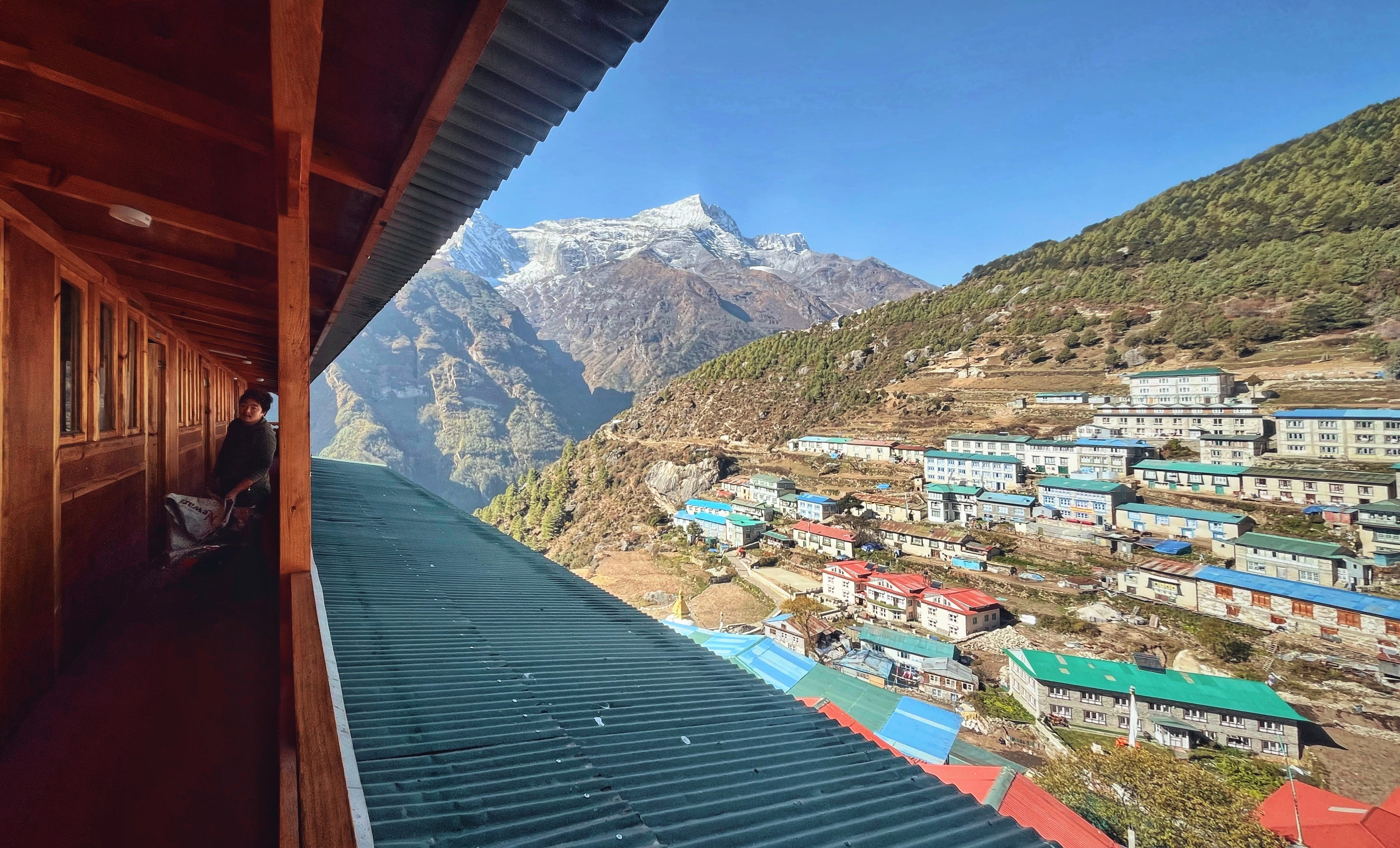
After a somewhat steep and long hike, we finally arrived at Namche Bazaar, where colorful buildings clung to the mountainside, shrouded in a thick layer of fog. The scene perfectly embodied the town’s nickname: "Cloud City."
By this point, Matt was visibly struggling—his sickness making every step a challenge as he fought to hike and breathe through worsening congestion. The difficulty was compounded as we searched for our preferred tea house, perched high on a hill and accessible only by narrow, winding paths.
After several wrong turns, we finally arrived—only to learn there were no rooms left. Thankfully, Gobinda, the tea house owner, directed us to another tea house right next door that had a room available. We quickly settled in, had dinner (I managed a hamburger, while Matt could only stomach some ramen), and drank tea before heading to bed early. Somehow, my left knee, sprained before the trip, held up all day. The steady pace and the strengthening effects of trekking seemed to be aiding its recovery.
Day 3: Everest View Hotel & Khumjung Acclimatization Hike
Trekking Distance: 7.6km / 4.7mi
Elevation Gain: 350m / 1,148ft
Max. Elevation: 3,790m / 12,434ft
Tea House: Hotel 8848
We woke up early at the Shambala Inn. Matt, not feeling well, started the day with lemon ginger honey tea and a breakfast of fried eggs and beans. I managed a quick, cold shower—just enough to wash my hair, face, and splash my body—before heading to the common area for muesli, black tea, and a bit of reading. I started a new book I bought on trail: Interesting Activities in the Culture of Nepal by Mahesh Kumar Karki and wrote a poem titled The Tea House.
Afterward, I went out to pick up incense to purify our room, where Matt was resting. Outside, the morning was clear, revealing incredible snowy peaks rising above the buildings. I bought sandalwood incense from a vendor who swore today would be a lucky day.
The weather was lovely, so I took a stroll up the steps of “Cloud City,” pausing to sit on a rock and take in the stunning mountains above, imagining getting closer each day to exposed, high elevation slopes. As I sat, a woman emerged, wearing hot pink shower shoes and hauling a heavy sack up the stairs, her hiking skills far surpassing my own.
Back in our room, I lit the incense, and we packed up to move to where we originally planned staying, Hotel 8848.
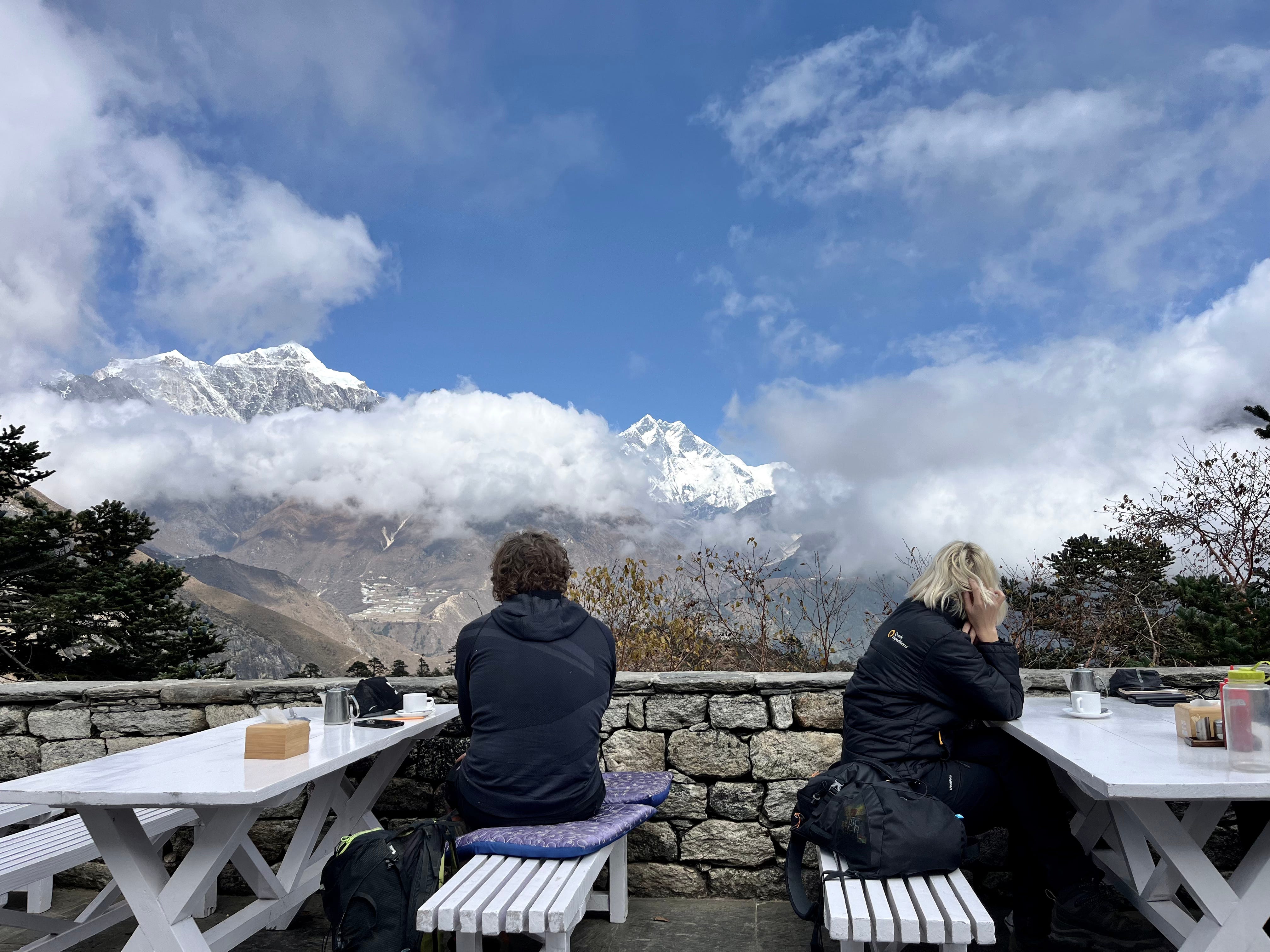
Gobinda showed us to a room on the fourth floor with vast valley views. We dropped off our bags and set out for an acclimatization hike to the Everest View Hotel and the village of Khumjung. Matt, though still coughing, couldn’t pass up the hike.
In the main square, Matt located a pharmacy—one of many scattered throughout Namche Bazaar and other towns along the Three Passes route—to pick up antibiotics and cough syrup before we continued towards the trailhead.
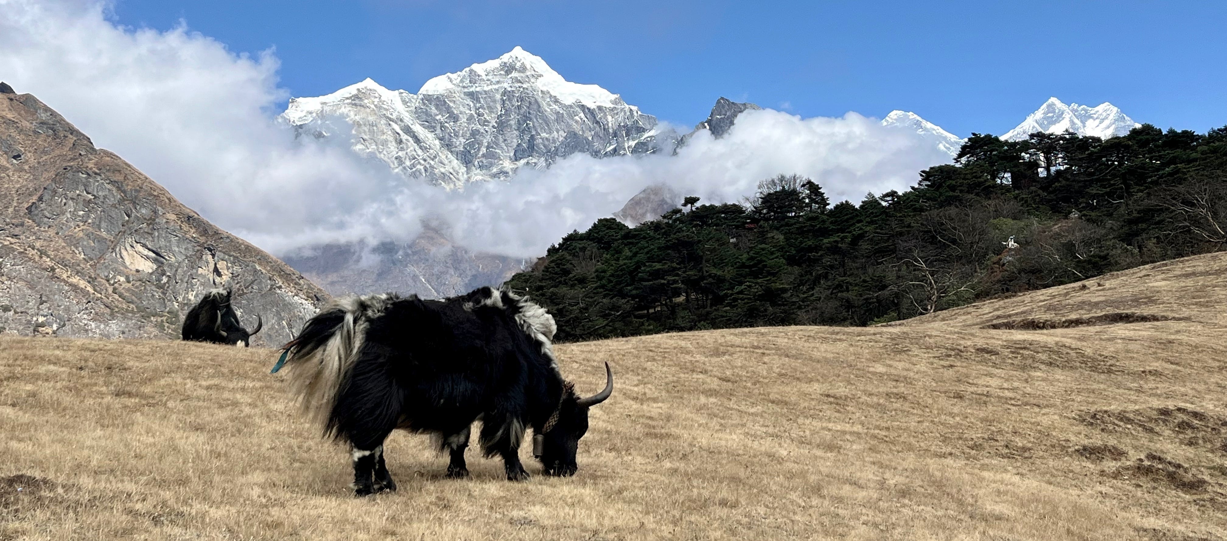
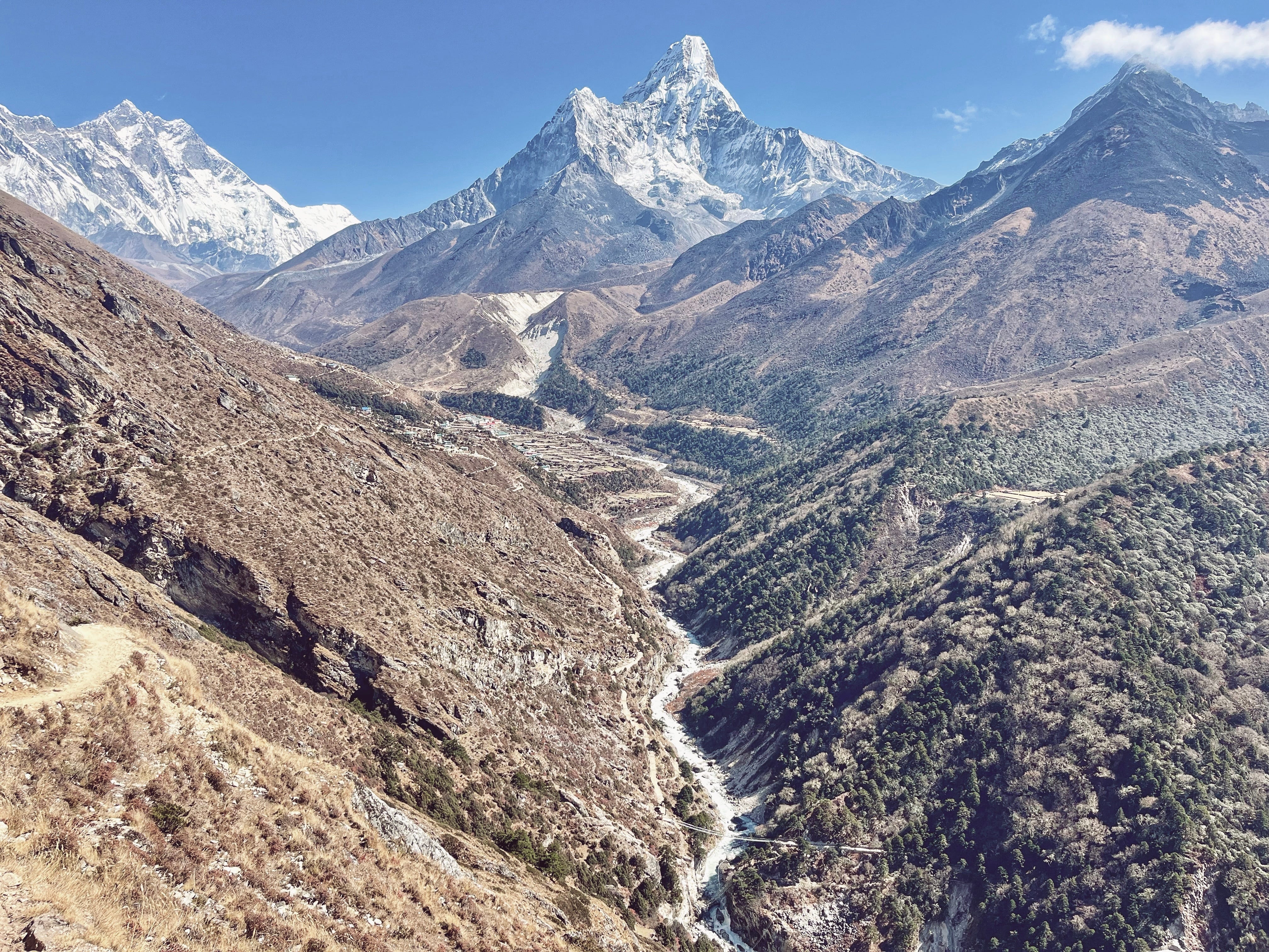
The first mile of the hike was steep before the trail leveled into rolling hills. Mount Everest appeared, with clouds framing its peak. We captured our first photo of the world’s tallest mountain, as a bushy blonde-tailed yak grazed in the foreground.
Arriving at the Everest View Hotel, we ordered a pot of lemon ginger honey tea and settled onto the terrace. Starstruck, we sipped our tea, gazing in awe at our long-time mountain crushes, Everest and Ama Dablam.
Helicopters took off and landed on nearby helipads.
Clouds rolled in around 12:30 p.m., so we decided to head back instead of completing the trek to Khumjung. For future hikes, we agreed to an earlier start, around 6:00 a.m.
On our way back, we walked through Sagarmatha Next, a museum featuring up-cycled trash art. Many of the pieces, such as a bird sculpture made out of aluminum cans, were unbelievably detailed.
After browsing the art, the museum attendants ushered us into a small theatre to watch a documentary on Khumbu’s waste management initiatives. When the film concluded, we were given virtual reality goggles, simulating the climb to Everest’s summit, as well as shown a virtual trek map. We left feeling inspired and fully aware that our trash won’t disappear on its own.
Our next stops, back in Namche Bazaar, were the Sherpa Culture Museum and Mount Everest Documentation Center, where we explored a traditional Sherpa home with a livestock room (followers of Buddhism, the Sherpa people typically hold great respect and love for animals), kitchen, and spiritual room called “Lhakhang,” a sacred space for Buddhist practices adorned with statues, scriptures, and ritual items.
The museum continued with an exhibit honoring Sherpas and others who summited the Himalayas, showcasing gear from the 1950s and key figures. Some of my favorites were Elizabeth Hawley, the legendary journalist known for documenting expeditions so thoroughly that climbers said, “If Elizabeth didn’t write about it, the expedition didn’t exist,” and Yuichiro Miura, who stood out as the first to ski Everest, as well as summit at age 80.
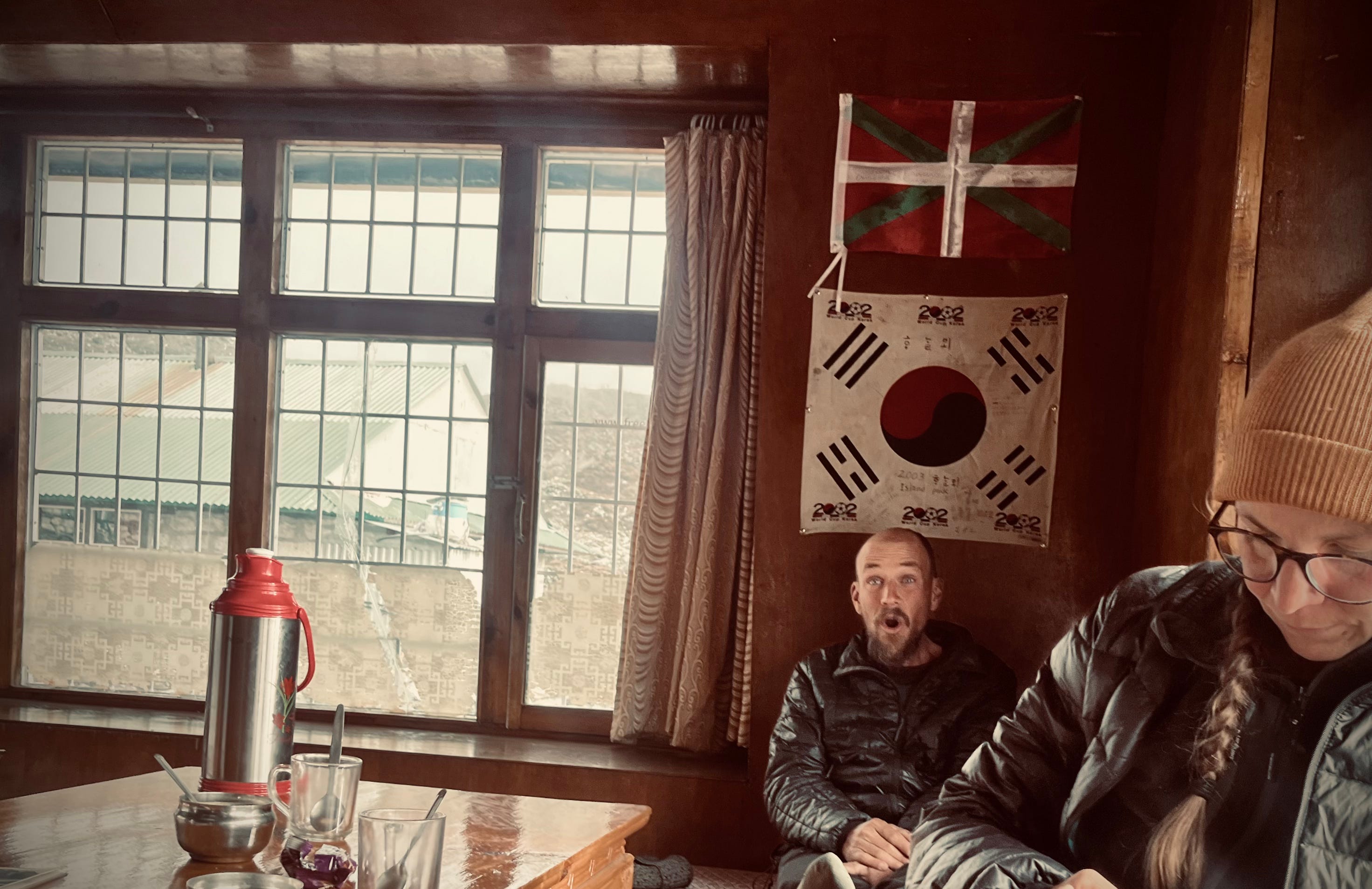
Hungry after the museum, we stopped for pizza, soup, and tea at Highcamp Cafe, then returned to our room for a much-desired hot shower. Later, at dinner, we saw a friend and guide from Kathmandu, Kaylan, video chatting with Gobinda with a big smile, asking how we were doing. We smiled and replied, “Pretty great,” then wrapped up the day with hamburgers, a club sandwich, and fries before heading to bed.
Day 4: Rest Day
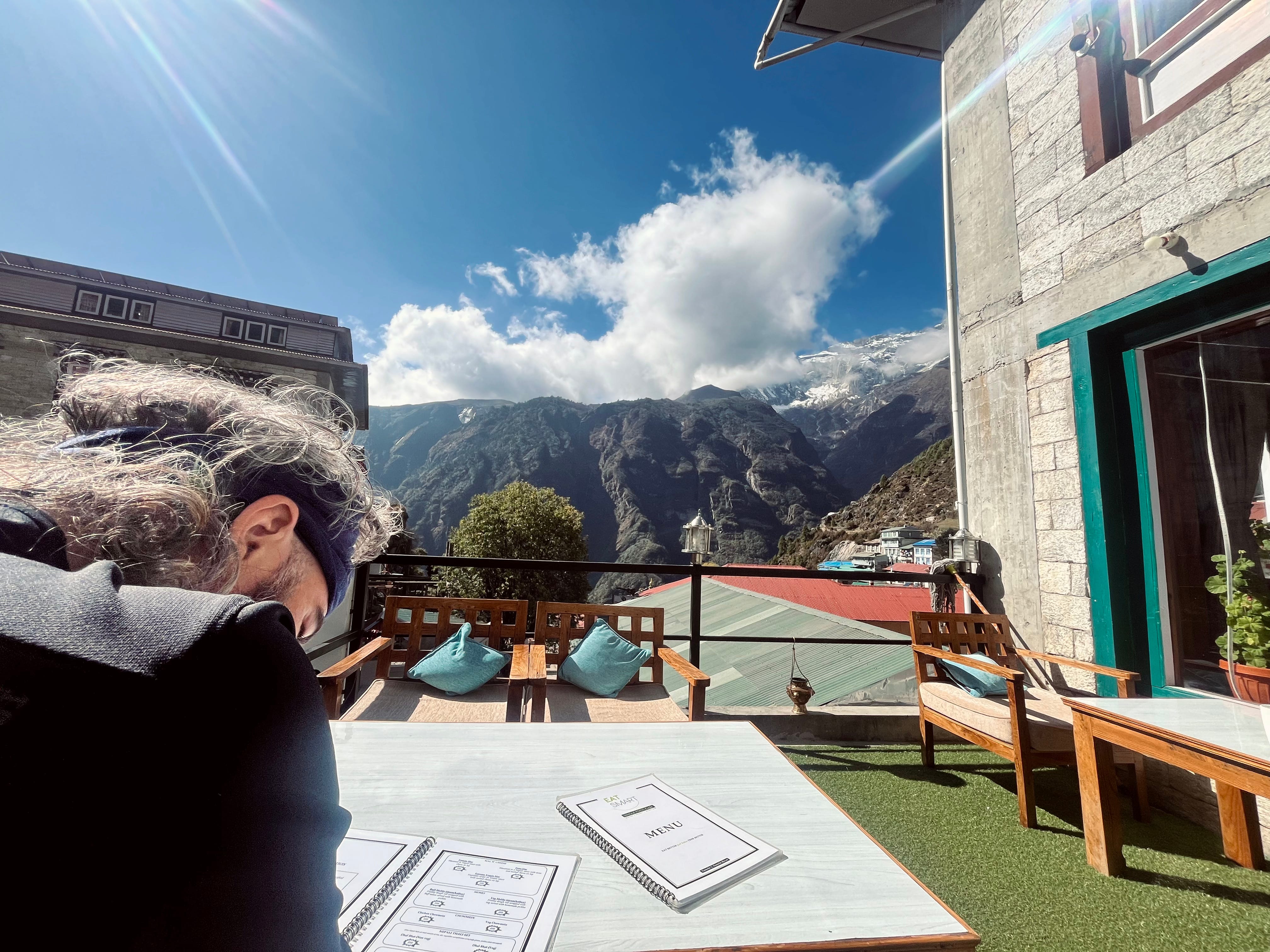
Matt was quite sick, so we decided to take an extra rest day. Not much to be said, except we ate breakfast as usual, lay in bed, and read. I had the chance to finish writing an article about rafting in Nepal, which I researched and typed up all on my phone.
We decided to venture outside to get some sunshine before the afternoon fog rolled in. We found a cafe called Eat Smart with a nice terrace and ordered tea.
The sun, high up on the mountains, was so strong, especially in the mornings. Today was no exception. We eventually started sweating and moved inside.
I ordered a cheesecake. It was delicious.
A couple hours later, Matt left to take a nap, and I socialized a bit with the baker who’s also a climber. His cheesecake truly was delicious.
I eventually meandered back to our tea house, and Matt and I ventured out to the Everest Steak & Wine House to try Yak Steak for lunch. It came with mushroom sauce, and we paired it with beer on tap. The Yak Steak was thick but not too chewy. The sauce and beer were delicious.
Later in the evening, we decided to check out some live music at the Hungry Yak. A cover band played Sublime, Coldplay, and other chill rock. The bar claimed to be the highest live music bar in the world, but Matt and I bet it wasn’t and sure enough, a quick Google search revealed that La Paz, Bolivia is higher and definitely has live music bars.
Satisfied with our day, we returned to the tea house for dinner and sleep. My stomach wasn’t great, so I just had soup.
Day 5: Namche Bazaar to Phortse
Trekking Distance: 5.9km / 3.6mi
Elevation Gain: 400m / 1,312ft
Max. Elevation: 3,840m / 12,598ft
Tea House: Peaceful Lodge
Many interesting things happened to us on day five.
It began like any other, rising early, around 5:30 a.m., packing, and eating breakfast—black tea, porridge, eggs, toast. We said goodbye to Gobinda, then ascended “Cloud City’s” stairs, veering right at the top towards Tengboche.
Matt felt better, energy wise, which was great, since we had a thousand foot climb to make it to Phortse, an authentic Sherpa town off the main circuit but totally worth it.
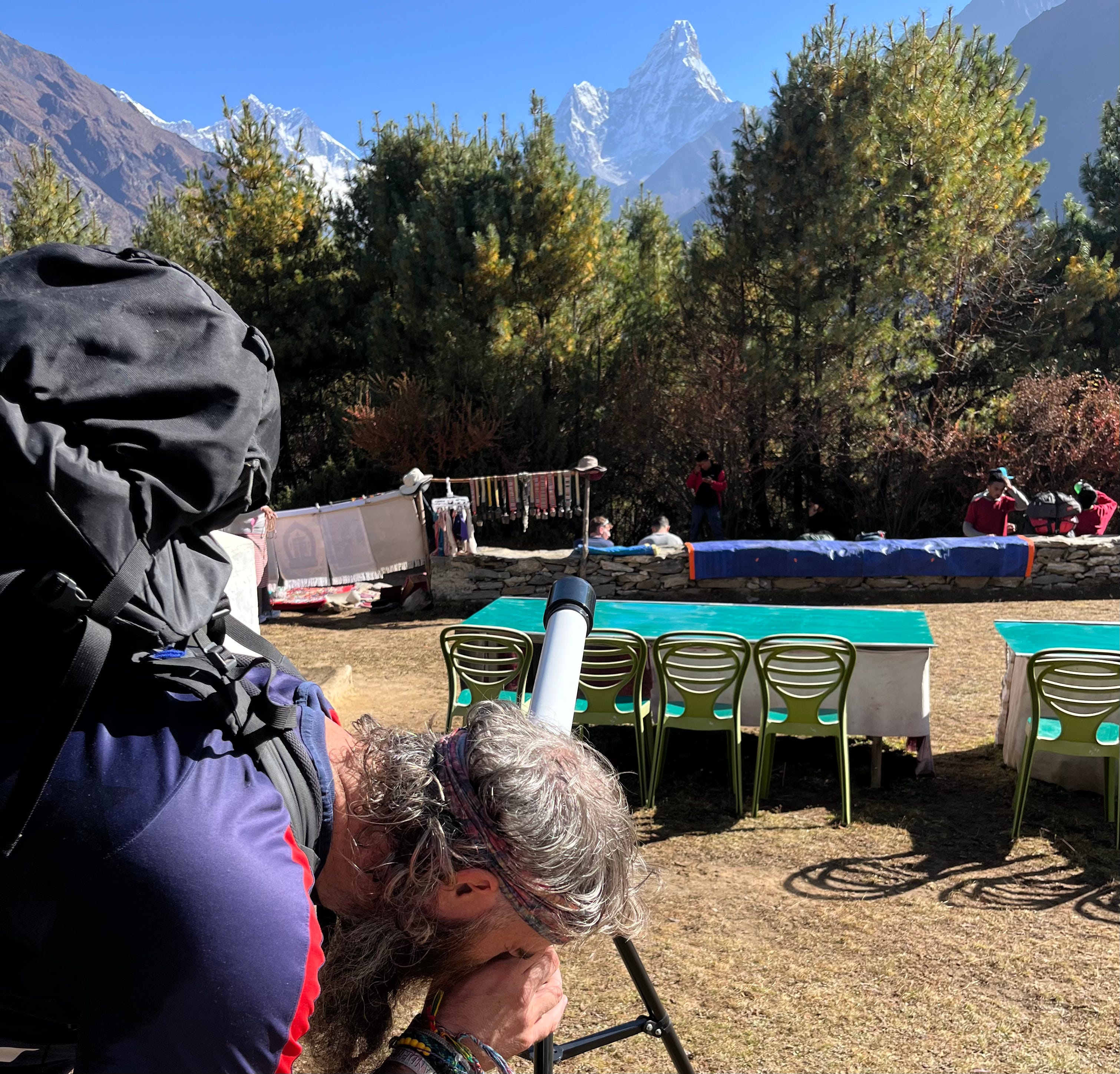
On the way, a teahouse owner and their friends, gathered by the trail for breakfast, invited us to view Ama Dablam through a telescope. I could make out a few climbers near the summit through the lens. After expressing our thanks, we continued on.
Eventually, we turned left at “Mong La” junction, leaving the majority of trekkers behind.
Ascending and ascending, the views of Ama Damblan and surrounding peaks were amazing. We meandered until lunch time, finding a restaurant with an in-your-face mountain view and drinking delicious lemon ginger honey tea.
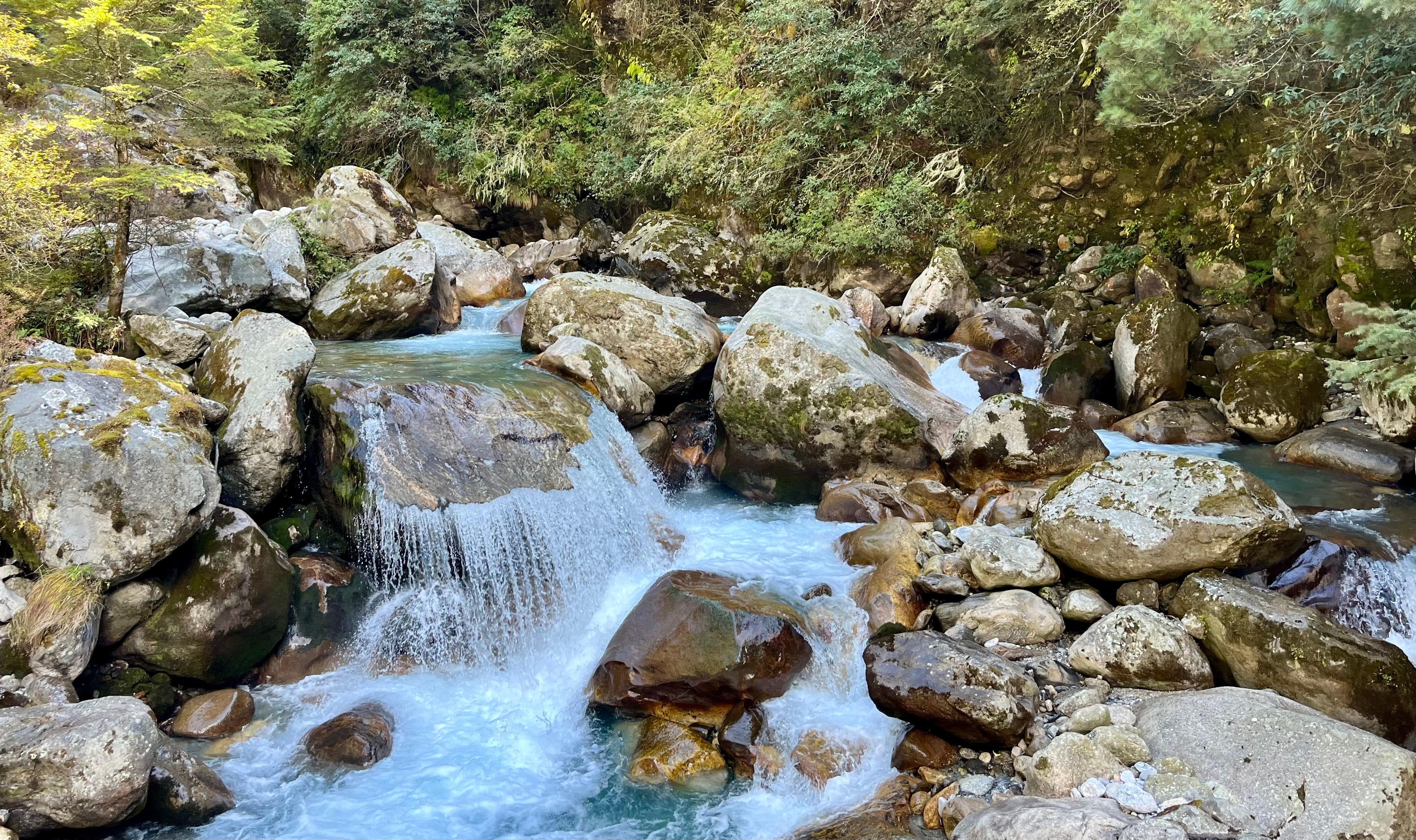
There was a welcome descent into a valley by a rushing river. We stopped for a rest at a bridge before our last ascent.
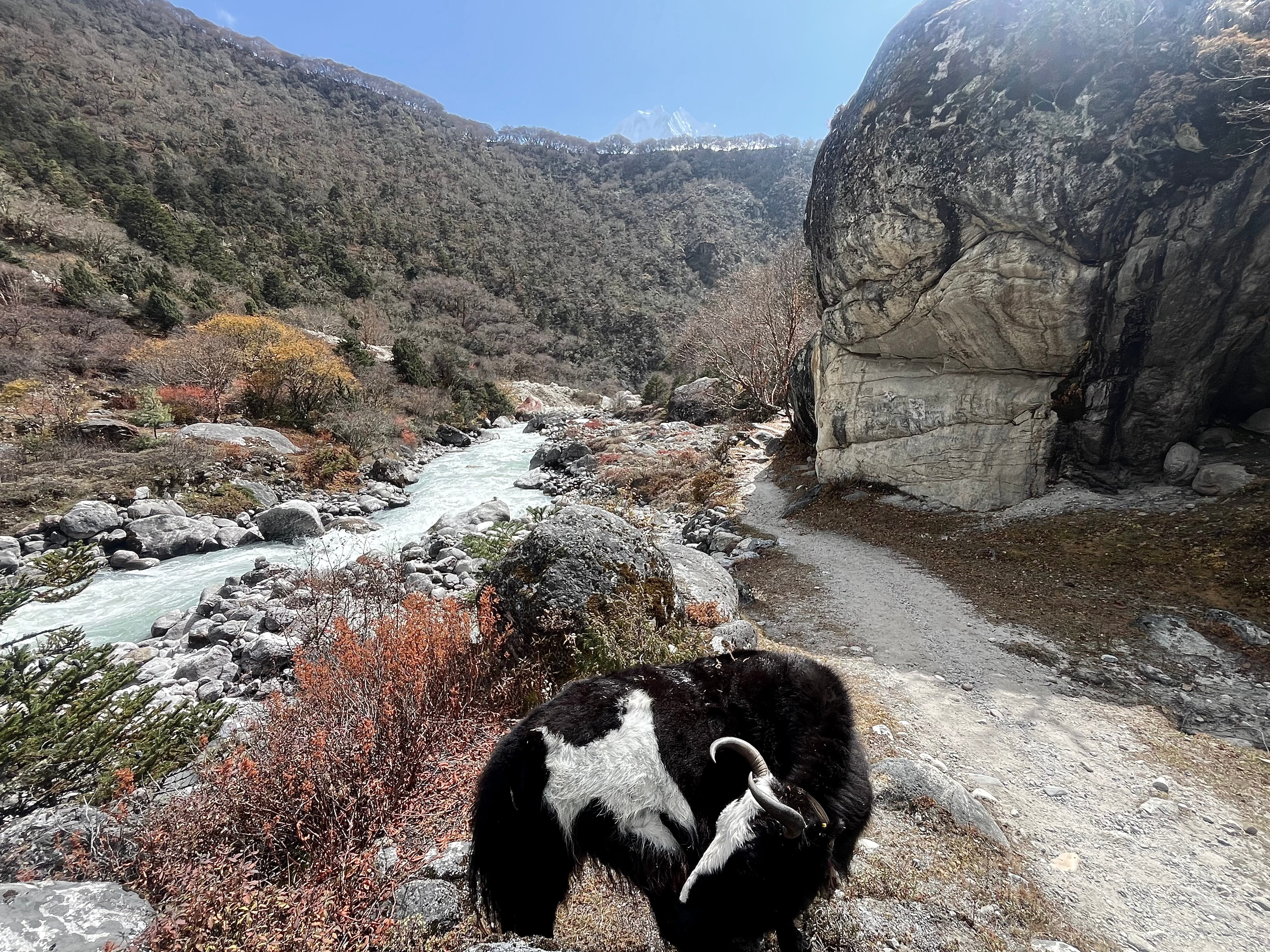
By the riverbank, a solitary yak kept us company.
Towards the start of our second climb, Matt was startled by a dark shape in the woods to his left. We stopped. It was a musk deer hopping through the trees, munching on leaves. Two strangers approached and I signaled “shhh.” But it was too late. The deer disappeared into the woods.
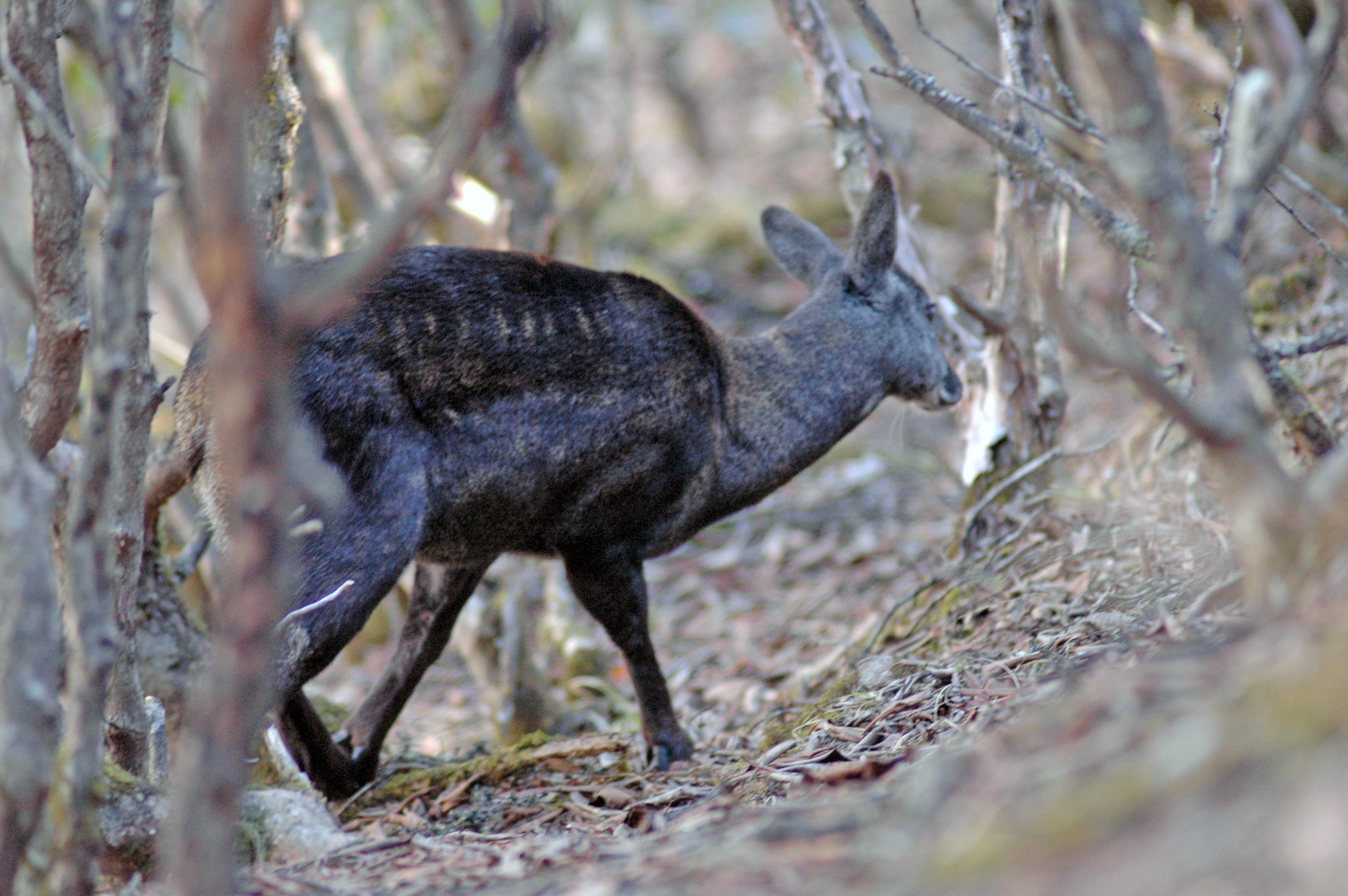
When we greeted the two and explained what we saw, they said it was rare to see musk deer and that we were lucky. They asked where we were staying, and when we said we didn’t have a reservation, the woman gave a glowing review of Peaceful Lodge, her friend’s family’s tea house. She said it was once featured in Lonely Planet, currently run by her friend’s dad, and was great.
We all finished the last ascent, entering Phortse through a painted gate, and all went to Peaceful Lodge. I was feeling calorie-depleted and tired, so I was very happy to approach the shelter.
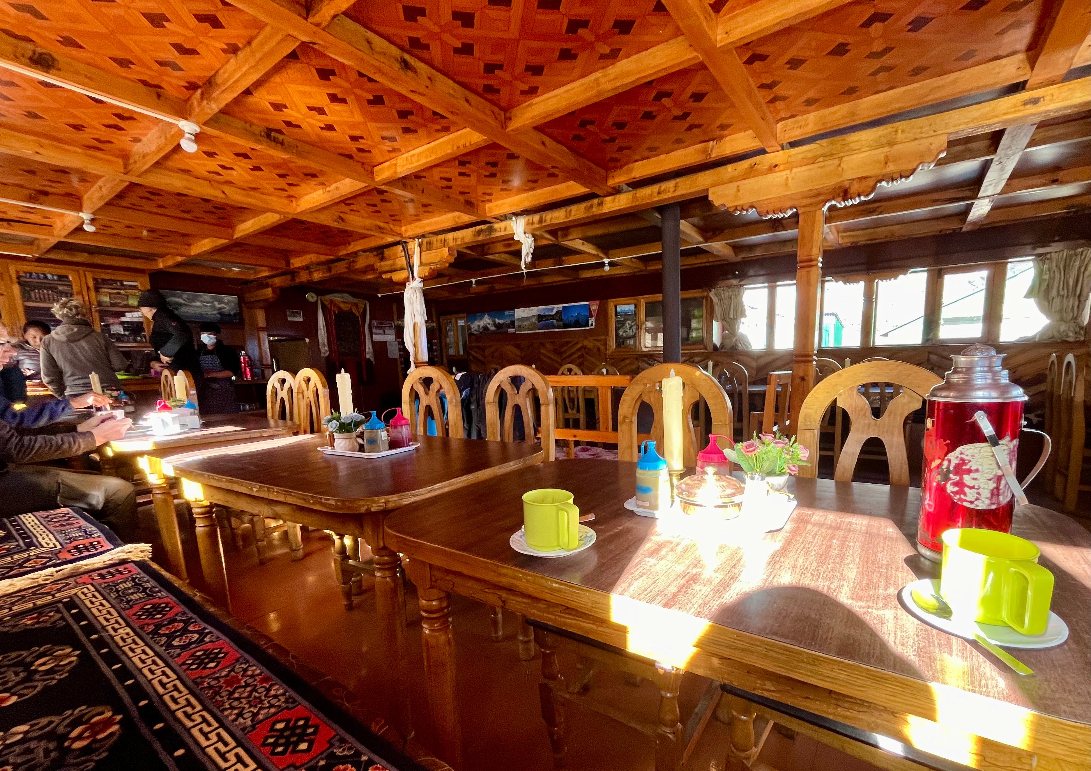
We entered the dining area, which was set up in traditional Sherpa fashion with bench seats covered in colorful rugs behind tables facing each other and bordering the room in a square shape. People sat, spread out along the benches rather than right next to each other since the set up was so nice for chatting. A wood burning stove stood in the middle of the room.
We learned the two’s names: Tashi, a Sherpa, guide, and businessman, and Dawn, an American, nurse, and climber, as well as Tashi’s dad, Pema. A German and another American from Telluride, Colorado with a guide were also staying at the tea house. We took hot showers in an outdoor wooden room, ate lunch—tea, potato momo, and egg noodles—then went for a rest.
After an hour, we accompanied Tashi on a walk to the Khumbu Climbing Center, the world’s highest climbing gym.
Of his many trades, Tashi is also an aspiring ski instructor and has spent time in Colorado. He was feminist-forward, having encouraged me to take the lead on our walk, ahead of the guys. He also shared a story about one of his sisters, who, as a child, felt excluded from her ski team because of her brown skin. I admired his political awareness and his willingness to start honest conversations.
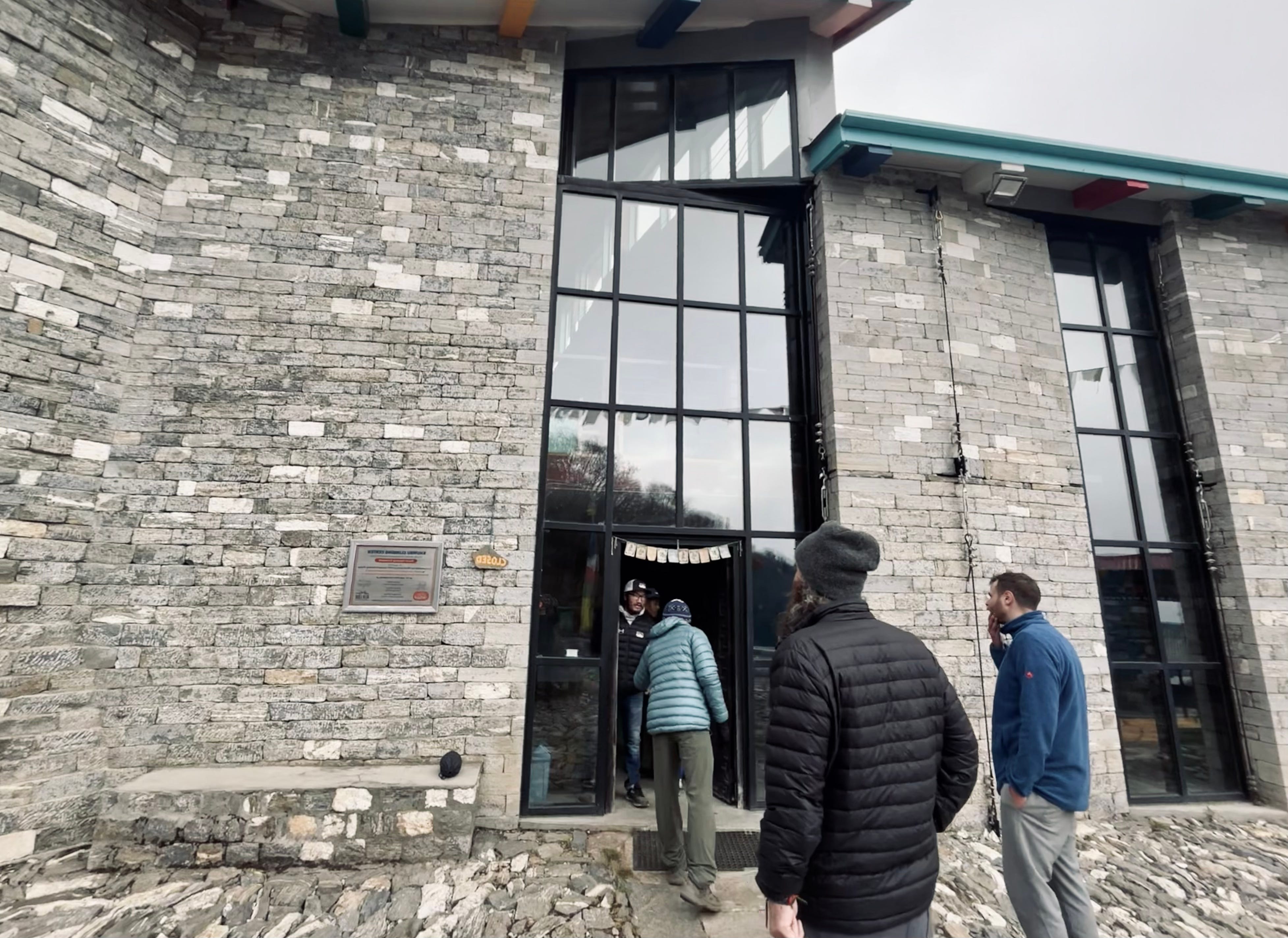
The Khumbu Climbing Center is the only earthquake-proof building in Phortse. Built with stone like a castle, one of the building’s exterior walls even has bolts you can clip into to lead climb.
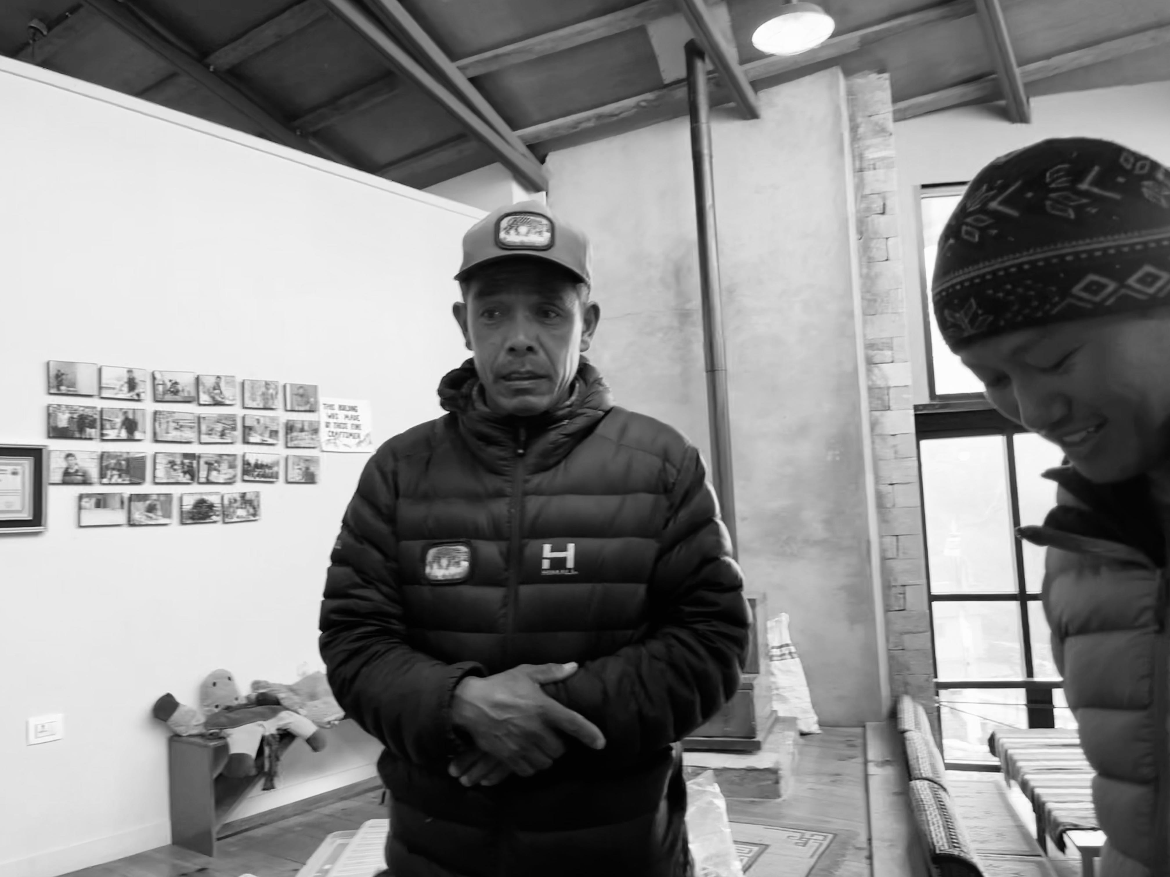
Inside the Khumbu Climbing Center, we were greeted by Dawwa Nuru, whose 25-year career included summiting Everest 12 times, Cho Oyu six times, and Makalu once. He manages the climbing gym and equipment center, where his laughter and banter with many a guest filled the space.
His first summit of Everest was in 1979 and his last was in 2019.
We also met a videographer named Manish who summited Everest while filming a French team’s expedition. Afterward, they flew him out to France for the film premiere.
Tashi gave us a tour of the climbing center, showing us the mountaineering equipment room, library where little kids play, and some history about the first people to summit Everest, including Sherpa Tenzing Norgay, who was the first man to reach the summit of Everest together with Edmund Hillary.
Tashi shared fascinating insights about the story, Into Thin Air. His father, Pema, a renowned mountaineer who summited Everest three times in the 1980s, played a significant role in the story. Pema was the guide who successfully led Rob Hall, an accomplished New Zealand mountaineer, to his first summit of Everest.
Later, when Rob invited Pema on a subsequent expedition, Pema sought advice from a spiritual leader, who warned that it would not be a favorable year to climb. Taking this counsel to heart, Pema declined the invitation. Tragically, that was the year Rob Hall and others lost their lives in a storm on Everest.
In the wake of the tragedy, we are grateful that Pema is still with us. His success as a guide not only earned him international recognition but also invitations from satisfied clients to visit them around the world. These connections, along with opportunities in business ventures, provided the means to send his children to school and secure a brighter future for his family.
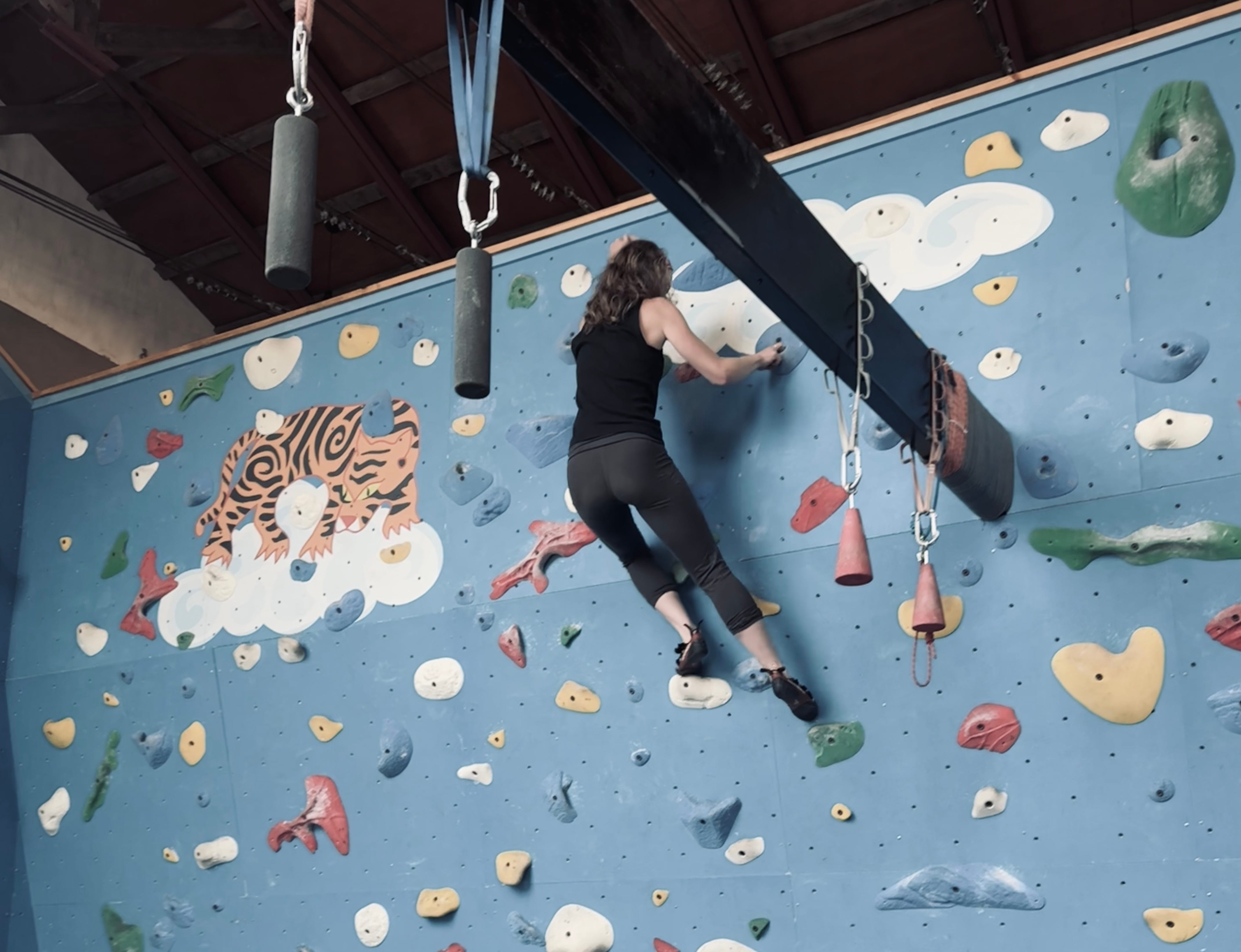
At the world’s highest climbing gym, I couldn’t pass up the chance to scale the indoor wall a few times, so I threw on some climbing shoes and gave it my best shot, despite feeling weak from not having been climbing much recently. It cost 500 rupees.
We headed back to Peaceful Lodge for rest and dinner, which was a hoot. Pema entered into a mode of being which I could tell was attributed to his success as a guide. He’s a wonderful people’s person with a warm, silly, sarcastic soul that entertained the room nonstop.
Dawn told stories of training for mountaineering with Tashi’s sister in the States, where they lived. She revealed that she was going to summit Ama Dablam in a few days and would later summit Everest—a dream she’s had since she was a teenager. Tashi and his family gifted her a red necklace, a type typically given only to Sherpa people. I was inspired, to say the least.
Before turning in for the night, Pema lamented that some old friends had booked him as their guide for the Annapurna Loop. He tried telling them he’d rather not do it and that there were other guides, like his son, who would happily go in his place. But they insisted he go. People just can’t get enough of him.
Day 6: Phortse to Pangboche
Trekking Distance: 9.1km / 5.7mi
Elevation Gain: 1,117m / 3,665ft
Max. Elevation: 3,985m / 13.074ft
Tea House: 360° View Lodge
We woke up and had breakfast—the usual, though I tried Tibetan bread for the first time, a delicious, fried dough that hit the spot, with Dawn, who kindly shared. After our goodbyes, we set off on the trail.
Today’s walk was one of the best so far. Ama Dablam rose above the trail, and as we walked, more and more of its distinctive shape came into view, until even a river zigzagged, fully visible, in front of us. The sky was clear, brightly illuminating shades of light purple, blue, and brown.
The hike was short, just three hours, and we settled into the well marketed 360° View Lodge—a bit pricier, but we decided to splurge.
Lunch was ramen soup with egg and fried rice. With the whole afternoon free, I read, rolled a smoke, and took a good rest. I’d noticed a nearby monastery, and if I’d remembered sooner, I would’ve gone for a pot of tea.
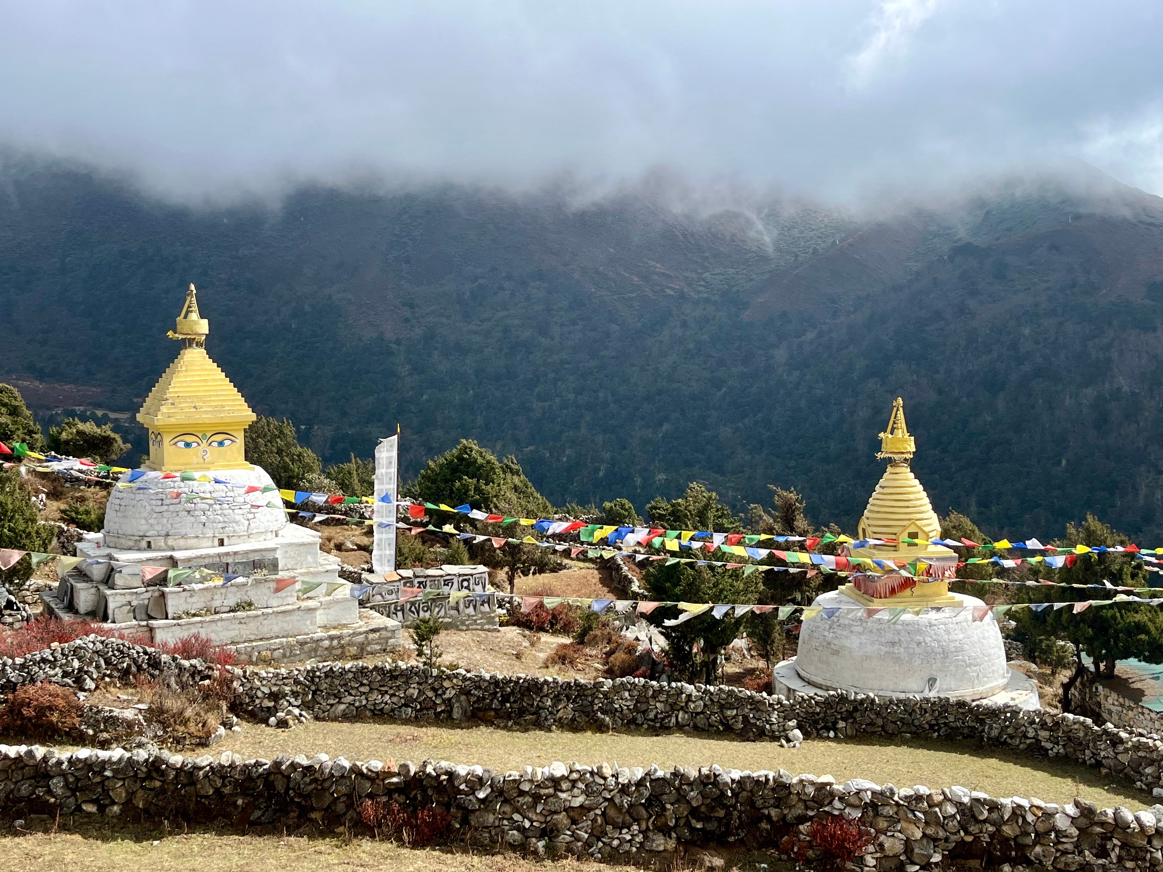
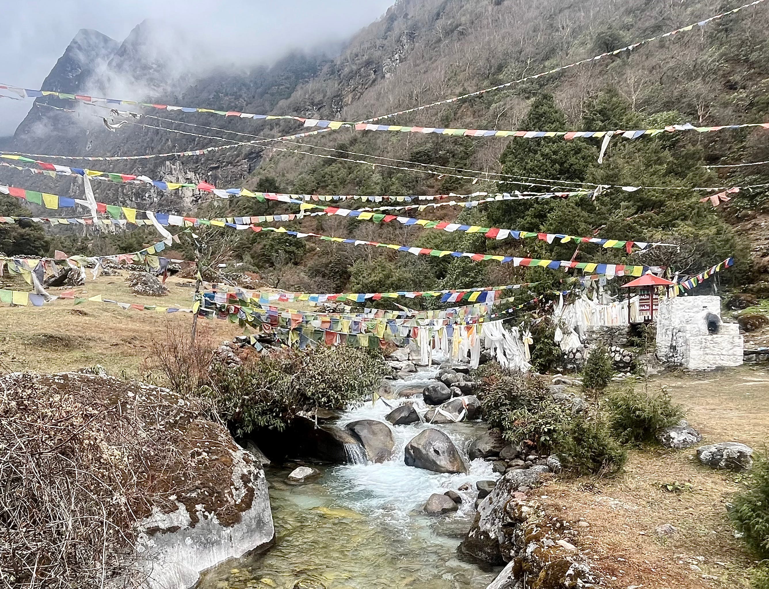
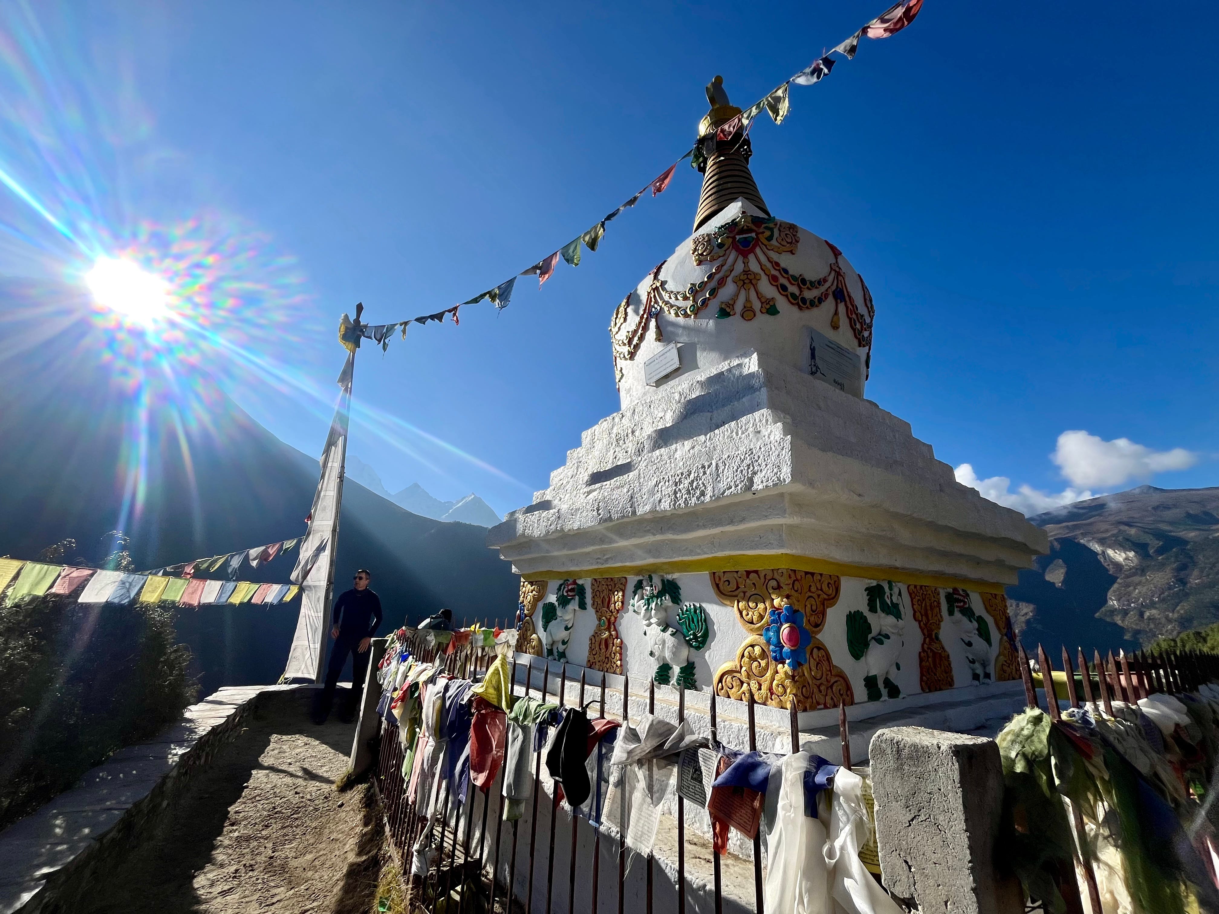
In the late afternoon, I stepped outside for a smoke, sitting on a stone wall facing two golden-topped stupas with Buddha eyes. Prayer flags were strung across the yard in faded strands, worn and weathered by the elements. I wondered how long they’d been hanging there.
Just then, three elderly women appeared from the fog, draped in layers of cloth dresses, capes, and wool hats. I waved, and one waved back enthusiastically. They held strings of beads in their hands, brushing each bead with their fingers as they walked. I recognized it as a Buddhist tradition: counting 108 beads as a form of meditation, bringing peace and connection to a higher self. They circled the stupa again and again, counting.
Back at the dining hall for dinner, the young girl serving us brought out hot, damp towels, which we pressed to our faces and used to clean our hands. We ate dal bhat, ramen, and played several rounds of the card game, Monopoly Deal. Matt won every time, but as a beginner, I was just trying to avoid total humiliation.
Day 7: Ama Damblam Base Camp & Pangboche to Dingboche
Trekking Distance: 6km / 3.7mi + 6.9km / 4.3mi
Elevation Gain: 485m / 1,500ft + 425m / 1,395ft
Max. Elevation: 4,600m / 15,092ft
Tea House: Dingbuje Guest House
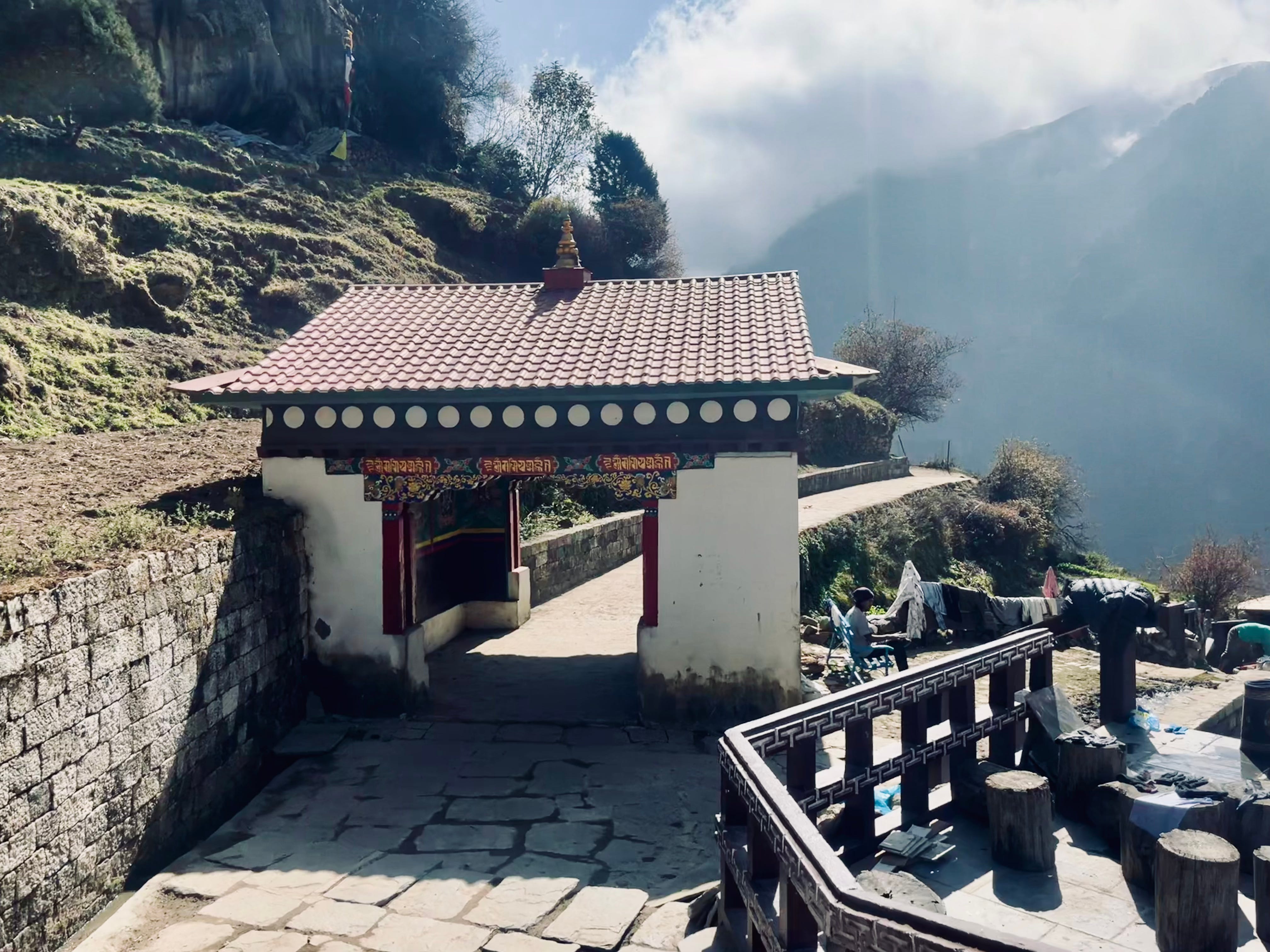
We started our day early, rising at 5:30 a.m. for a morning hike to Ama Dablam Base Camp, a six-mile trek round-trip. We set off from our tea house, passing through Pangboche with its stone walls, monastery, and rows of houses.
In hindsight, we probably should’ve stayed deeper within the village—360° View Lodge sits on the outskirts, which added an extra mile or so to our hike. But, no regrets.
The trail was tricky to find at first. After crossing the river, we guessed the general direction and decided to go straight up the hillside, off-trail. Eventually, we emerged onto a wide meadow, rewarded with expansive views of the peaks, including Lhotse and Everest.
After a steady ascent, we finally reached the base camp, a cluster of yellow tents nestled below Ama Dablam’s distinct, jagged peak. A few campers eyed us curiously as we waved hello. I lit up a smoke to celebrate, and Matt, despite my warnings since he wasn’t feeling his best, asked for a hit.
After savoring the crisp air and impressive sights, we began our descent, eager for brunch back at the teahouse. Along the way, we crossed paths with the late-morning crowd, glad we’d had the trail mostly to ourselves earlier.
Finding our tea house on the outskirts proved a bit of a challenge again. But it felt good to have accomplished our morning hiking goal.
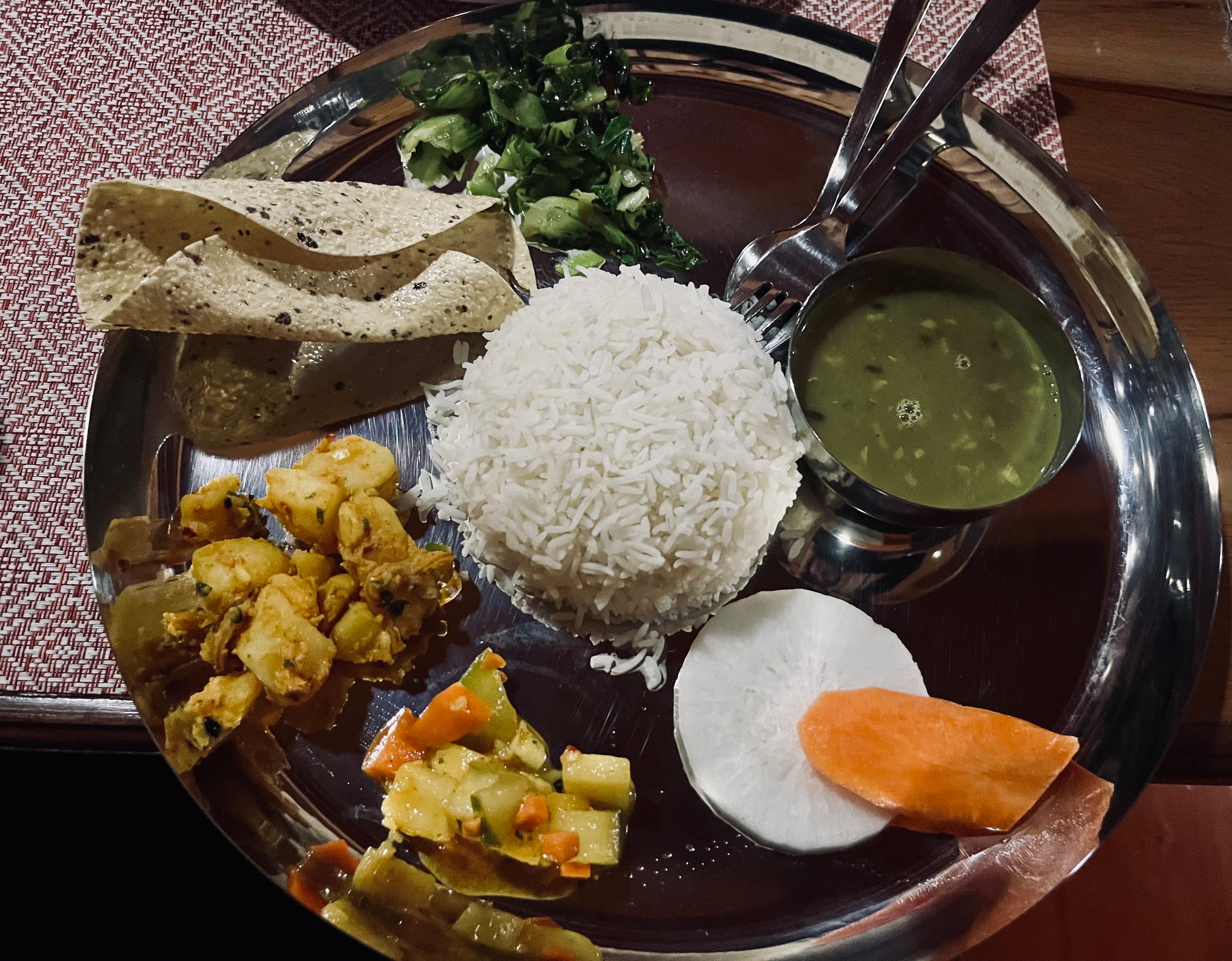
For brunch, we ordered chapati with egg, mushroom soup, and dal bhat, taking in the views of Ama Dablam from the dining room as we waited. We packed up while our food was being prepared, ate, paid, and hit the trail once more.

The next leg was about four miles, and either the trail was friendlier or I was stronger. The steep ascents were broken by stretches of flat terrain. Being back on the main circuit, we saw plenty of other hikers. We passed scenic views of the river as mystical fog rolled in.
Arriving in Dingboche, we checked into a tea house with hot showers—a luxury as we headed into the more remote passes where they’ll be harder to come by. It was also conveniently close to the next day’s trailhead.
After showers and rest, we waited for dinner and played more Monopoly Deal.
Matt beat me every time until the last game of the night, when I finally managed a win.
We drifted off to sleep in warm blankets, content and ready for tomorrow’s trek.
Day 8: Dingboche to Chhukung
Trekking Distance: 5.03km / 3.1mi
Elevation Gain: 403m / 1,320ft
Max. Elevation: 4,730m / 15,518ft
Tea House: Panorama Lodge
We slept in today, by our standards. The morning was unusually foggy, so we decided to wait for the sun and enjoy a breakfast of eggs, toast, potatoes, and Tibetan bread before setting off on a day hike.
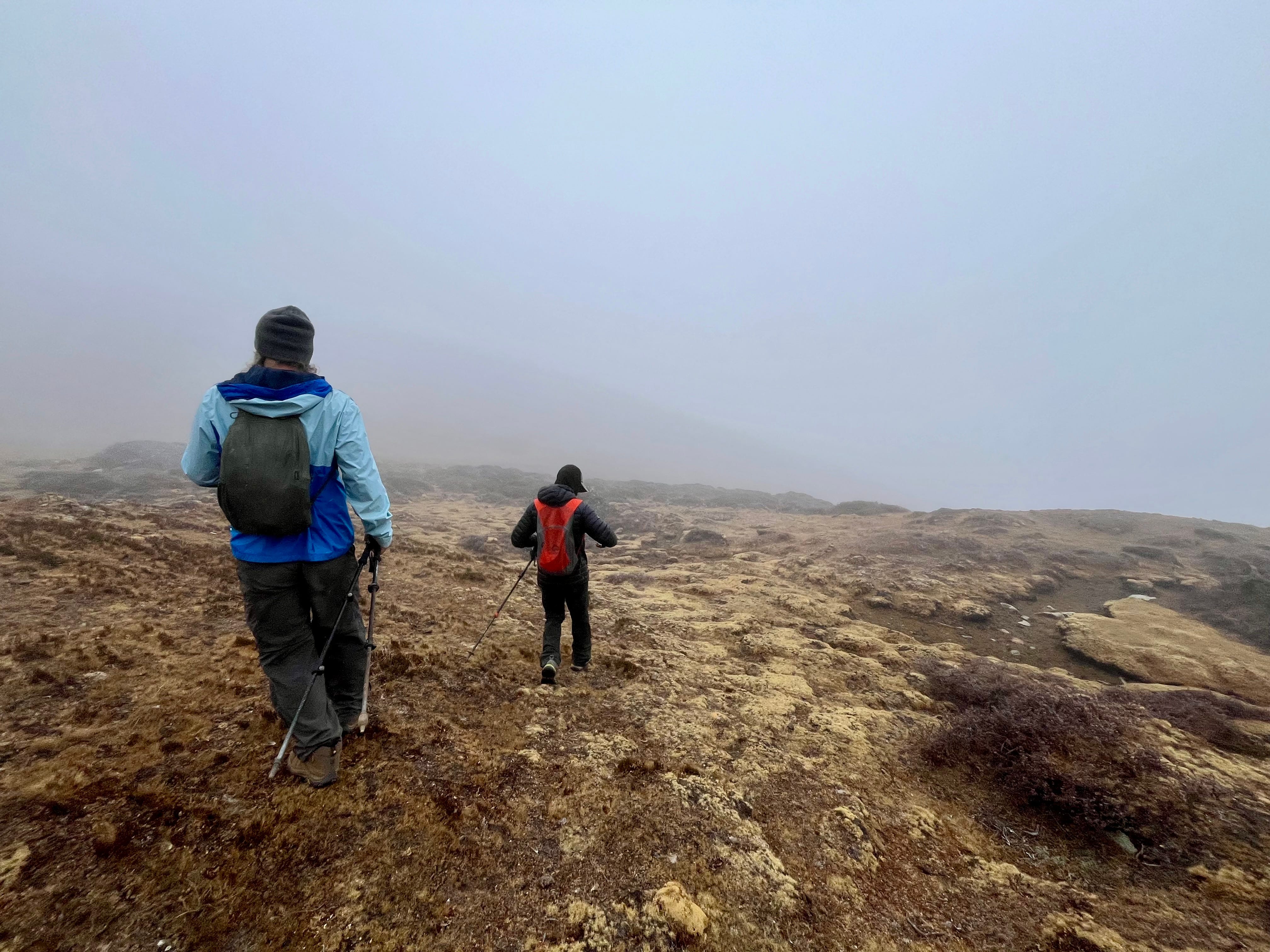
We wandered up the ridge above Dingboche, where golden stupas and prayer flags marked each viewpoint. The sun came out strong, and more trekkers filled the trail.
After reaching the first viewpoint, Matt decided to head back for some rest, still nursing a nasty cough. I continued alone, hiking up to two more viewpoints. It was lovely—no backpack, the sun warming me, and the mountains in full view.
I eventually descended back to the tea house. We packed up, enjoyed a black tea, settled our bill, and hit the trail.
The hike to Chhukung was short, just three miles along an alpine stream, but it was exactly my kind of backpacking: remote, rugged, with an undefined trail marked only by the occasional pile of rocks. The rocky meadow was flanked by Lhotse, Island Peak, and other giants, with patches of bushes turning red as fall took hold. We hardly saw another soul.
When we reached Chhukung, I was feeling calorie-depleted. The first three tea houses we tried were fully booked for the next two nights, which didn’t help. Eventually, we found a room at Panorama Lodge, settled in, and ordered food in a cozy common room filled with good energy and sunlight streaming through the windows.
A couple of Swiss travelers named Tania and Joos joined us in the tea house, ordering milk tea and sitting beside us in the sun. They were seasoned adventurers who had been biking for two years through Pakistan, Kyrgyzstan, Turkey, Israel, Georgia, and many others, with Everest as the epitome of their journey.
Matt and I ordered a pot of tea to share, and the afternoon flew by as we exchanged stories and laughs with the Swiss. Later, a German trekker and his guide joined us by the wood burning stove, and we all shared our routes and experiences as we waited for dinner.
We ate, read by the fire, and eventually made our way to bed, content from a day well-spent.
Day 9: Chhukung Ri Acclimatization Hike
Trekking Distance: 3.2km / 2 mi
Elevation Gain: 320m / 1,049ft
Max. Elevation: 5559m / 18238ft
Tea House: Panorama Lodge
Matt and I woke up and had breakfast at the reasonable hour of 7:00 a.m. I went all in to avoid going calorie-depleted again—chapati with egg and cheese, plus porridge.
The sun didn’t make its usual appearance today. Instead, the fog was thick, meaning we’d miss out on views of some of the highest peaks—Lhotse, Cho Oyu, and Malaku—usually visible from the top of Chhukung Ri.
We began hiking, spotting glimpses of mountains peeking through the thick clouds. Though they weren’t fully visible, being there, I could still feel their presence looming above us.
It was not an easy hike, requiring a couple hours to make it to the false summit. Here, prayer flags were strewn about, and we ran into a friendly German and his guide from our tea house. We rested for a bit, and I indulged in a ten minute nap. Matt rationalized that, since we made it as far as we did, we should try to summit, even without any visibility. Upward and onward we went.
The trail grew more and more technical, and fatigue set in. I took more breaks than normal. High altitude, steep day hikes like these were not my strength, I learned. I managed to push through to meet Matt at the summit, marked by another shrine of prayer flags—and, randomly, a Chinese flag. We huddled together, and I felt lucky for my awesome trekking partner at that moment.
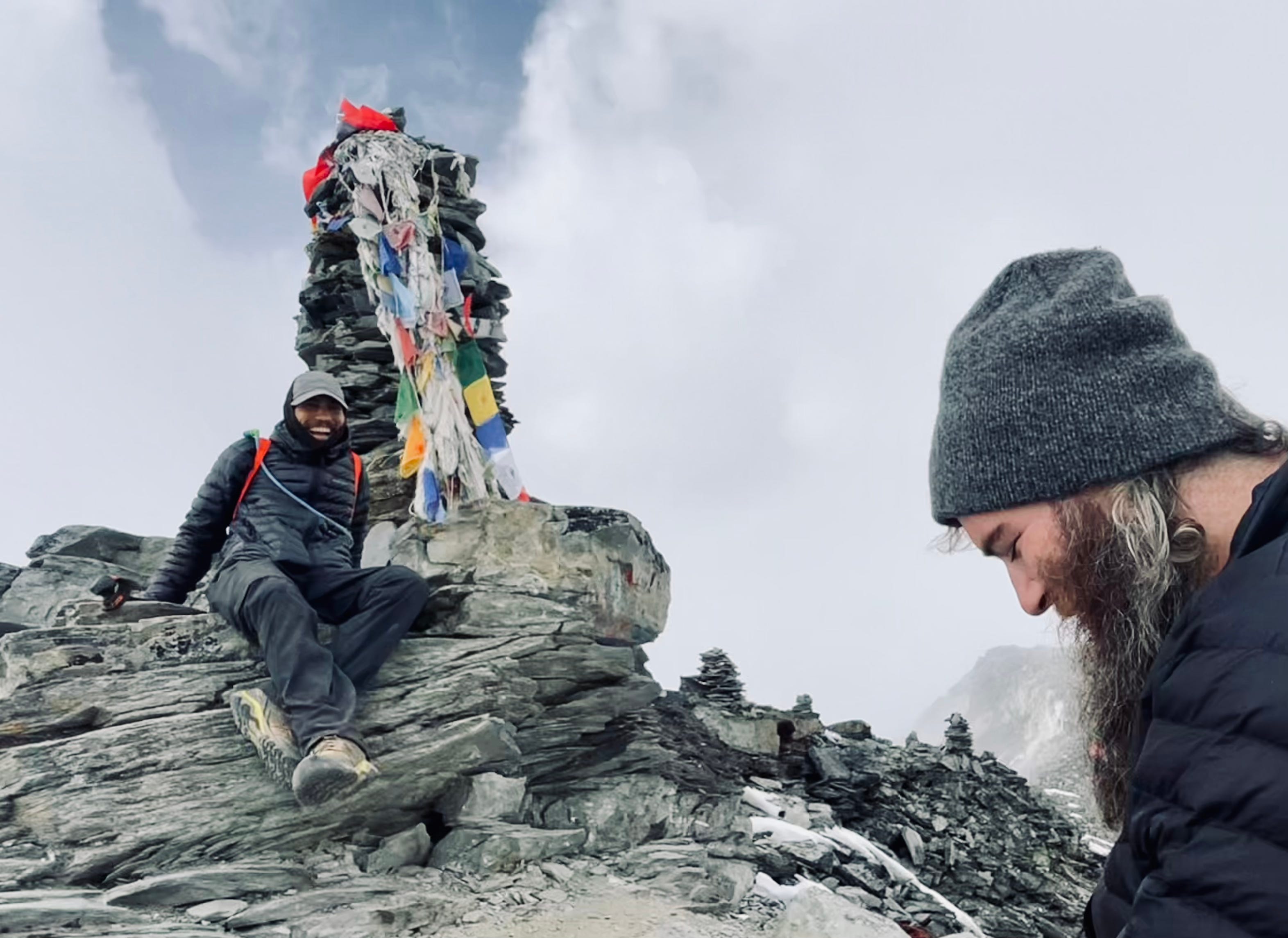
A Nepalese adventurer named Sachin joined us at the summit soon after. He sat down next to us and we began conversing. Having lived in Australia for many years, he spoke English with an Australian accent. He shared stories about the Himalayas, famous climbers, and life where he currently lives in Berlin with his German partner.
We chatted, despite the cold, for close to an hour on the summit, then followed him down the mountain.
We talked about Kathmandu, and I mentioned Newari food—e.g. beaten rice, spiced buffalo meat, bara (lentil pancakes), fermented pickles, and more—which led to discovering that he was Newari from Bhaktapur. We reminisced about his hometown, fondly recalling the popular traditions of going out for yogurt served in clay cups and drinking rice wine, which he explained is actually beer and should be sweet.
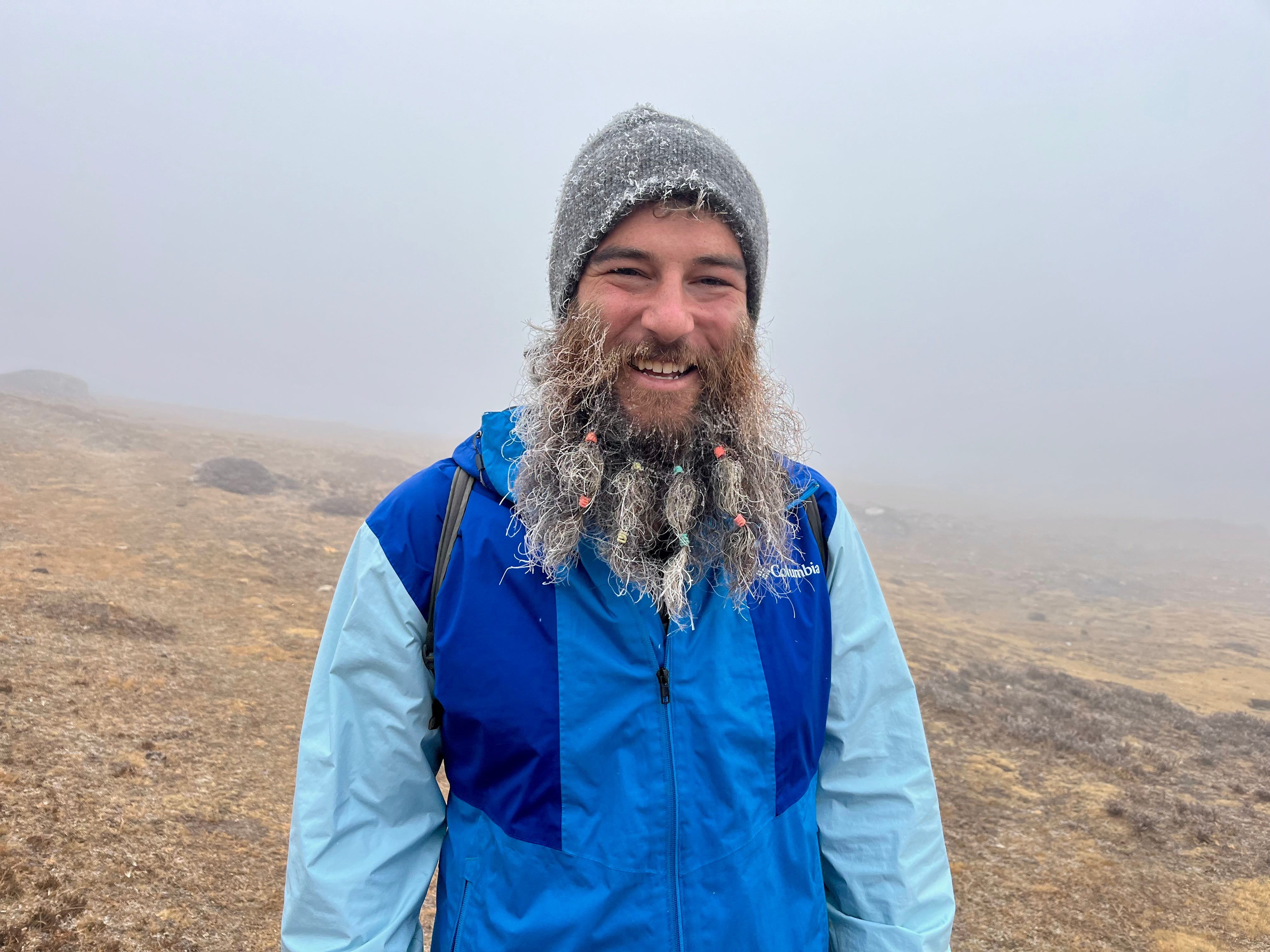
The descent felt like an adventure with Sachin leading the way, even more so when it started snowing and Matt’s beard turned into an icicle. The landscape, a mix of yellow and brown earth dotted with mounds, contrasted with the snow. Sachin pointed out that the land here was similar to parts of Australia.
Back in town, we exchanged contact information with Sachin. He told us that he was aiming to summit Island Peak and Ama Dablam, both very technical and challenging. We wished him luck and said our goodbyes.
Matt and I returned to our tea house to warm up, then headed out for momo at a nearby spot. We sat in a cold room, the door open to the falling snow, sipping sweet coffee and enjoying veggie momo with chili and tomato sauces. We watched the world outside turn white. The ground would surely be covered in a couple inches of snow tomorrow.
We discussed whether to attempt the Kongma La Pass in the snow or take a safer route to Lobuche. We decided to see how the weather looked in the morning and, if possible, follow behind another group; if conditions were poor, we’d take an alternate path.
As evening fell, the snow continued, blanketing the town in white. We chatted with a Polish woman based in Scotland, who had just completed a mountaineering trip from the other side of the Himalayas. The guides reassured us there wasn’t enough snow to cause major concerns for the pass, but we’d know more in the morning.
I sipped a cup of milk tea while snowflakes drifted down outside. Another Polish trekker and his guide joined us in the common room, where talk turned to what to do if the pass was impassable. Though just a few inches of snow had fallen, hikers have slipped down the steep pass before. Plan B for many would be to backtrack to Dingboche and take an easier route to Lobuche. The German trekker at our tea house was planning to wait a day for better conditions, hoping the snow would melt.
As the fire in the common room faded, people slowly headed off to their sleeping bags, wondering what tomorrow would bring.
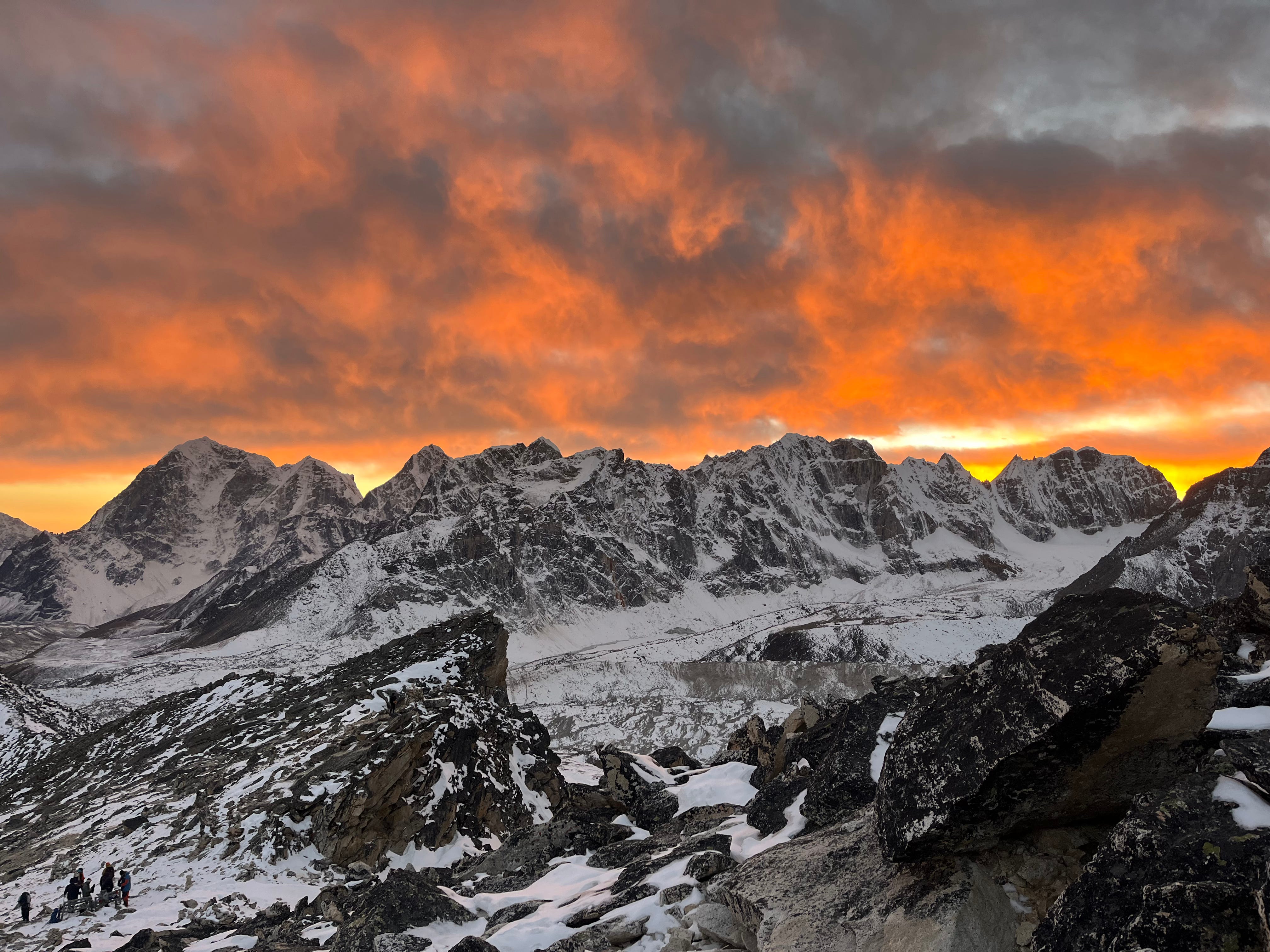
Day 10: Chhukung to Lobuche via Kongma La Pass
Trekking Distance: 10.65km / 6.62mi
Elevation Gain: 902m / 2,959ft
Max. Elevation: 5,244m / 17,206ft
Tea House: New EBC Guest House
Matt woke me up. “It’s 5:15.” I opened my eyes to darkness. “I’m going to check how it is outside,” he said, slipping out of the room. I rose slowly, changing into my trekking pants and the socks I’d kept warm in my sleeping bag overnight. Reluctantly, I left the cozy cocoon, laced up my boots, packed a few things, and wandered to the common room for breakfast.
Matt returned. “It’s cloudy and snowy, and I don’t see any lights heading up to the pass. Do you want to hold back a day or take the Dingboche route?”
“Let’s keep moving.”
“Sounds good. We’ll just bypass Kongma La Pass.”
After finishing our breakfast—tea, chapati with egg and cheese, and pancakes—we packed up and stepped outside. The sky had cleared completely, with the sun breaking through. We glanced to our right and saw a line of about eight hikers beginning the pass.
“Let’s just do it!” I said, bubbling up.
We wandered around town until we found the path leading up to the pass. As we started the ascent, we caught up to the group, led by a guide. We paused together to apply sunscreen and marvel at the peaks dusted with fresh snow under a blue sky.
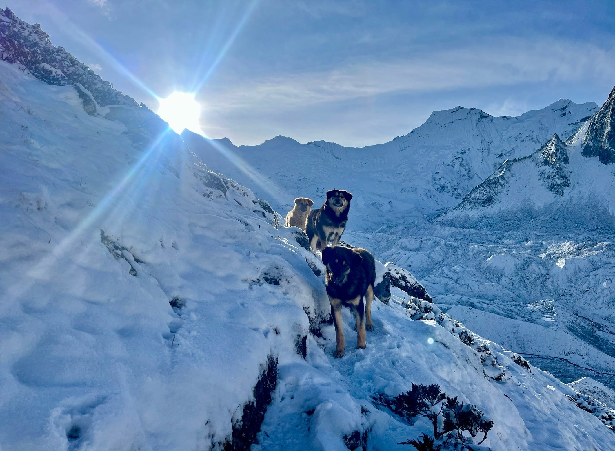
Three adorable dogs followed us, their ears perked as they rounded the hill, silhouetted against the glow of the rising sun.
The climb grew progressively steeper. Fellow trekkers—a Danish couple with their guide and porters—were invaluable for finding the trail in some rugged sections.
Clouds and fog started rolling in sooner than we’d hoped. The sun had burned the back of my calves, anyway.
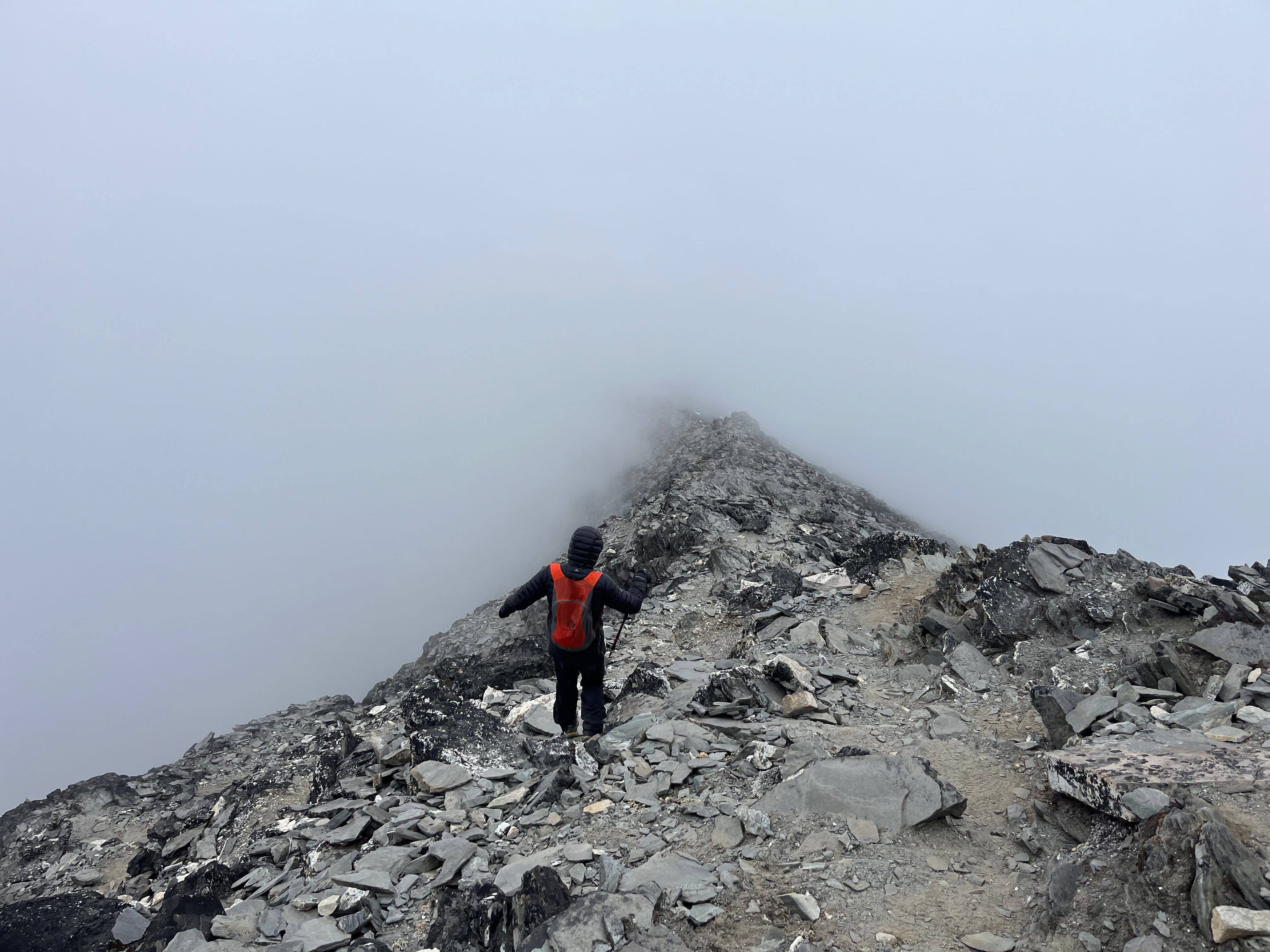
We stuck close to the guided groups as we ascended Kongma La Pass, the fog thickening with each step.
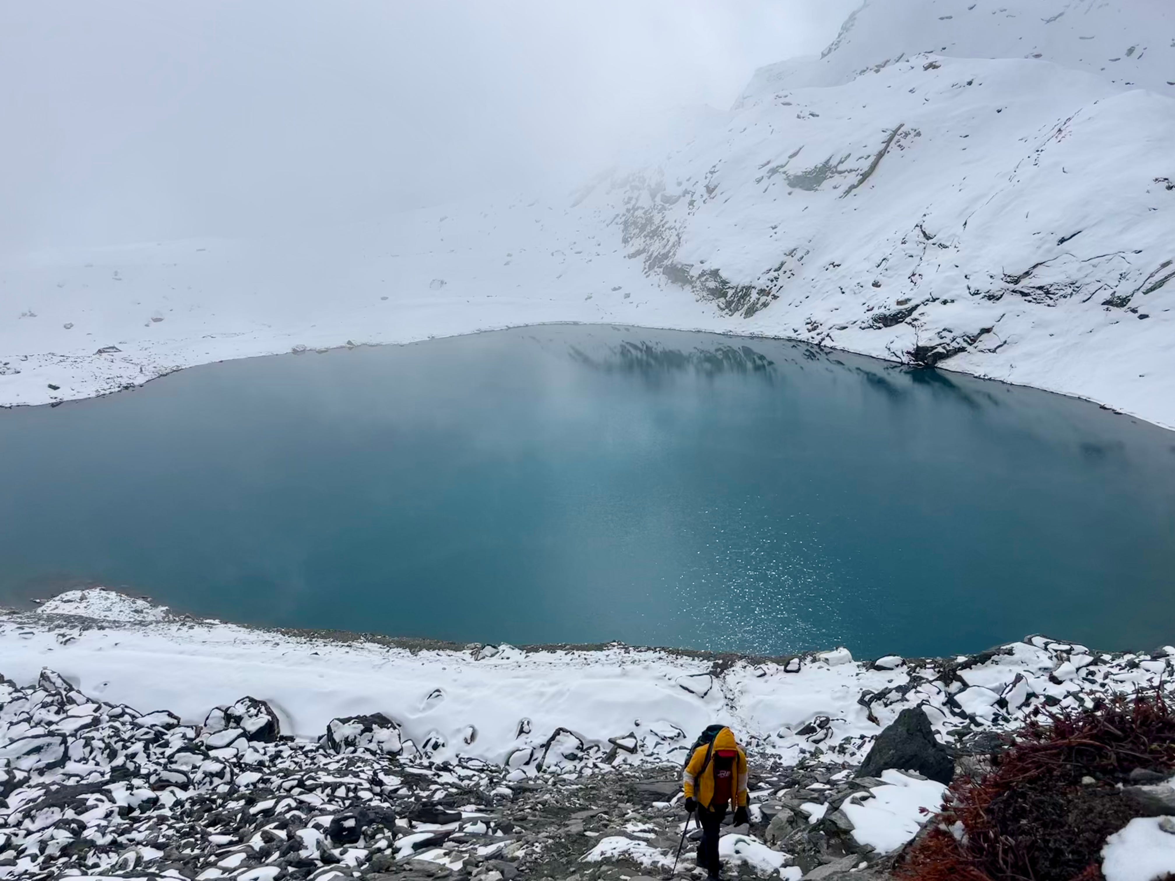
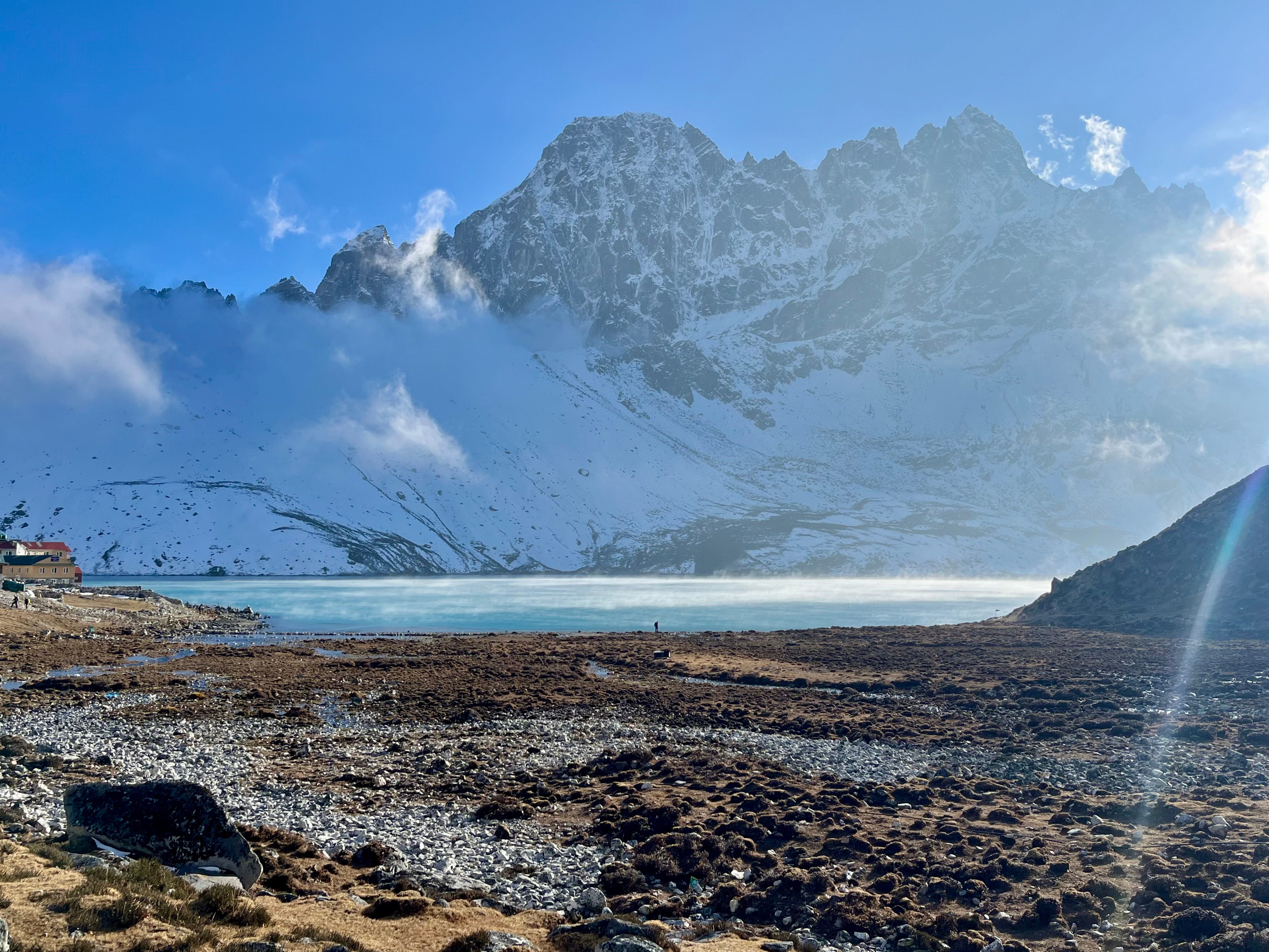
By the time we reached the lake just below the pass, snow was falling. The incredible views of the surrounding 8,000 meter peaks were completely obscured.
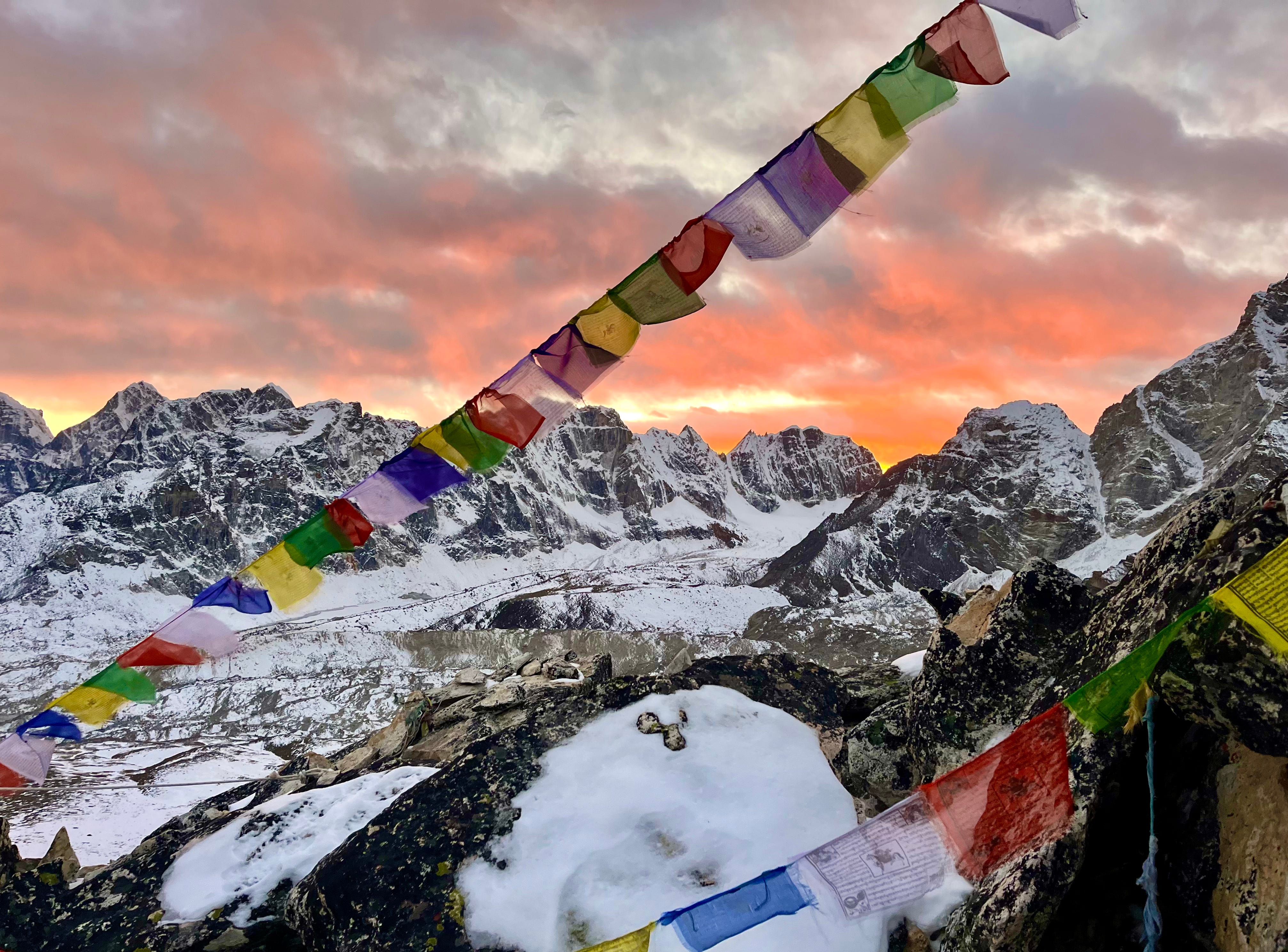
Prayer flags adorned the summit. We celebrated, but it was short-lived, thanks to the cold. After layering up and strapping on our microspikes, we braced ourselves for the long, snowy descent that seemed endless. Our exhaustion set in well before Kongma La was behind us.
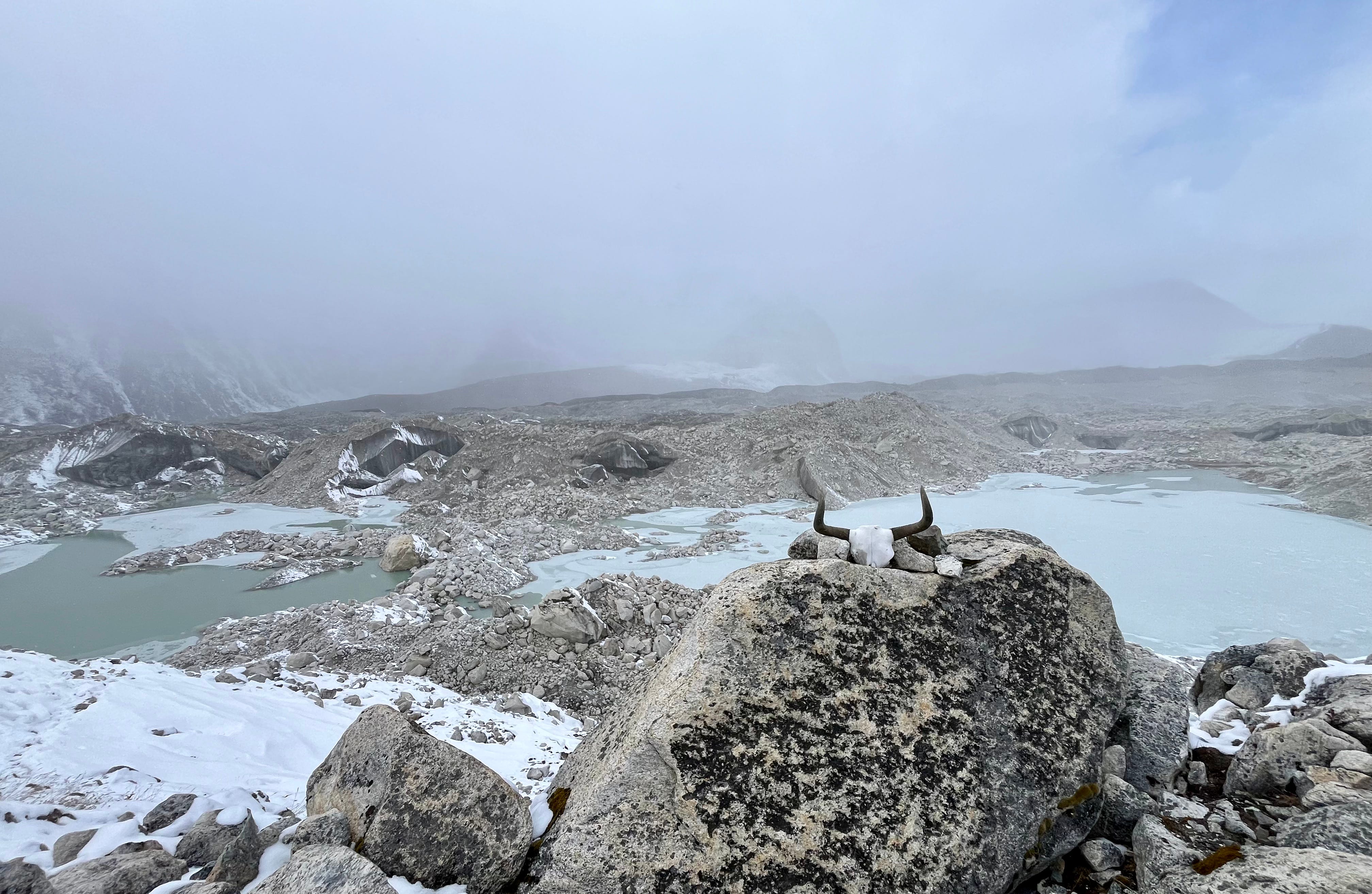
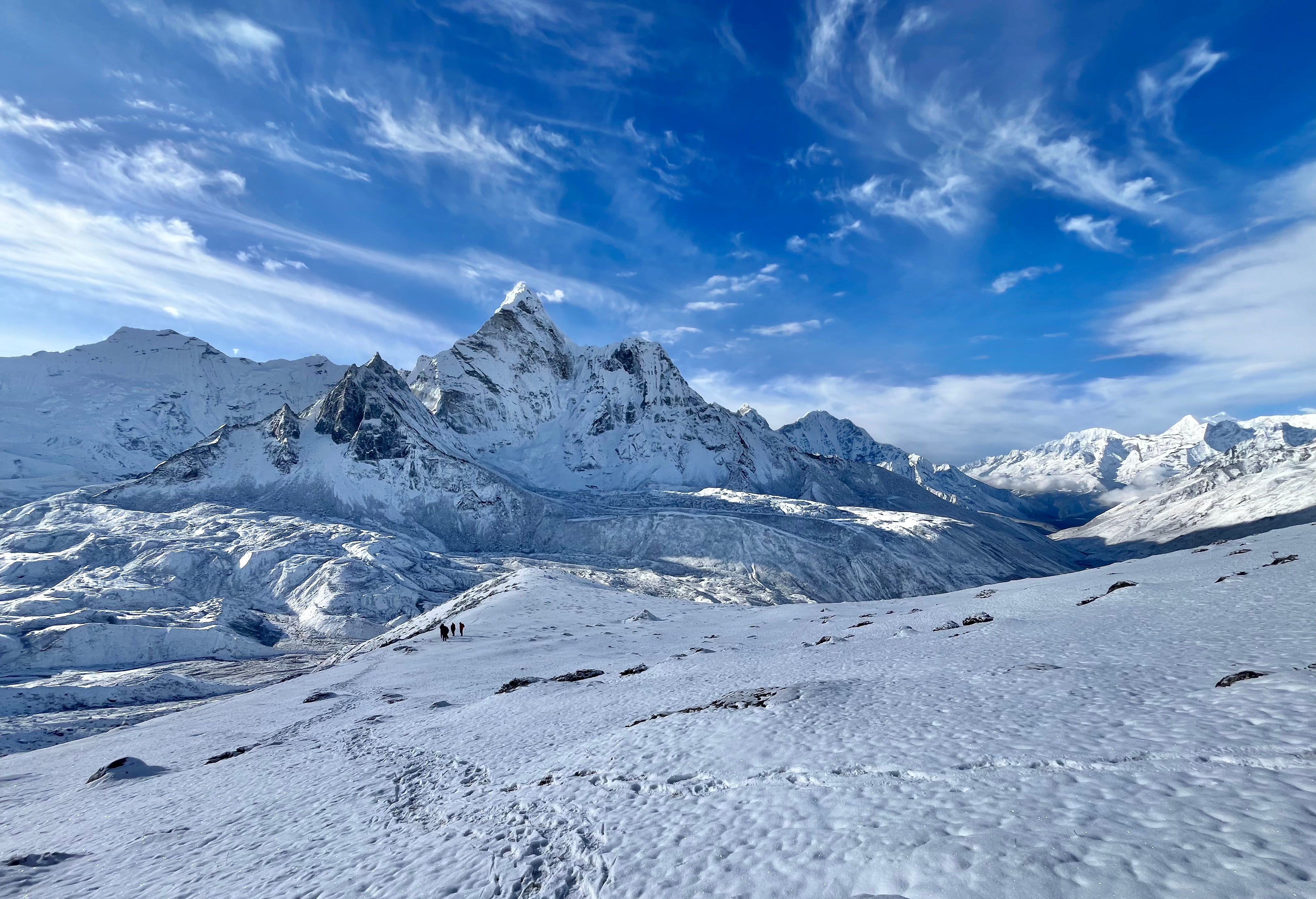
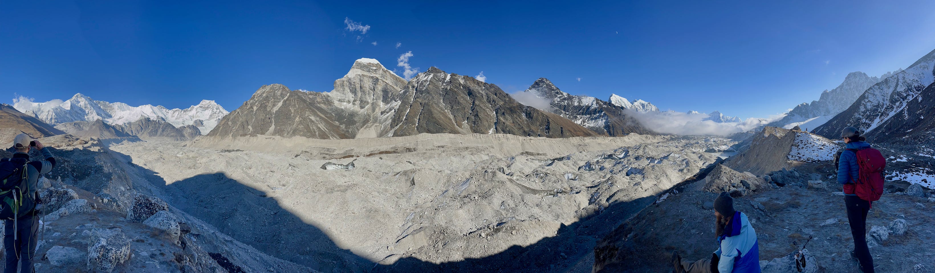
At the end of the downhill, another climb awaited, leading up to a glacier’s edge, marked by a yak skull. With much of the glacier melted, it no longer resembled its former state. Instead of crossing it directly, we rock-hopped around what was now more of a frozen pond. Luckily, we had a guided group of French Canadians to follow, sparing us from getting lost in the vast, rocky stretch.
Around the glacier, we began the final leg towards Lobuche. We were cold, hungry, and exhausted, crossing our fingers for an available room as soon as we reached town.
Lobuche finally appeared over the last hill. We entered town, immediately spotted a lively-looking tea house, and decided to give it a try. Inside, the common room was packed with trekkers warming by the fire, and to our relief, they had a room available.
We quickly changed into warm clothes, then joined the others by the fire to dry out our boots. A kind and funny Romanian couple sat across the table from us. We ordered soup and tea, then settled in to read, play games, and savor the cozy warmth until dinner. Eventually, craving sleep, we called it a night.
Day 11: Lobuche to Gorakshep, EBC, & Kala Patthar
Trekking Distance: 4km / 2.5mi + 3.4km / 2.1mi + 1.2km / 0.75mi
Elevation Gain: 300m / 984ft + 220m / 722ft + 415m / 1,362ft
Max. Elevation: 5,644m / 18,518ft
Tea House: Buddha Lodge
Today, we were finally about to set foot on Everest Base Camp (EBC) and the legendary Kala Patthar viewpoint.
After breakfast, Matt and I packed up and began the three-mile trek to Gorakshep. Since this trail lies on the main circuit to EBC’s gateway town, it was well-trodden and packed with fellow trekkers.
At one point, we reached a narrow section of the path, where the sheer volume of traffic forced everyone to pause. The uphill trekkers had priority, while those heading downhill waited in single file along the edge. When we saw a herd of yaks round the corner, Matt and I exchanged wide-eyed glances, astonished at how they managed to navigate the narrow, crowded trail.
Around another corner, we crossed paths with Tania and Joos. Full of energy and always great for a conversation, they seemed to be conquering the Three Passes Trek and recommended a small tea house in Gorakshep called Buddha, where they had stayed.
When we reached Gorakshep, we headed for Buddha Lodge. Fortunately, they had a room for us. I ordered tea and a ham-and-cheese sandwich—an unusual choice, as we’d been avoiding cheese and meat during the trek to prevent upset stomachs, knowing they might not always be stored properly at higher altitudes. But my hunger got the better of me, so I ate it anyway. Recharged, we set off for our hike to EBC.
I quickly regretted wearing fleece pants under my rain pants. Though the added layer had seemed smart in the morning’s chill, I had started to overheat.
Despite my slow pace, the skies were clear and the sun strong, granting us fantastic views of Lho La, Nuptse, Pumori, and even a glimpse of Everest’s peak on the way to EBC. The trail was busy with people, all eager to snap photos and celebrate the high point of their journey.
Matt and I joined the happy crowd, savoring the moment by soaking up the sunshine and posing for pictures. Many boulders were marked with Sharpie signatures from tourists who had passed through before us. The exposed glacier field highlighted the conditions that Everest climbers endure in their pursuit of the summit.
The glacier spread out like dollops of whipped cream on cake.
We returned to the tea house around 2:00 p.m., splitting momo and soup, and made plans for a sunset hike up Kala Patthar. I took a short rest, stripping off my fleece pants and lying down under a warm blanket to recharge. I could feel the day’s effort lying there with me.
At 3:30 p.m., Matt and I set off, after assessing the sky—there were high clouds, but they were thin enough to let the mountains peek through, and we figured the clouds might even make for a nice sunset.
The hike was challenging, the elevation slowing me down—so Matt led the way. We passed other hikers, some excited to see the sunset, others turning back in doubt. I’d thought the climb would be shorter, but it kept ascending—one steep slope after another—the highest elevation we’d arrive at throughout the entire trek.
When we finally neared the summit, the payoff was breathtaking. The sky blazed a brilliant yellow-orange, lighting up the peaks and eventually casting Everest’s tip in a golden glow. Matt reached the summit well before me and was soaking it all in. I made my way slowly, snapping photos along the way to capture what I could, as I feared missing the main event by the time I reached the top.
As I climbed higher, the vibrant orange hues deepened, painting the sky with a richer intensity. I reached the summit just in time to witness the final moments of the spectacle. With darkness quickly closing in, we began our descent soon after.
Matt had his headlamp, and the crescent moon cast a soft glow over the snow-dusted peaks.
Back at Buddha Lodge, we found the common room lively and warm. We ordered a well-deserved dinner—fried noodles and French fries with an egg—and celebrated the day with a beer.
After a few rounds of Monopoly Deal, we stepped outside for a smoke under the starlit sky, then got ready for bed, grateful for a day well spent.
Day 12: Gorakshep to Dzongla
Trekking Distance: 6.7mi / 10.8km
Elevation Gain: -295mi / -968km
Max. Elevation: 5,125m / 16,814ft
Tea House: Maison Sherpa Hostel
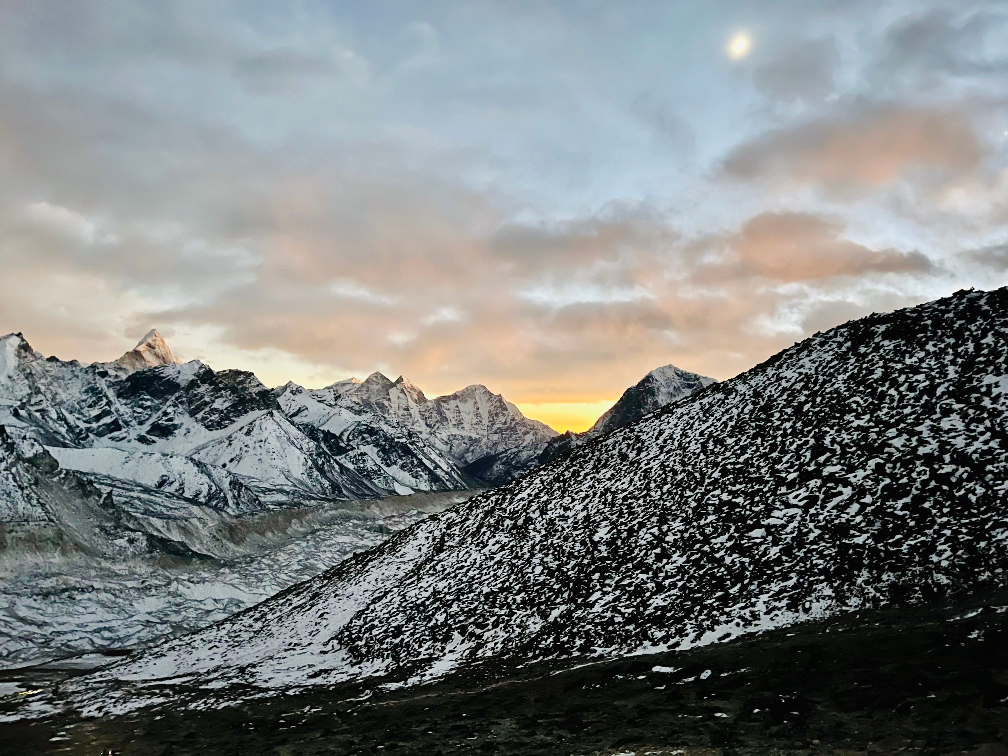
Today’s trek from Lobuche to Dzongla was one of my favorites. It brought me back to life after our cold days in Chhukung and Gorakshep.
I woke up with a sore throat, which I soothed with a pot of lemon ginger honey tea, apple porridge, and ibuprofen. Like the past few mornings, it was a cold start, and both Matt and I felt the lingering fatigue of the previous day’s hikes. We went through the usual routine of layering up in our chilly room, packing our gear, and mentally preparing to step out into the cold.
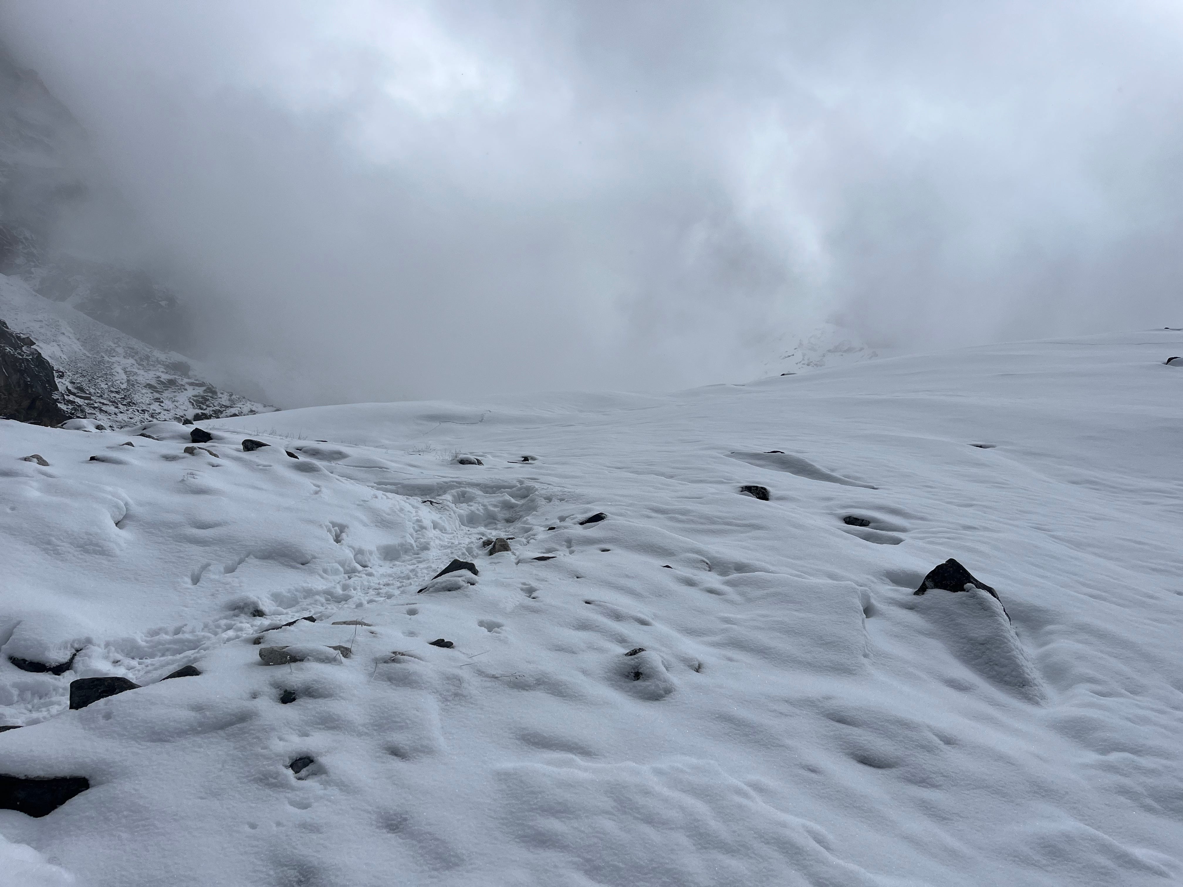
At least it was sunny, though windy. The trail promised to be easy—just three miles, mostly downhill. We meandered down the trail, passing by snow and dirt mounds, until Lobuche appeared over the ridge.
We returned to the EBC Guest House and, to our surprise, ran into our Romanian friends again. We conversed, lingered, and ate potato soup and more tea, taking our time to rest and recharge before finishing out the day’s walk.
With the sun strong overhead, I shed a few layers, put in my headphones to listen to tunes, and felt noticeably better. The path, initially a gentle descent, began to curve around the mountainside.
I wasn’t sure what to expect from today’s commute, but the views of Ama Dablam’s glorious northwest face and Mount Cholatse looming above a mesmerizing lake impressed. I was down to a T-shirt, grinning, singing along to my music, and dancing as we walked.
Eventually, among meadows, snowy peaks, and headwaters, Dzongla came into view on a hill. Painted white arrows on rocks guided us to the entrance, where groups of trekkers were sitting outside, soaking up the sun.
We made our way to Maison Sherpa Lodge, one we had both marked on Google Maps, and it turned out to be the perfect choice: our room was on the top floor, right where the sun streamed in, making it the warmest room we’d stayed in so far. Matt immediately stretched out on the bed in his shorts, savoring the warmth, while I headed to the common room for another pot of tea and a plate of momo. Later, we both returned to the room to bask in the sun like lizards.
When evening rolled around, we ordered dinner, played a few rounds of Monopoly Deal, indulged in a warm Snickers roll pastry, and eventually drifted off to sleep.
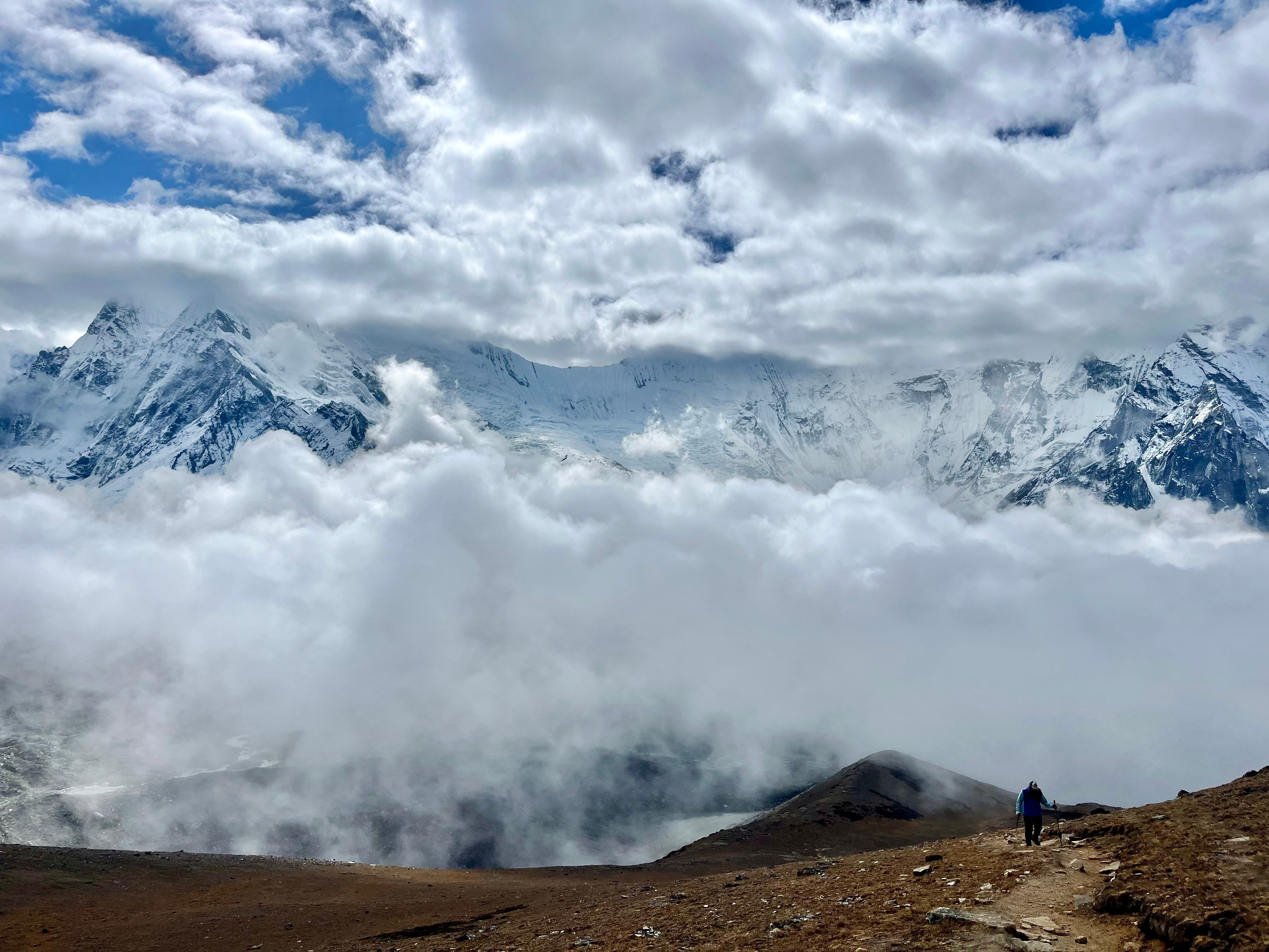
Day 13: Dzongla to Gokyo via Cho La Pass
Trekking Distance: 12km / 7.5mi
Elevation Gain: 910m / 2,986ft
Max. Elevation: 5,420m / 17,782ft
Tea House: Gokyo Resort
Today was long—not because of the Cho La Pass itself, which was more forgiving than Kongma La, but because we decided to push on to Gokyo instead of stopping to rest at Dragnag.
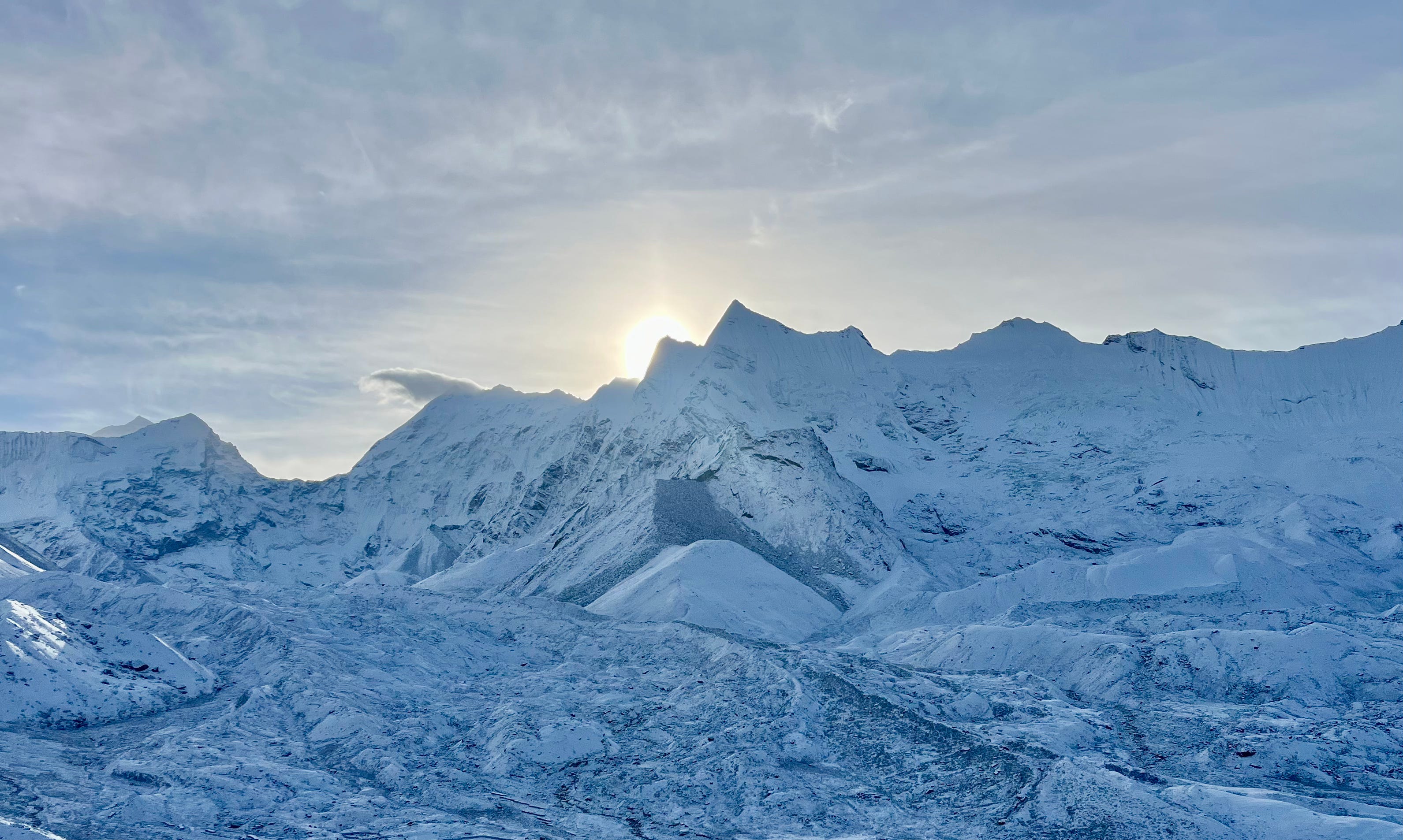
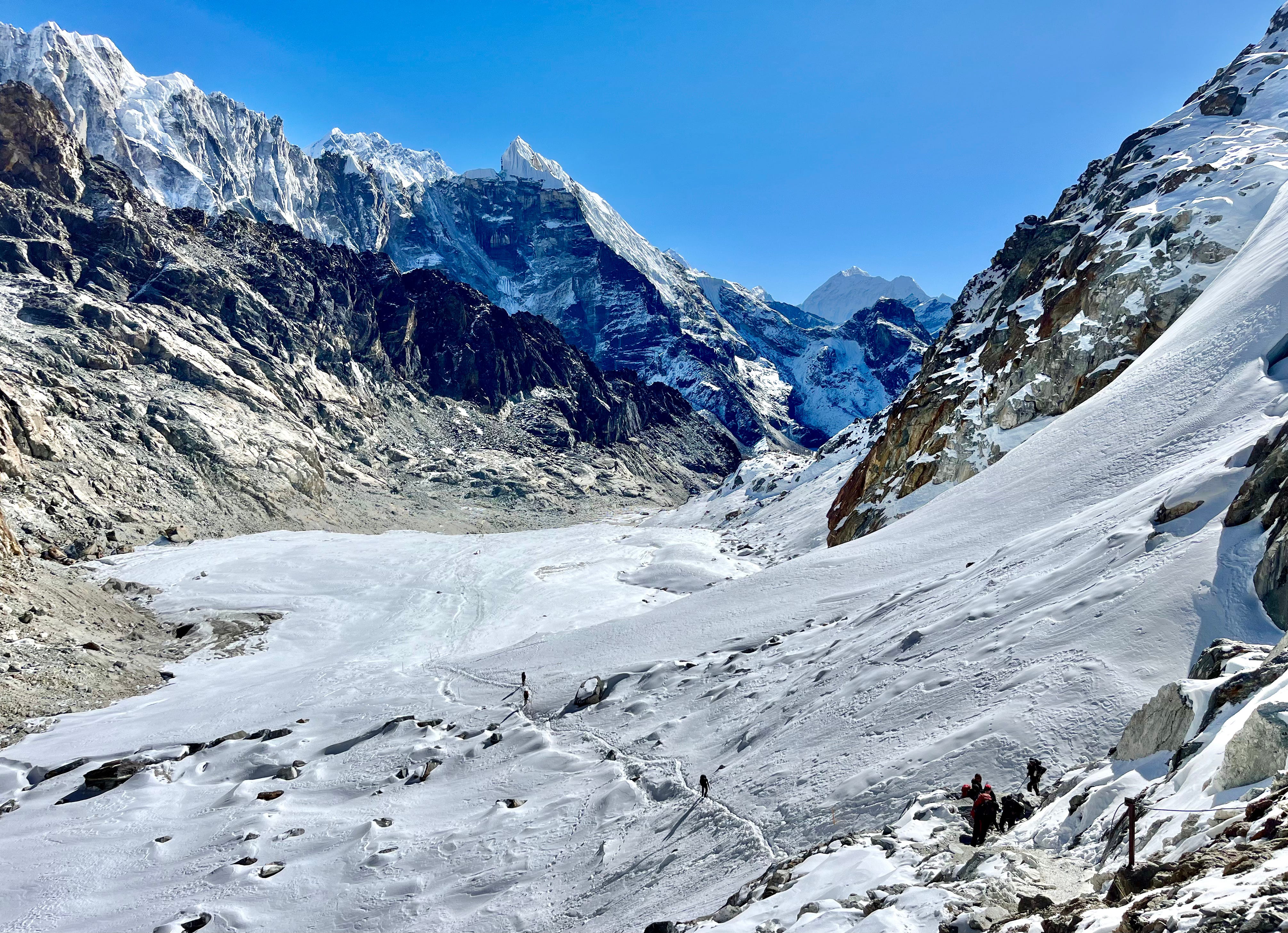
Like Kongma La, this route ended with a glacier crossing, but thanks to climate change, it wasn’t as straightforward as it once was.
Where you used to be able to simply walk over solid ice straight to town, now there’s only a path across fields of boulders where a glacier used to be. Constant switchbacks, interspersed with lakes, led defiantly to Gokyo.
Without a clear view of our destination, the barren terrain felt like an asteroid.
But before all that, our day began like any other day—eating apple porridge and a chocolate pancake for breakfast, packing, paying, and setting off.
It was a perfect bluebird day—clear skies, no wind. The trail started out flat, winding through low shrubs with the Himalayas rising in the distance until the Cho La Pass came into view.
The ascents were steep but manageable, broken into smaller stretches that allowed for plenty of breaks and time to enjoy the views. We were surrounded by fellow hikers, including the group of French Canadians, their guide, Jambo, a seasoned professional with decades of experience, and porters, Raz and Prashant.
We trudged across a snowy glacier to the pass. After one final rocky descent, we arrived at the top. There, people were charging their phones at a permanently installed outdoor station, dancing to Bollywood music, and high-fiving. A couple of grouse-like birds hung around as well.
We put on micro-spikes for the long, steep, icy descent. A metal cable bolted to the mountainside was a huge help, and we only needed the spikes for a short stretch.
After descending the rocks, we came to a meadow, where our French Canadian friends were cooking dehydrated stew and insisted we join them, saying they had too much. We happily dug into a “Santa Fe” (spicy and smoky) beef stew while chatting about ice hockey and skating on frozen rivers. I practiced my beginner Nepali with the porters. We said goodbye, joking that we’d probably see them again soon, as seemed to be our trend.
We continued downhill by a rocky stream, which wasn’t easy on the feet, until we reached Dragnag.
Determined to make it to Gokyo, we pushed on.
I changed my shoes, which helped a lot as we crossed the grueling remains of the glacier. We passed a porter, exchanging a “rock on” hand signal.
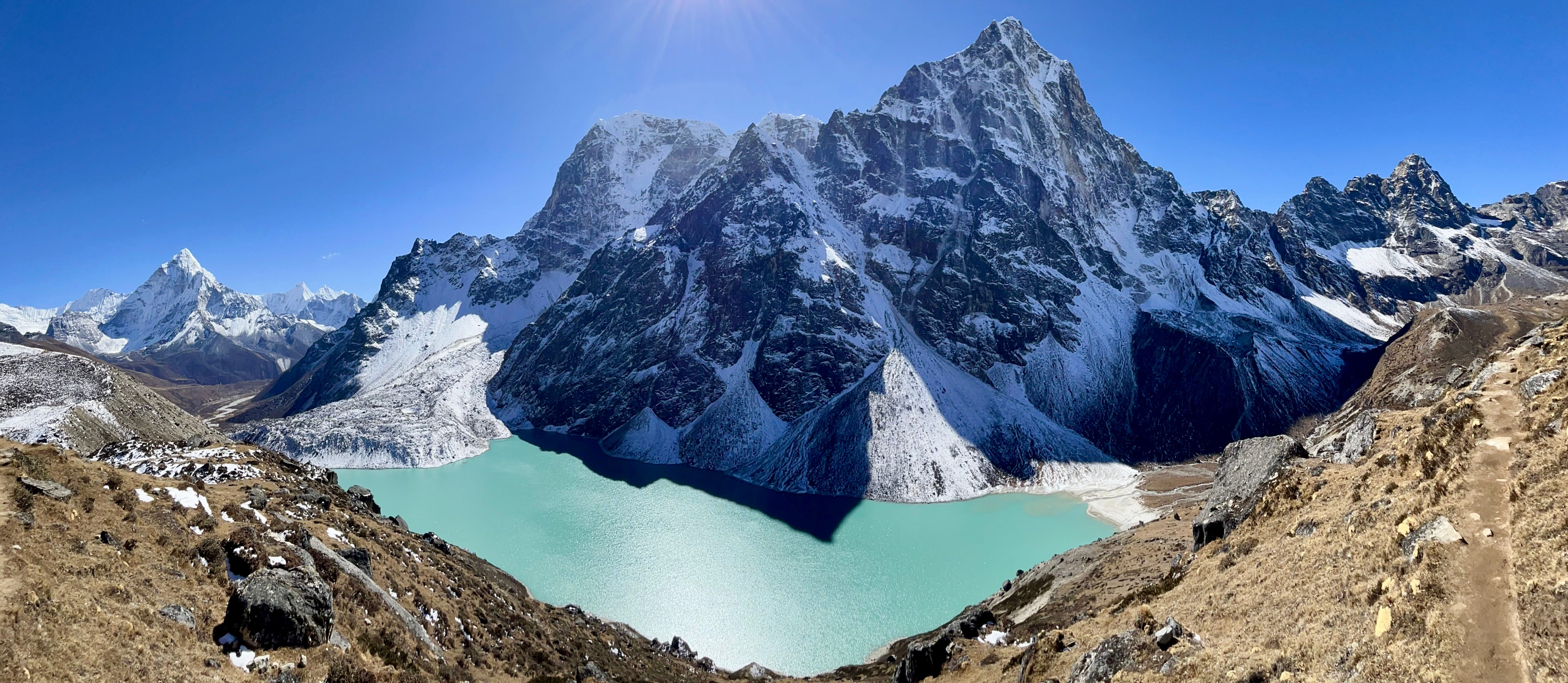
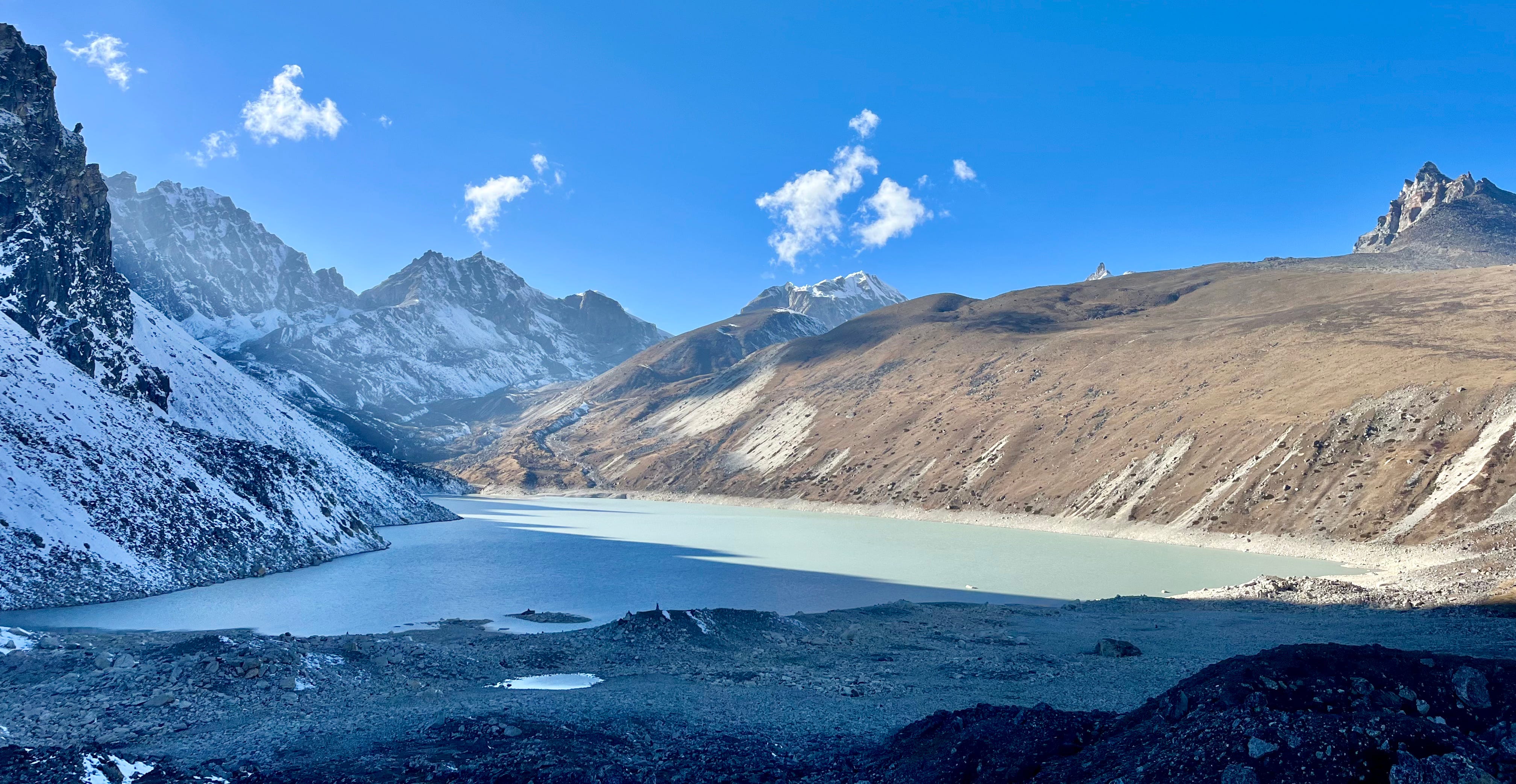
Finally, we crested a hill to see Gokyo and the emerald lake below. We stopped for photos, joining the porter and his friends, along with two Indian men we’d met back at Kongma La Pass.
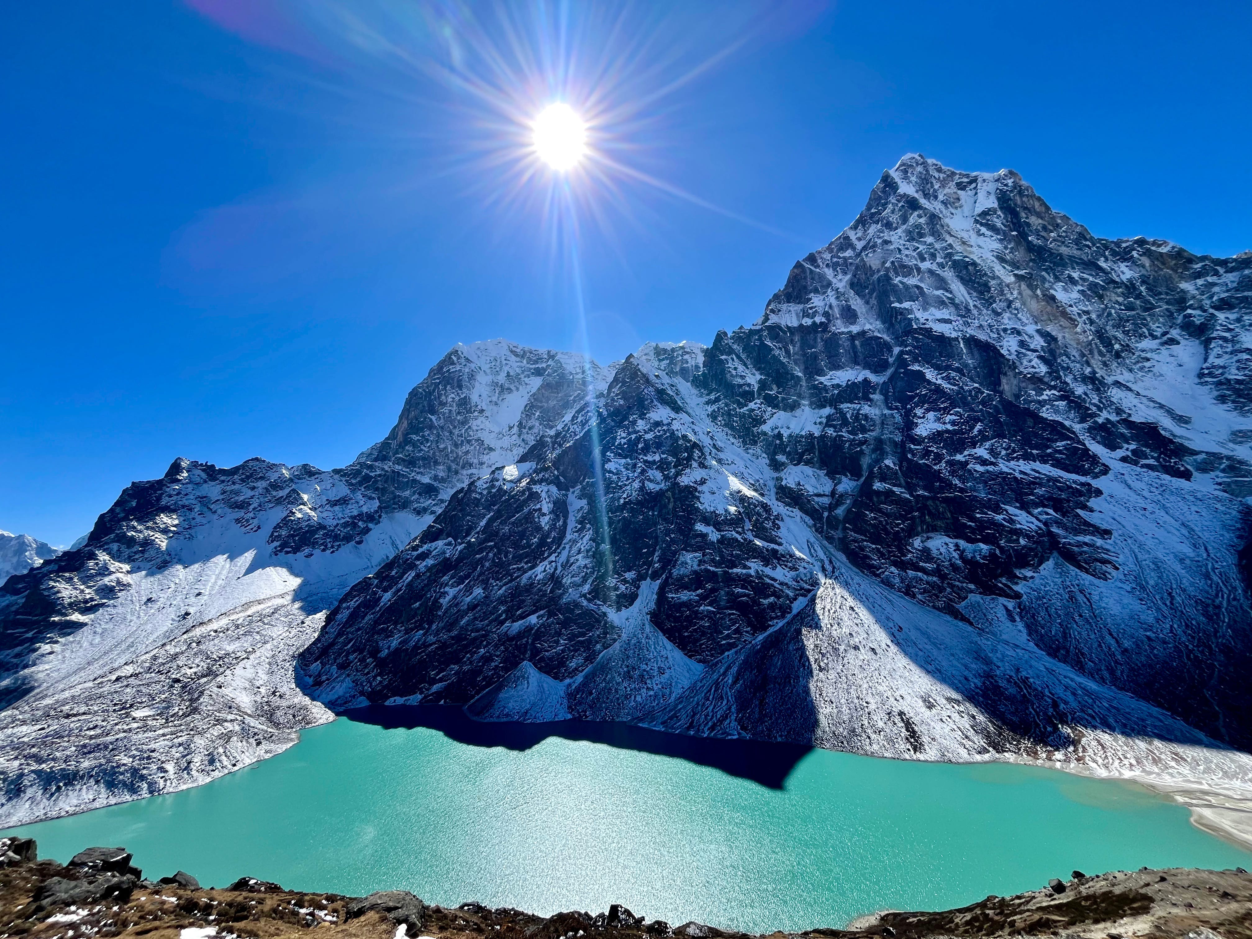
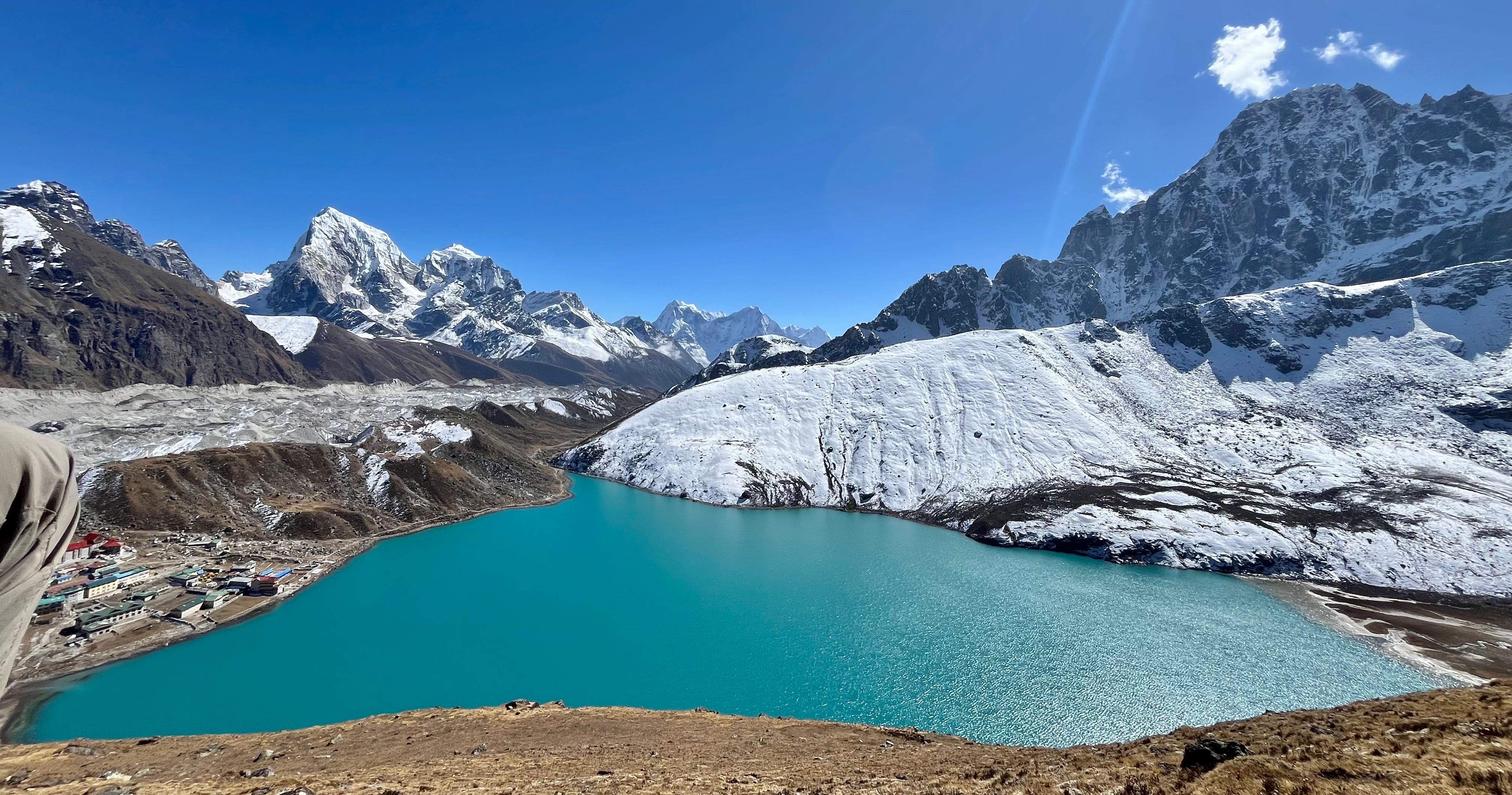
We strolled into Gokyo and found the Gokyo Resort, recommended by Tashi who’d also kindly dropped off some books I’d left behind. It was his friend, Sonam’s place. The prices were fair, so we checked in.
The Gokyo Resort menu was a real treat, featuring a Korean section, pastries, cocktails, and more. The warm dining room overlooked the lake, making it the perfect spot to relax. We ordered Dol-sot Bibimbap—a Korean rice bowl with veggies, kimchi, sauce, and an egg—which hit the spot.
A brownie to come…
Day 14: Gokyo Ri & 5th Lake Hikes
Trekking Distance: 1.5km / 0.9mi + 5.6km / 3.5mi
Elevation Gain: 600m / 1,970ft + 80m / 263ft
Max. Elevation: 5,357m / 17,575ft
Tea House: Gokyo Resort
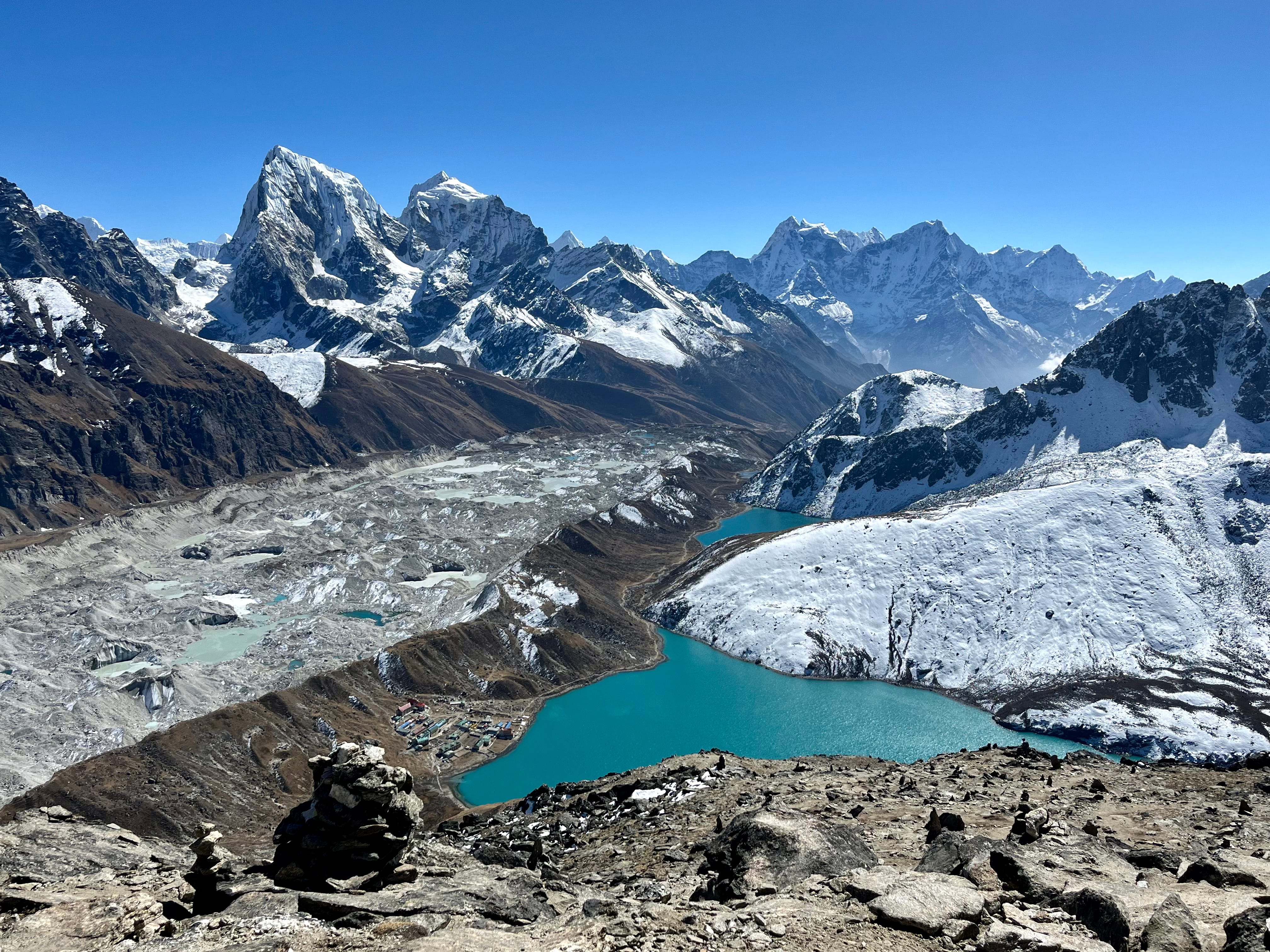
Today, we stayed in Gokyo to take on what many call the most epic day hike of the Three Passes: Gokyo Ri, known for its views of many of the highest peaks, i.e. Cho Uyu, Everest, Makalu, and more. We also planned to hike to the Fifth Lake after lunch, though we ultimately only made it to the Fourth.
We let ourselves sleep in a bit, rationalizing that the cold morning with the sun rising in the opposite direction than Gokyo Ri wasn’t worth an early start. After a hearty breakfast of croissants, sausages, beans, eggs, and potatoes with jam and butter, we set out with high spirits toward the steep trail up Gokyo Ri.
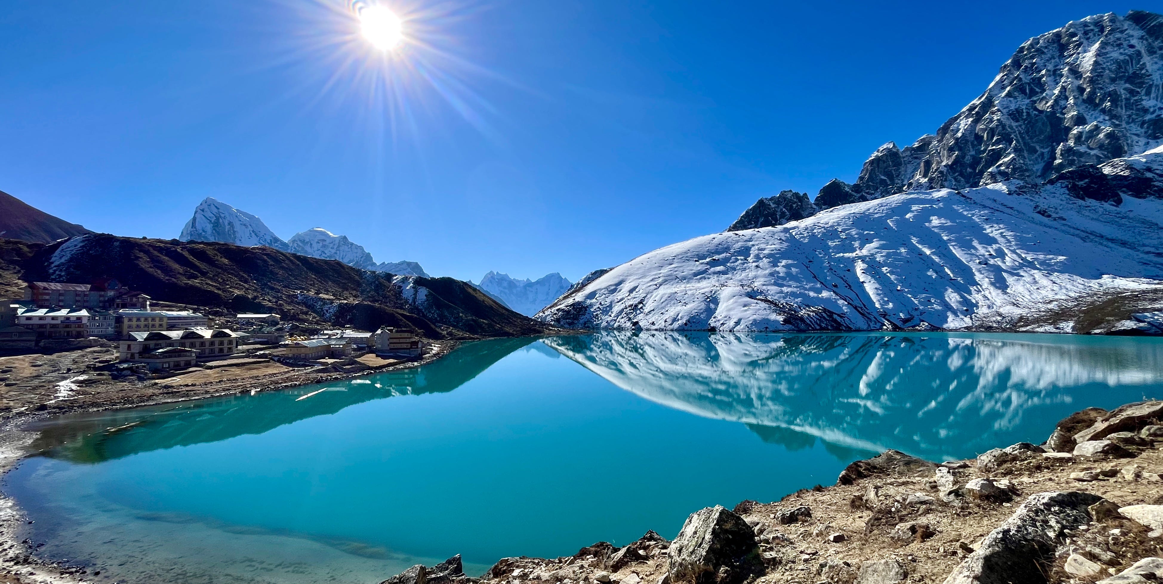
Gokyo Lake looked dapper in the morning light, mirroring the mountains.
We followed the lake’s edge to the trailhead and started the steep ascent. The sun was bright, and I soon stripped down to a T-shirt. Matt, with his knack for tackling uphill climbs, powered up ahead, while I found myself lagging slightly behind—a funny contrast, given that I usually shine on thru-hiking trails while carrying a full pack.
At the first false summit, I started to feel the strain. My pace slowed, my head felt fuzzy, and my stomach churned. Matt pressed on, reaching the summit ahead of me. I continued at a slower pace, counting 40 steps at a time before pausing to catch my breath.
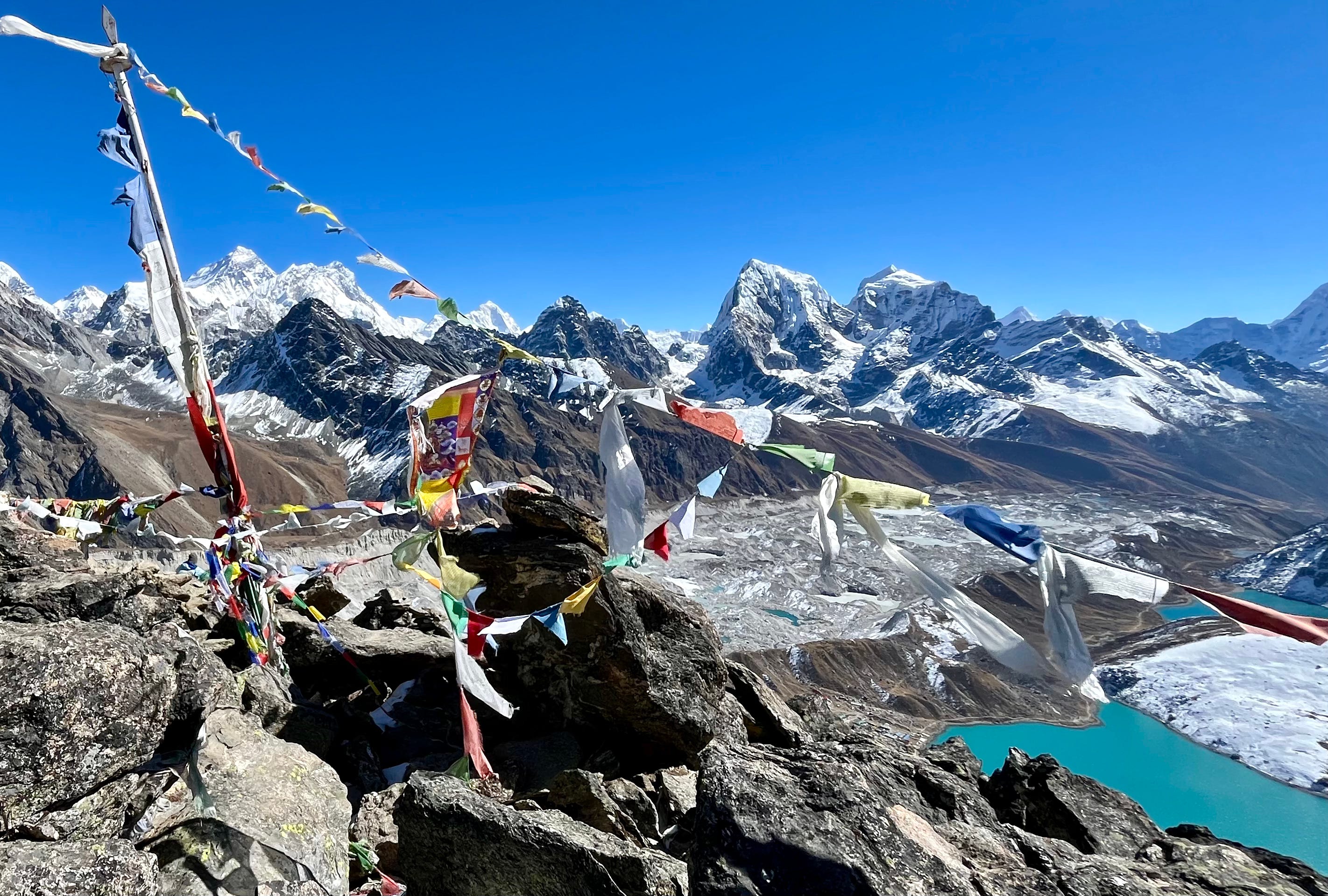
Finally, I summited, 15 minutes after Matt. I rested, taking in the amazing mountains around us, framed by layers of colorful prayer flags fluttering in the wind.
At the top of a hike in the Himalayas, the world falls away, thin air blurring the edges of vision. The mountains stand silent, while the sky and sunlight, when bright and clear, bless the earth.
Still feeling delirious, we began our descent. I wobbled down, unable to take my usual fierce strides, while Matt’s pace remained quick. He paused to lie in the grass a little ways down, waiting for me and soaking in more of the beautiful view. I joined him, lying down to recover before we got back up to continue. I forced myself to keep up.
By the time we made it back to town, I was wiped.
Back at Gokyo Resort, Matt brought me tea in bed. After a bit of rest, I felt ready to join him in the dining hall for some Korean-style sushi and a fruit salad. He suggested I stay behind if I was still tired, but with the weather so perfect, it seemed too good a day to waste indoors.
We gathered our energy for the afternoon and set out for another hike, with Matt leading at a brisk pace along the mostly flat trail.
Along the way, we met an ER Nurse from California, her friend who was visiting Nepal for the ninth time, and their guide and porter. They were friendly and suggested we skip the Fifth Lake, as clouds were starting to roll in with miles to go, meaning we’d get back after dark. A glance back confirmed the cloud cover, so we felt content aiming for the Fourth Lake instead.
The Fourth Lake basked in the last rays of sunlight, half of it cast in shadow. It was a balance of light and dark, bordered by earth and snow. We paused to rest and capture a few photos.
The sun slipped behind the clouds, and the shadow brought a sharp chill. We quickened our pace as we made our way back to Gokyo, eager for warmth.
Back in the dining hall, we settled in with burgers, books, and another round of Monopoly Deal, where Matt claimed victory in every game, once again.
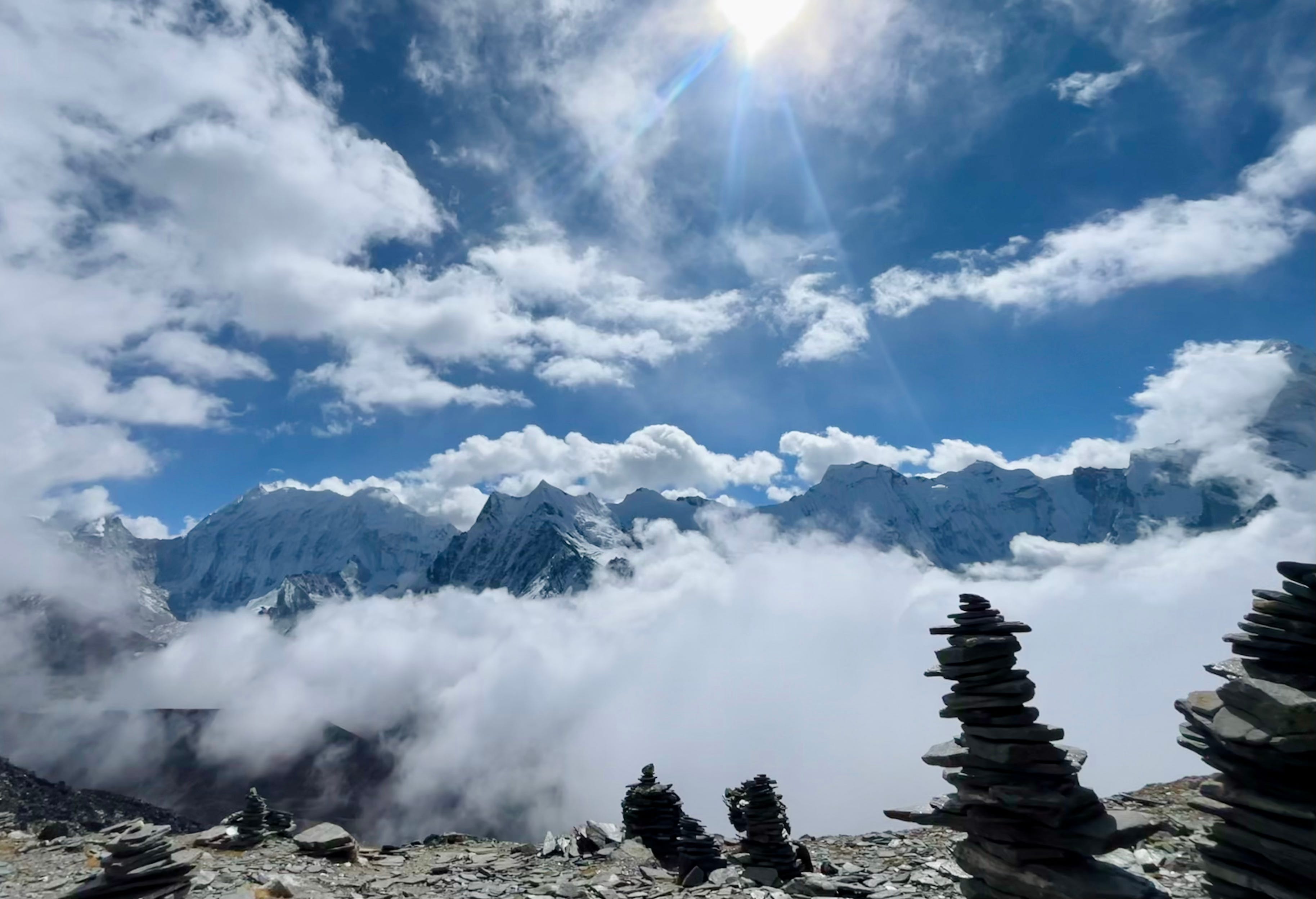
Day 15: Gokyo to Thame via Renjo La Pass
Trekking Distance: 22k / 13.7mi
Elevation Gain: 980m / 3,215ft
Max. Elevation: 5,345m / 17,536ft
Tea House: Himalayan Guest Lodge
Today, we’d complete all three passes!
We woke up early for breakfast at 5:45 a.m. Out of curiosity, I tried the Sherpa breakfast set—a meal of porridge, a potato pancake with spicy sauce, and butter tea. It was so filling that I had to pack the pancake for later.
We said goodbye to Sonam and were off, the morning light shimmering across the lake’s surface. Quite a few trekkers were also headed to the pass.
The route involved two main ascents, each offering incredible views of Everest under a bluebird sky. I kept a quick pace for the first, enjoying the climb.
Then the trail wound its way to the second ascent, which looked daunting from below, making the approach feel endless. But it turned out to be less steep than it appeared. Still, we moved slowly.
At the top of the pass, there were piles of prayer flags, a charging station, and groups of trekkers happily taking in the views, snacking, and chatting in the sunshine.
The sky felt like a gift.
Overcome with bliss, Matt and I relished the atmosphere before hurrying down the pass, aiming to cover the remaining miles quickly since we had a total of 13 to go.
The landscape, with jagged, dark peaks rising above golden pampa, reminded me of Patagonia, a paradise and my place of residence from 2018 to 2023.
Midway, we rested briefly on the side of the trail. Matt shared some Mentos. Eventually, we hobbled into Lungden, where a friendly guide recommended Lungden View Lodge for lunch. There, we enjoyed steaming bowls of noodle soup, momo, and tea, which gave us the boost we needed. We rested a bit, grabbed some chocolate bars, and set out again into the foggy afternoon.
Following the Bhote Koshi River, we kept a steady pace, crossing bridges (Matt’s greatest fear) and pausing only for chocolate and Mentos. As we descended, the air grew thicker and easier to breathe. At 14,000 feet, things felt a little more manageable after days above 18,000.
We started to notice signs of local life, with more displays of Sherpa and Buddhist culture—stupas, prayer flags, sacred painted stones depicting deities, and traditional homes. The landscape gradually transitioned back into the lush Himalayas we had encountered at the start of our trek.
Eventually, we spotted Thame. Tea houses cleverly had their names painted on their roofs, making it easy to pick one out from above. Fog covered the village, keeping the mountains as secrets.
We made our way down. The first tea house we tried was closed. Thame was still recovering from a recent landslide caused by glacier runoff.
Fortunately, the next tea house, recommended by the last tea house owner we’d met, had smoke rising from the chimney. We entered, got a room, and bundled up in warm clothes. We ordered popcorn before dinner, played a few rounds of Monopoly Deal, and settled in for the night.
Day 16: Thame to Namche Bazaar
Trekking Distance: 9.5km / 6mi
Elevation Gain: 360m / 1,181ft
Max. Elevation: 3,800m / 12,467ft
Tea House: Hotel 8848
We weren’t feeling very motivated to move today! We lingered over breakfast—French toast, chapati with omelet, and tea—and stayed in bed for as long as possible, considering we only had a six-mile walk back to Namche.
Eventually, we checked out and set off. Himalaya Guest House in Thame had been a pleasant stay with its cozy common room, fresh greens that came with the dal bhat, and useful amenities like an outdoor sink and outlets in the rooms.
We followed the trail out of Thame, winding down a hill and crossing a bridge. The path passed through an area where the landslide had destroyed the hillside and the original trail. It was a testament to the locals' resilience, as they had swiftly built new trails and structures.
As we descended, the landscape shifted to jungly woods. Breathing felt easier.
After just 1.5 miles, we spotted a large sign for a restaurant and, having fallen for the marketing, decided to stop for lunch. We ate momo, fried rice with potatoes, and salad.
The restaurant owners struck up conversations, cracked jokes, and blessed some guests with a silky khada scarf.
Refreshed, we set off at a leisurely pace through more jungle-like terrain. Along the way, we spotted mountain goats scaling a village wall, their nimble hoofs defying gravity.
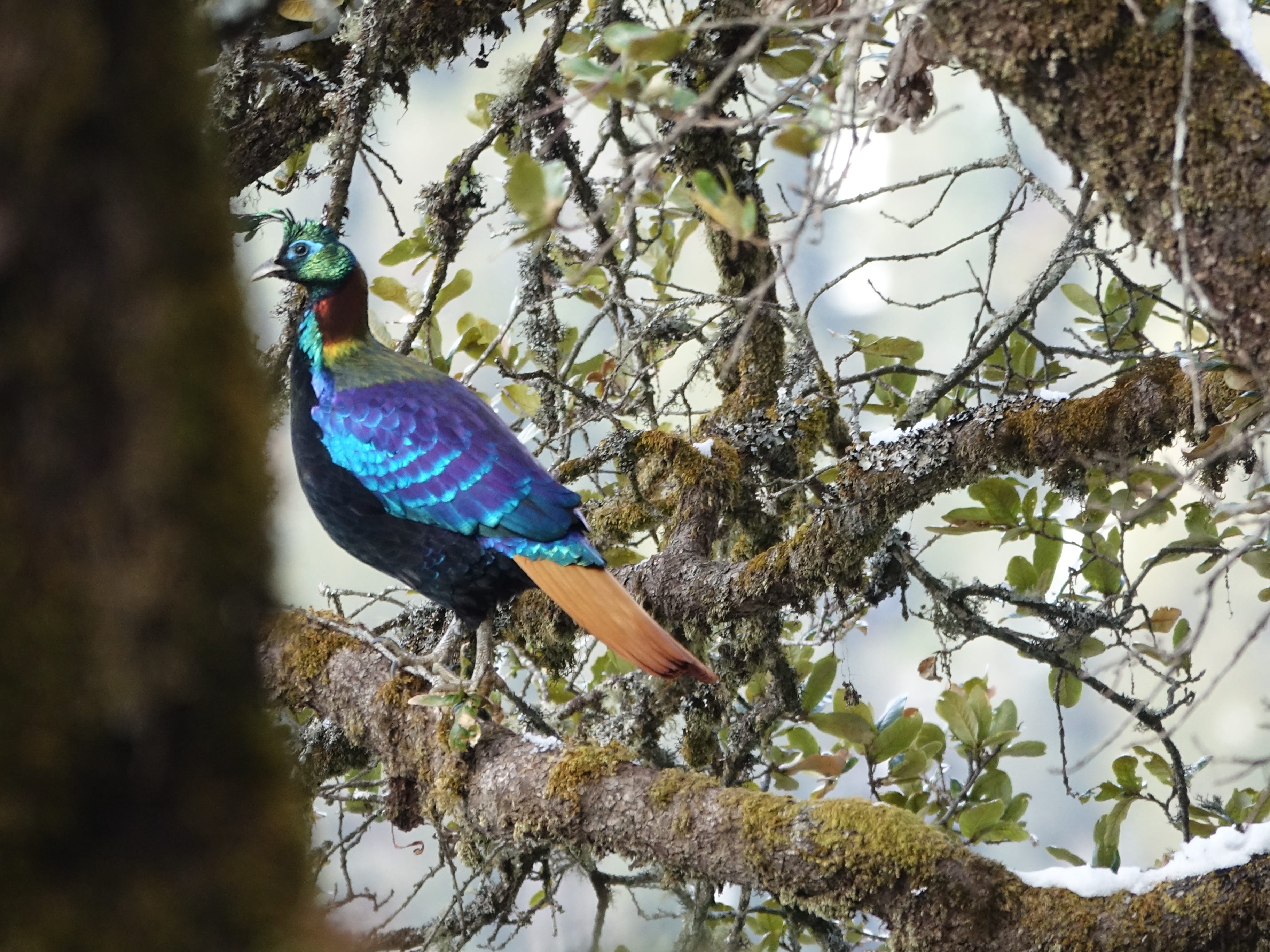
As we continued, a flash of rainbow-colored feathers caught our eye—a Himalayan monal, Nepal’s national bird, darted into the woods, its neon plumage briefly visible before it disappeared into the trees.
Fog descended earlier than usual, making us even more grateful for the stunning weather we'd enjoyed for most of the trip.
We picked up our pace until Namche Bazaar, with its usual clouds, finally came into view. We passed the Namche monastery and made our way to the main square, returning to Hotel 8848.
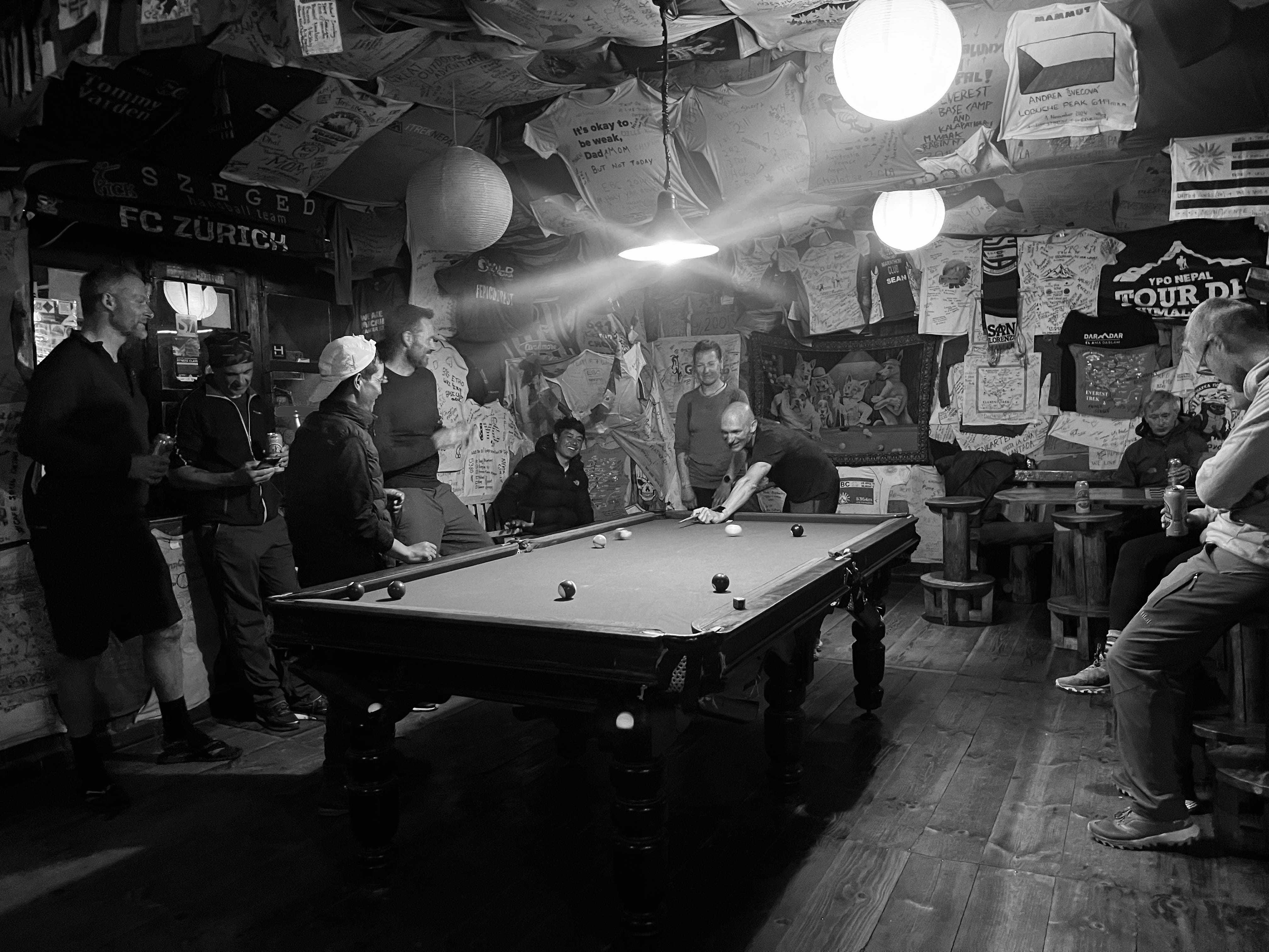
Once checked in, Matt retrieved some stuff he had stored at the tea house, and I finally had a shower. We relaxed, later heading out for burgers. From there, we went to Liquid Bar, grabbing a beer on the way and chugging it in the street. We settled in with some hookah, popcorn, and drinks, watching MacGillivray Freeman’s 1998 Everest documentary. The bar was cozy with quirky photos of people smoking hookah.
Feeling celebratory, we headed next to the Irish Pub and ordered the “Three Passes” cocktail with espresso.
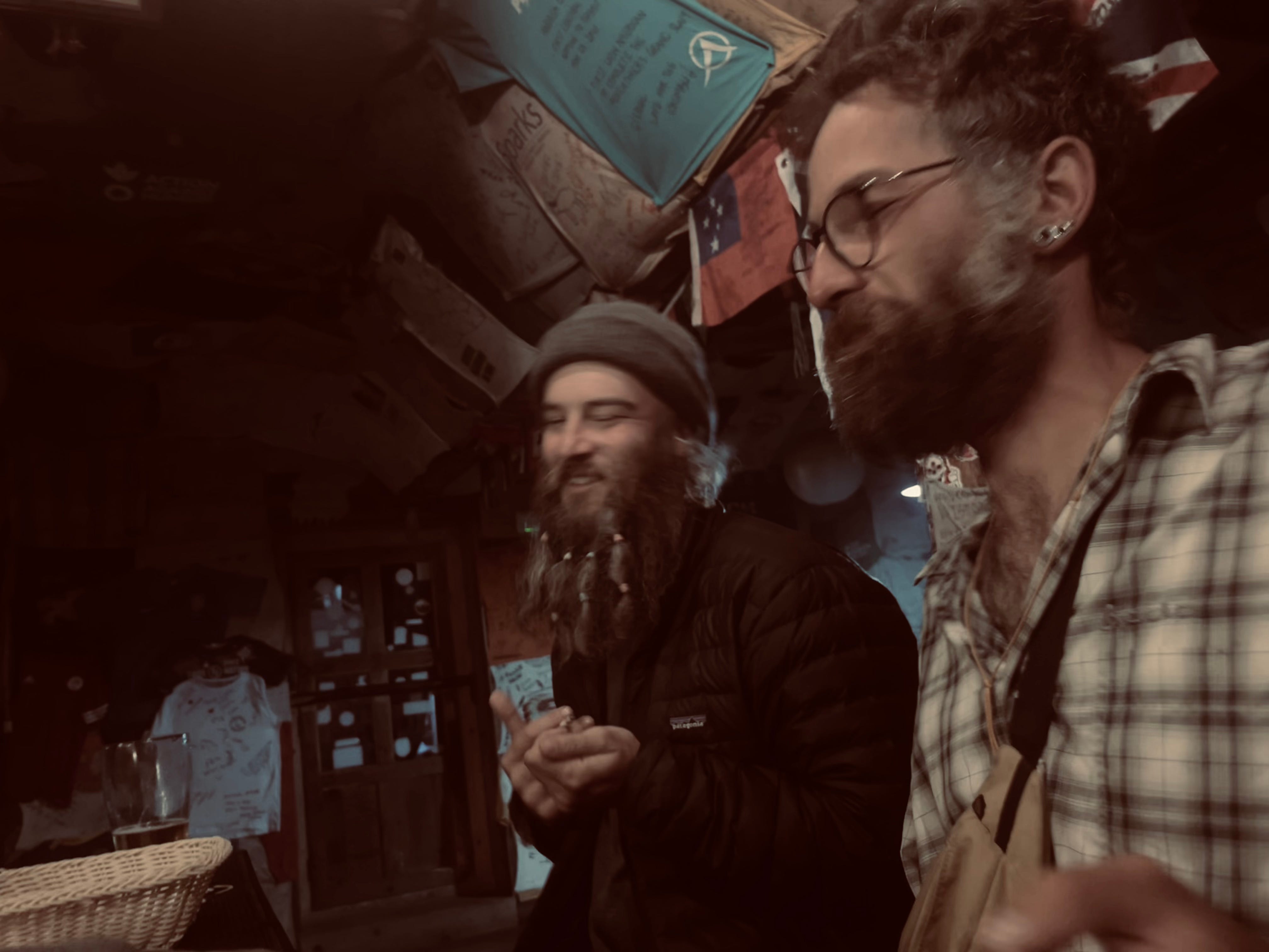
We played foosball, had more beers, watched pool, and stepped outside, where we recognized a hip-looking guy from Lobuche who remembered us, too. Matt asked to bum a cigarette, and we learned he was from Northern France and his name was Hugo. We also met a Newar guide who shared his smokes. The two had great stories. Matt invited them to join us at the next spot: Blues Bar.
Walking into Blues, we laughed at the techno music playing instead of blues, but the vibe was great—locals were the only ones partying. We played a few rounds of pool, winning one game before losing, and got nicely buzzed. Eventually, we settled our tab, wandered back to the tea house, and happily crashed for the night.
Day 17: Rest Day
After a big night out, we took our time getting out of bed. By the time we were ready to eat, breakfast was long over, so we went straight for an early lunch of fried potatoes, a burger, and fried rice to satisfy our hunger. With grand plans to explore afterward, we headed back to the room—but a wave of drowsiness hit, and before we knew it, we had napped away a couple of hours until dinner.
Tip: Namche Bazaar is home to a local dog shelter where you can stop by and show the pups some love. You can also visit the Tenzing Norgay Memorial, with a statue of the legend himself and great photo opportunities.
That night, we feasted on noodle soup, momo, and pizza. Matt showered, and then we set out for another evening out.
Rounding the corner at the Irish Pub, we immediately spotted Hugo stepping out for a smoke. We joked about how we’d been wondering if we’d see him, and he turned out to be the first person we ran into. He laughed, saying he’d been looking for us too.
Back inside, we ordered the “Three Passes” cocktail again, prompting Hugo to raise an eyebrow. “Fancy,” he teased. We shared stories and laughs before heading over to the Hungry Yak. It was quiet, so we returned to our favorite spot: the Blues Bar. The place was buzzing with the usual mix of bar owners, locals, and a crowd of Westerners. Spirits were high, with people dancing, beating drums, and even spinning random objects—like tea kettles—in the air. Some were dancing on tables, and the whole scene felt like one big celebration.
Fueled by liquid courage, we danced, and I found myself in a limbo contest with a couple Finns, even dropping into the splits—a move I didn’t know I could pull off.
Before long, it was past 3:00 a.m., and although it was hard to call it a night, we headed home with happy memories and new friends.
Day 18: Namche Bazaar to Lukla
Trekking Distance: 18.2km / 11.3mi
Elevation Gain: -600m / 1,969ft
Max. Elevation: 3,440m / 11,286ft
Tea House: Alpine Lodge
After last night, starting our day was, as expected, a little rough. We slept in until 10:00 a.m., had eggs and toast for breakfast, and then returned to bed for some more rest and relaxation before setting off a little after 11:00 a.m.—a slow start considering we had around 11 miles ahead of us.
The light fog, with the sun occasionally peeking through, was the perfect companion on our walk. I felt a kind of giddy appreciation, wanting to soak in every sound of our footsteps on stone, the gentle murmur of conversations in the woods, and the earthy smells. We were nearing the end of our trek in the Himalayas, and I wanted to hold on to every last moment of it.
We reached Phakding around 4:00 p.m. and stopped at a bakery for a bite to eat. The food took longer to cook than we’d hoped. With about four miles left to go, we knew we’d be trekking in the dark.
The twilight along the trail was beautiful, though, and we weren’t alone—locals and porters were wrapping up their day’s work, and parts of the trail had lights. The last light of day cast a peaceful glow over the villages. Soon, we pulled out our headlamps and continued in complete darkness.
In the villages, cafe owners were clearing outdoor tables by lantern light, and small lights dotted the hillsides. I didn’t mind the night walk; even as the last mile presented a steep, uphill grind—it was our last push before the end.
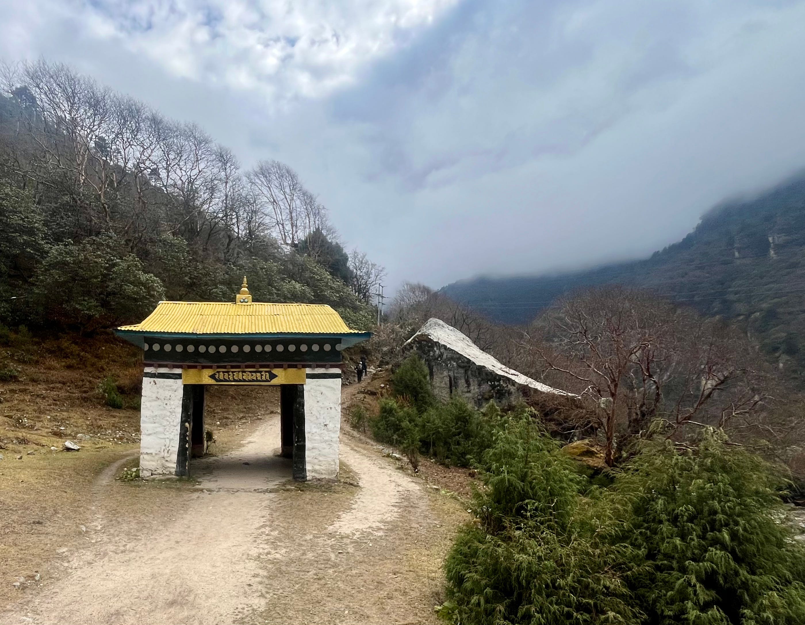
Finally, a painted gate appeared, marking the entrance to Lukla and the end of our trek.
We made our way to Alpine Lodge, where our friend Tashi had told us he would be. Sure enough, his smiling face greeted us in the dining room amidst the chatter of his guests.
Since the tea house was full, Tashi kindly led us to a nearby alternative with an available room and helped us order food. We said goodnight, grateful for the journey and hopeful to cross paths with our wonderful friend again someday.
Tomorrow, we’d face Lukla’s Tenzing-Hillary Airport once more, this time catching a direct flight to Kathmandu that would last about 40 minutes, hoping all would go smoothly...